Paddling out of the Upper Missouri River Break National Monument, who pretty much everyone agrees is the most beautiful part of the entire river, I was prepared for a change of pace and an increase in difficulty as I entered Fort Peck Lake. I’ve kind of lost track of the days, I am indeed on river time, I think it was last Wednesday when I made a quick stop at James Kipp campsite, successfully begged for extra water from two young outfitters who were pulling their boat out, and continued. I wanted to get as close as possible to the start of Fort Peck Lake – where the river current slows down, the valley widens and you suddenly find yourself in a wide open lake. I went about 10 miles, my maps had lots to be desired in terms of instructing me how far I could safely go. I didn’t want to encounter braided channels or even worse, running aground in nasty mud at the start of the lake very late in the day. I set up camp that night at a pretty rough spot – had to climb a mud bank to get out of the river, deal with weeds, mosquitos and a curious Bull Snake as I was setting up camp. I did enjoy listening to the Blues win Game 3 (I think) on the radio.
Fully rested, I woke up and prepared to take on the start of Fort Peck Lake. There was about 10 more miles of true MO River before the lake – I could have easily made it further the day before. Eventually, I encountered the main channel breaking up into side channels, beautiful islands of cottonwoods and willows everywhere. But still, current. I stopped mid-day to climb an amazingly perfect conical hill overlooking the start of the lake.

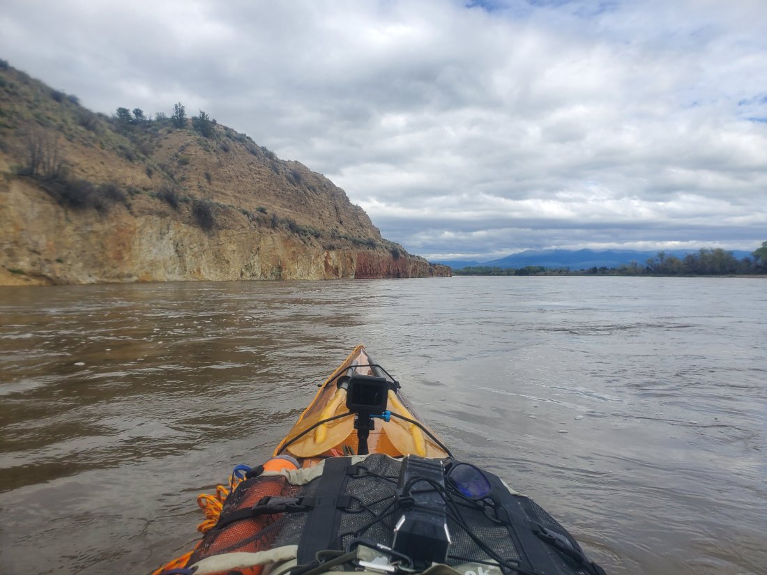
Later in the afternoon, I approached the start of UL Bend. This massive U-shaped bend in the river is notorious for shallow spots, dead end channels, out-of-nowhere winds and just being a challenge.

I encountered just the opposite. Oddly, the wind died down as the river widened. It was a sheet of glass for the most part. The river is higher than normal everywhere, including here, so I didn’t come close to running aground in shallow water. I even got a message from Norm later in the day asking if the river was up because according to his map, I was paddling across land. He also told me to keep paddling for 1.5 more hours to some great camping. I finally took out around 6pm at this amazing spot, close to the bottom of UL Bend:

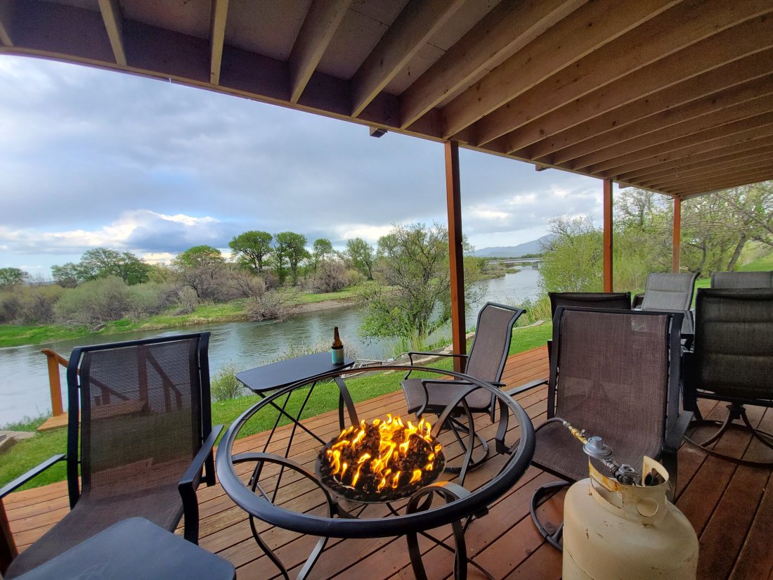
The next morning, I was prepped for rougher conditions – wind and waves. I hear you don’t get a free perfect day on Fort Peck Lake. The first few hours were pretty amazing as well, the sun rising over a very calm lake as I paddled around the bend then turned north. Mid-morning, the winds picked up and I experienced open water waves for the first time. I started to get a feel for the boat and how it navigated rougher water. I didn’t panic, just tested how far away from shore I could go and still feel comfortable. How I adjusted my boat via the rudder or directional paddling depending on what direction the waves were coming from. I stopped for a snack mid-morning and caught my breath and stretched my legs. By around 1pm, I was spent. I pulled into Devil’s Creek campground and called it a day. Temperatures were approaching 90 degrees in the sun, so I took my hammock up the hill to a pavilion and relaxed with my journal and those of Lewis and Clark, taking in all they experienced when this massive lake was just a simple river. I talked a bit with a retired journalist and investigator Ted who was doing some fishing there, who early the next morning sent me off with a cold beer to be enjoyed later that night, as well as a promise to send me a few photos he took with his nice camera. Today’s challenge was to try three separate big water crossings:

From south side to north side, then at the big bend, from the west side to the east side, then at the next bend, from the south side back to the north side. Winds were from the south generally this day, so my south to north crossing was a wildly entertaining ride on the waves. They weren’t terribly big, maybe 1 – 2 ft, but my adrenaline was definitely elevated as I made the long crossing. Another hot day, I stopped briefly to immerse myself in the lake and hike up the hill to get a view at Bone Trail Recreation Area:

It was still early afternoon so I pressed on for about 8 more miles until the storm clouds started to approach behind me. I had heard from messages and weather updates that it was supposed to storm, so I found a sheltered cove in plenty of time to set up camp before the weather rolled in. I also installed the extra guy lines on my tent connected to 12″ stakes to ensure my tent could ride out most storms. I was treated to a spectacular display of storms rolling in just north of me, getting hit by a second round, posting up in my tent making sure it stayed put and staying dry. Even got a rainbow as I laid down for bed.
Next morning I was out early again and did the Go Pro video before the wind got strong. At one point, I had no sense of where the waves were coming from, just trying to paddle through and not tip over. I pulled off after 10 miles and decided to wait for the winds to go down. I spent the time climbing a nearby mountain where I got some much needed phone reception to post some updates. At the top of the mountain, I noticed the wind was slightly less and the whitecaps out on the water were more sparse. Back into the yak I went and covered another 14 miles into the early evening. I even tossed the fishing line in later in the day and managed to pull in a beautiful Northern Pike. I don’t portend to be a fisherman, I was shitting my pants, trying not to kill myself or the fish. He eventually set himself free back into the lake, I didn’t plan on keeping him anyway. Camp was a lovely spot around the bend out on the end of a nice coulee.

The next morning was windy, so I opted for the Graveyard Hill adventure previously posted. But instead of staying off the water all day, I had the burgers and beers of Fort Peck Marina flashing in front of my eyes so I paddled on. I wasn’t making the Marina that night, but I got to Pines Recreation Area, after crossing 5 very windy and wavy inlets – varying from 1 to 3 mile open water crossings.

I was mentally and physically exhausted after hiking all morning and surfing on bouncing waves all afternoon.
I woke up planning to finish the lake and went hard after it. There were 5 more open water crossings, the last being the most difficult – a 4 mile paddle to near the dam. Waves were big, 2 – 3 ft and some whitecaps. Winds were generally from the northwest so I managed to keep my boat positioned ideally, but there were some harrowing moments. And as I made the final turn into the cove of Fort Peck Marina, wouldn’t you know it was straight into the stiff headwind out of the northwest, the last few hundred yards of paddling had my arms and shoulders burning. The burger and beer for a late lunch never satsified me much as these did.
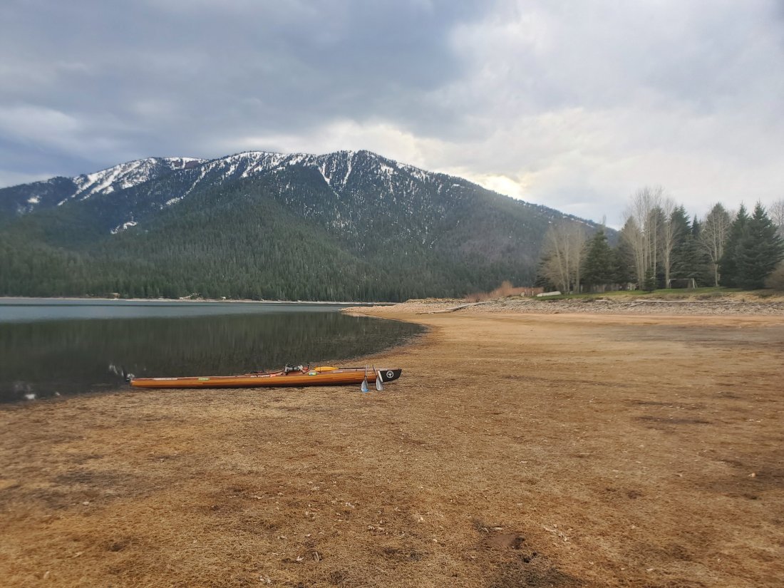
130 miles over 5 days. I think if had one of my other kayaks, or a canoe, I would have certainly had to take a day off here or there on the lake to wait for the wind to go down. Note that I didn’t put myself in any dangerous situations. Other than the morning I pulled off after 10 miles, I felt challenged but in control. Handling the waves in what is essentially an ocean kayak was a steep learning curve, but one I feel I navigated successfully. I’m no Peck expert, but from what I gather, the conditions I experienced were average. I hear many stories of MO River paddlers that are stuck on shore for multiple days at a time waiting for the wind to die down in order to cross safely. I have two more big lakes where I am sure to be tested further, but overall I am happy with my experience on Fort Peck Lake. I appreciate its power, unpredictability and certainly its beauty.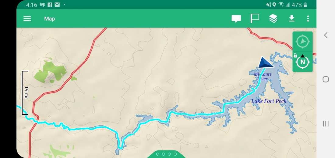 mf
mf


 I set my alarm for 5:15 but ended up not neding at as it starts to get light this far north before 5am. I jumped up, grabbed a Cliff Bar and water and climbed the hill. 1000 ft and a pit stop to take my morning constitutional is a self-dug hole later, I was standing at the exact spot where Meriwether beheld the snow-capped mountains that would later nearly put an end to their westward exploration. No mountains were to be seen today, I was told the day before that the increased haze was due to wild fires in Alberta, Canada.I took a few photos of the scene as the sun came up over the mountains. Pretty sure I’ll be framing this panorama:
 Later that morning, I stopped by a Homestead that wasn’t marked on the map. If it gets published when I have reception again, I had an Instagram post that gave a short explanation of Homesteads along this part of the river. Basically, in the mid to late 1800s, the US government basically gave away tracts of lands in order to get people out west, settle the land and, ahem – move Native Americans off the land. While some stuck it out and made a life on the wide open plains through farming or raising livestock, many others weren’t able to sustain a life with the harsh Montana weather and conditions. Some of these Homestead sites can be found along the river here. Some are actually still in use as working farms, many others are just ruins of the old farm sites. You are able to stop and walk around in them. Some of the images are pretty stark. As I explored a few on my own, I had feelings of insignificance and impermanence. Here were homes and workshops of people whose lives were here or 10, 20, 30 years. And then it was done. They moved on to something better, something easier. And here were the remains of their lives and their work for that period of time. Captured in history.


 Another site I passed later that day was the Nez Perce Trail. While it isn’t a specific site you can stop and take a picture of, the map I was following was marked where the trail paralleled the river and eventually crossed over and headed North. As the young US was expanding westward, the Nez Perce signed a treaty to move to 7.5 million acres of land in Montana and further to the Northwest. As the 7.5 million acres became 1 million, 300 men, women and children of the Nez Perce refused to sign a revised treaty and tried to make a run for the northern border of Canada. Pursued by US troops, they were eventually tracked down, some killed and the rest forced to reservations. As I paddled by where these 300 tribespeople marched along and over the Missouri River, I reflected on the dark parts of our nation’s history, the sacrifices and horrible incidents that happened during our nation’s rapid expansion. Certainly, I’m proud to call America home. But I feel like educating oneself about the horrific things that got us to where we are today are a necessary part of being American.
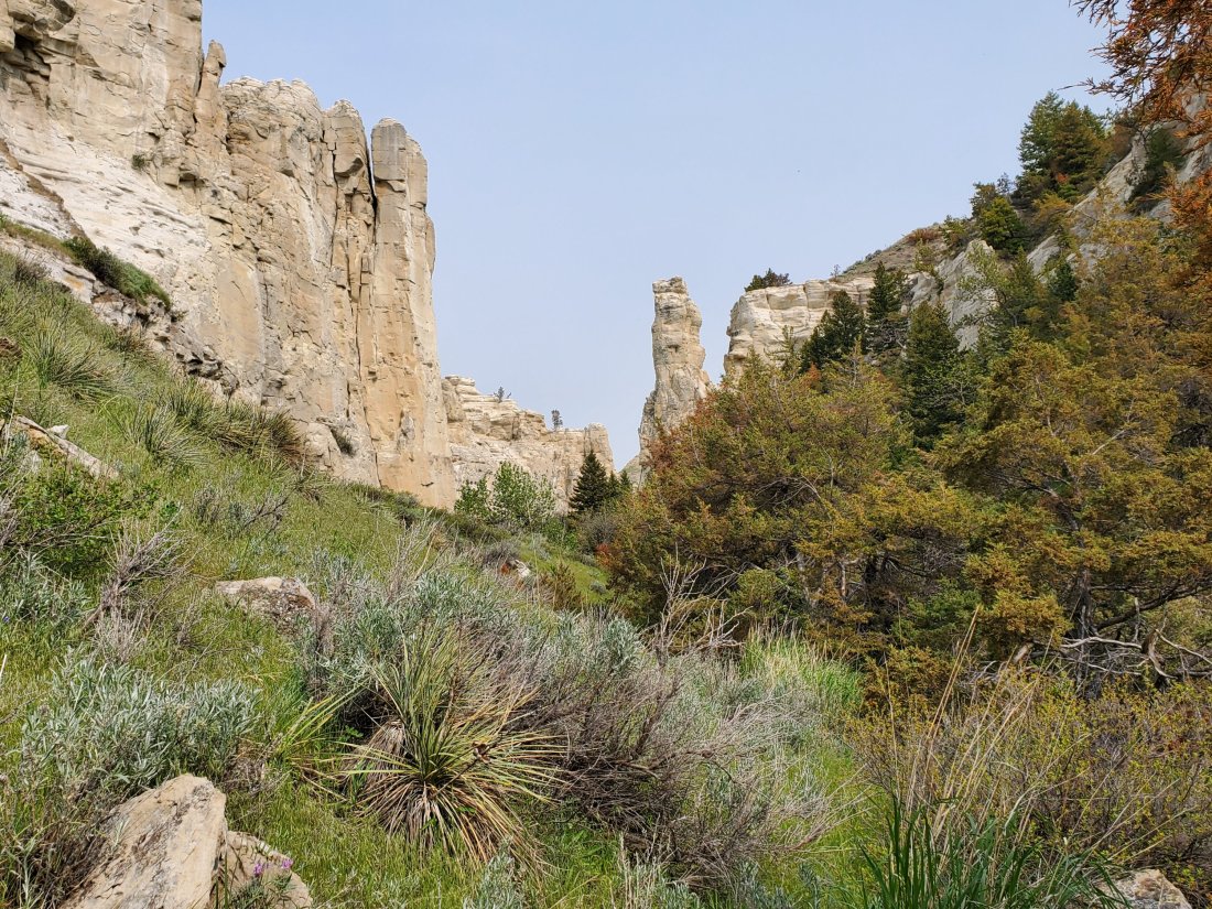
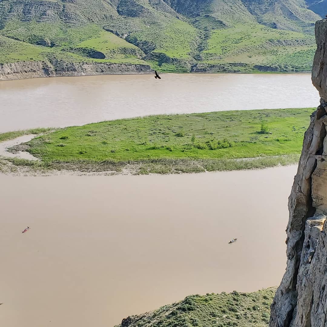 I played with the Go Pro while paddling the rest of the day. I did take another mid-day pit stop to hike back up into a couple more spectacular canyons.
 As the day got later, I motored on to Judith Landing, encountering a completely emtpy campsite except for a big old snake – can anyone identify what this is? And should I be concerned about sharing a camp with him?
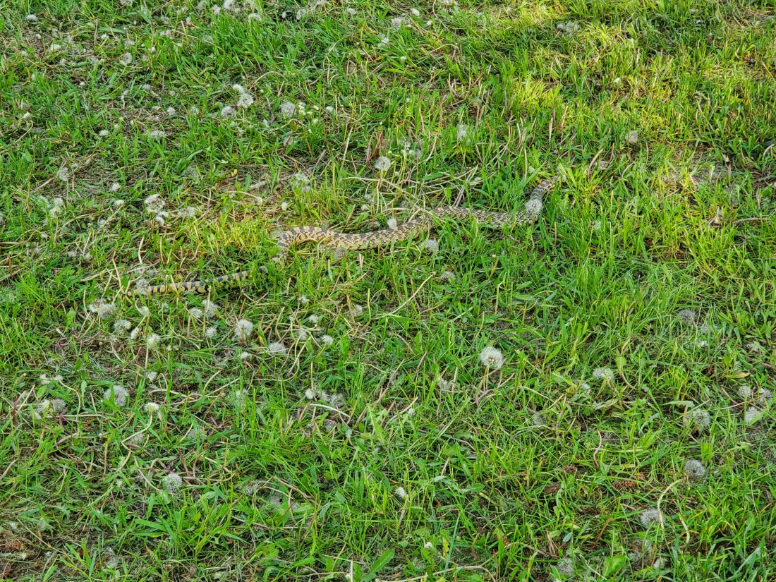 As I mentioned, finding enough drinkable water is a challenge on this part of the river. A few campsites that would normally have water suffered damage during the abnormally cold and icy Montana winter and their water supplies are shut off. I topped of my approximately 7 gallons of cpacity at Fort Benton and have been trying to go slow. They say you should consume at least a gallon a day. Luckily, Norm put me in contact with an outfitter in Fort Benton, and she told me where I could find a secret stash of water here at Judith Landing. Sure enough, shortly after I arrived, I located the old cabin, then a really old, disconnected gas station ice machine behind the cabin, inside which I found about a dozen large casks of drinking water! Sweet relief! I wasn’t running low on my supply, but I got more confidence topping off my supply, not knowing when will be the next opportunity to re-supply.Also note that today was the first day (and probably pretty much every day after today) I immersed myself in the river after a long hot day of paddling. Sweeeeeeeeeeeeeeeeeeet Relief!
 mf
mf