Big Old Trip & Logistics Recap: Lower Mississippi 2025

(Apologies in advance – likely long, overly detailed, sometimes technical, and paddle-nerd speak. Capturing these details probably more for me for future reference, but also maybe to help fellow paddlers with future planning and trip logistics. In any case, thanks for reading!)

Big Picture

New Haven, MO to Burns Point, LA

Dates: Oct 1, 2025 – Oct 30, 2025 – 28 total paddle days, 2 zero days (travel to and from STL for the 24 Hours from Home Challenge – average of 38 miles per day, long day: 65 miles – New Haven to Pelican Island, short day: 5 miles getting into Caruthersville, MO

States: Missouri, Illinois, Kentucky, Arkansas, Tennessee, Mississippi, Louisiana

Missouri River: 82 miles from New Haven, MO ramp to the confluence of the Mississippi.

Mississippi River – Upper: 195 miles from confluence of the Missouri to confluence of the Ohio

Mississippi River – Lower: 649 miles from confluence of Ohio to Old River Lock/Canal entrance (+1 mile up and back to Vicksburg ramp on Yazoo River)

Old River Lock/Canal: 6 miles

Atchafalaya River: 104 miles from Old River Canal to Six Mile Lake

Six Mile Lake, Intercoastal Connector/Diversion Channel, Horse Bayou, Gulf of Mexico: 29 miles

Grand Total: 1,067 river miles

Boat/Gear/Tech

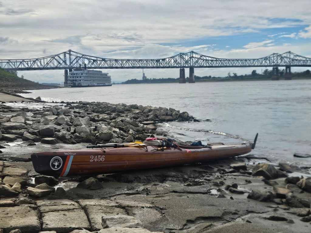
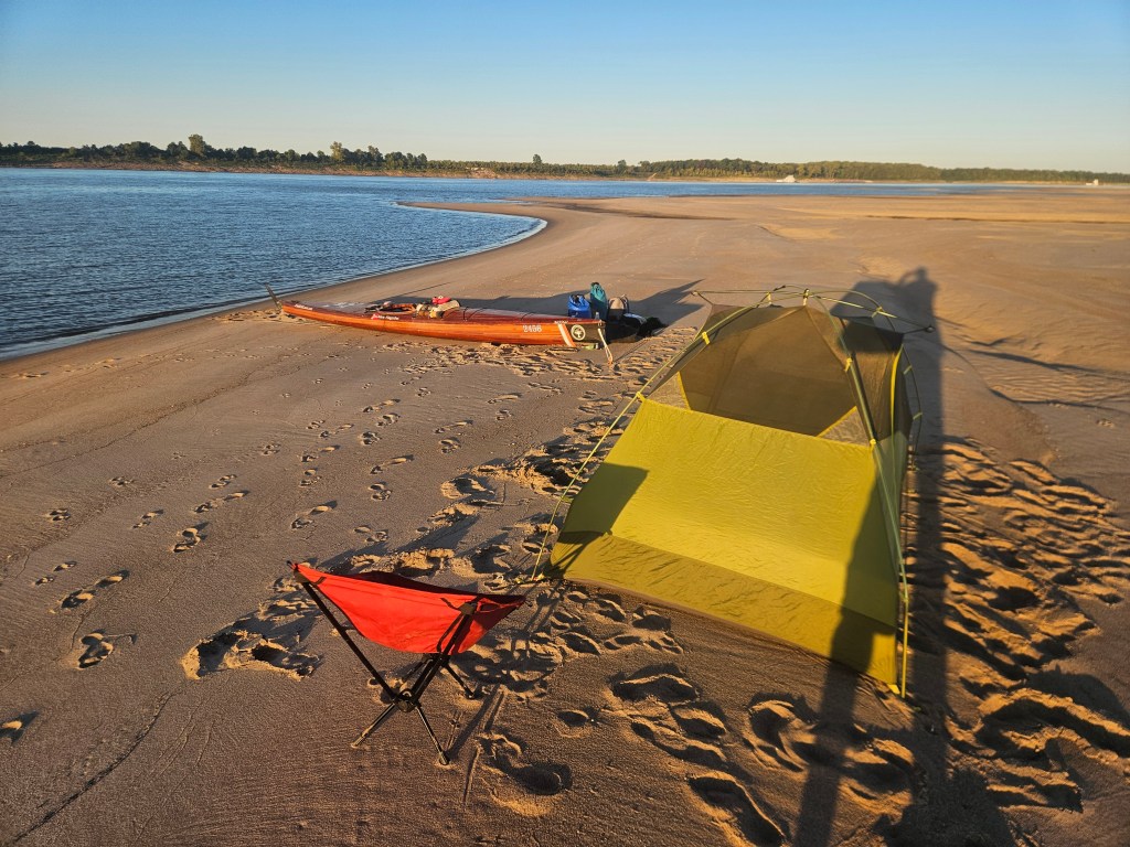
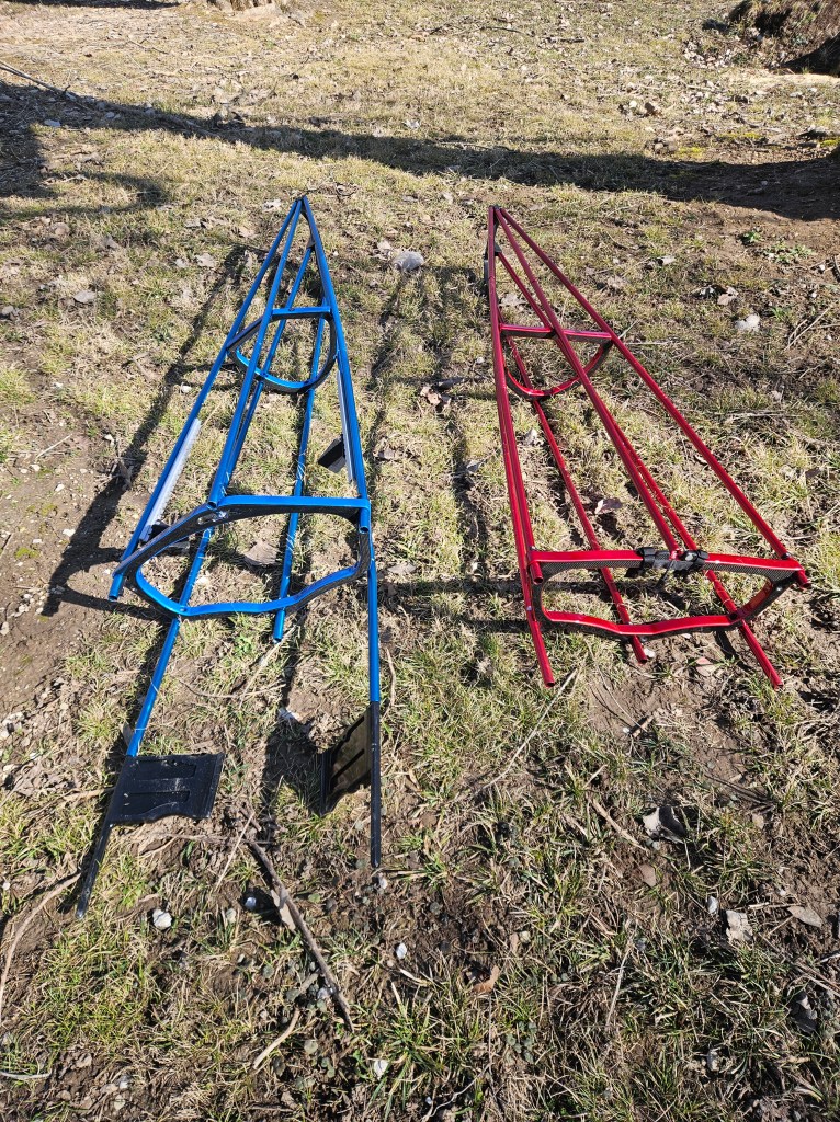
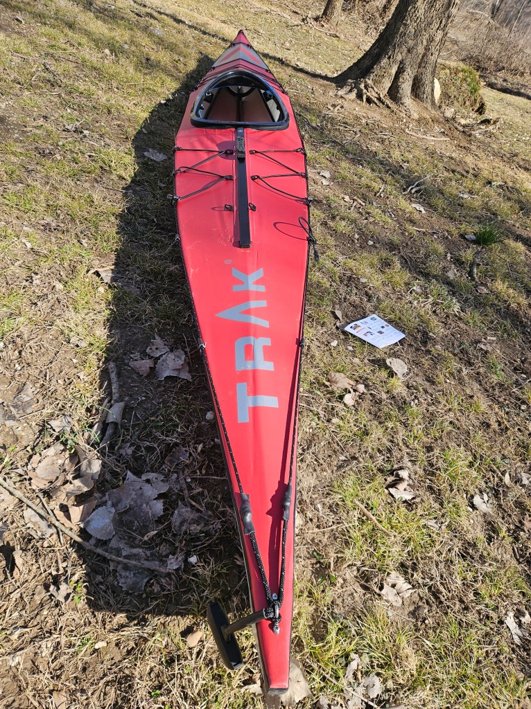
Mostar – Timber Longboard, Co. 20ft cedar strip kayak – custom build by Shane Camden, 60 – 65lbs unloaded, est. 350lbs fully loaded

Paddles: RPC paddles – mid-wind blade, Swift euro blade as a backup

C-Tug collapsible kayak cart – though only used on the Chain of Rocks portage and hauling my boat up the ramp at Vicksburg for overnight safekeeping

Tracker: Garmin InReach GPSMAP 86I (thanks Bill Behrns!) + monthly subscription for messages/live tracking capability

Key Apps/Sites used: Google maps, Windy, Weatherbug, Findship, Marine Traffic, Navionics, USGS river guages, Garmin apps, Rivergator

VHF radio for barge/lock communication (thanks Bill Behrns!) – barges use channel 13, Old River Lock uses channel 14

Samsung S23 Android phone, replaced with Samsung S25 Android phone – upgraded due to dropping phone in the intercoastal waterway on the final day of the trip

JBL portable speaker for occasional playlists, audiobooks, podcasts

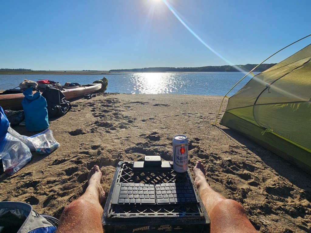
Portable keyboard for typing out longer blog posts

Batteries: Assorted brands of portable batteries/bricks, could charge critical devices for up to 5 or 6 days until having to recharge batteries, no solar charging on this trip

Nutrition

Dinners: pre-dehydrated meals (homemade), assorted. Favorites were pasta/ham/sauerkraut, garlic rice/chicken/broccoli/butter chicken leather, pasta/chicken/broccoli/tikka masala leather, pasta/ground beef/tomoto sauce leather, chicken/carrots/black bean/wild rice, pasta/chicken/broccoli/king mushroom. Key add-ons: concentrated chicken stock, Boracayan Jerk seasoning, Cholula hot sauce. Rehydration via JetBoil/camp pot. Assorted meals from local bars/restaurants when I could score them

Breakfast/Daily Snacks: assorted breakfast bars, protien/nutrition bars, PB&J snacks, turkey jerky, Briney’s Boiled Peanuts – amazing – thanks Zach!! Huell powder/shakes – Vanilla and Berry (meal replacement)

Estimated 10-15lb bodyweight lost

Hydration: 5 gallons of water, refilled every 4 or 5 days at local sources, morning coffee via Jetboil, Liquid IV mix packets, instant strawberry/lemonade packets, nightly whiskey ration – assorted brands, cold beers when I was lucky

Geography/Key Towns Visited

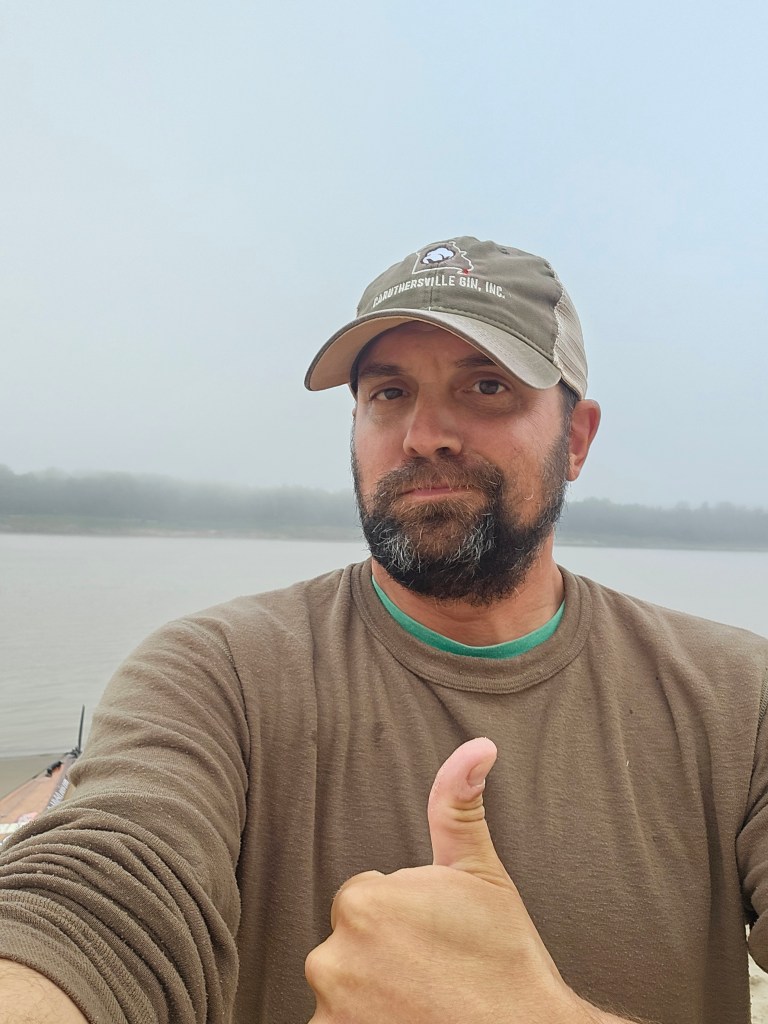
St. Louis, Chester, IL, Cape Girardeau, MO, Wickliffe, KY, New Madrid, MO, Caruthersville, MO – boat storage for 2 days, rental car from Enterprise Dyersville, TN, Memphis, TN – overnight with River Angels, Helena, AR, Greenville, MS, Vicksburg, MS – overnight at Mulberry Hotel, Natchez, MS, Riverview RV Resort – Krotz Springs, LA, Calumet, LA, Burns Point, LA – takeout

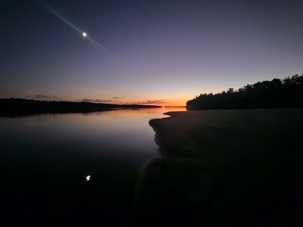
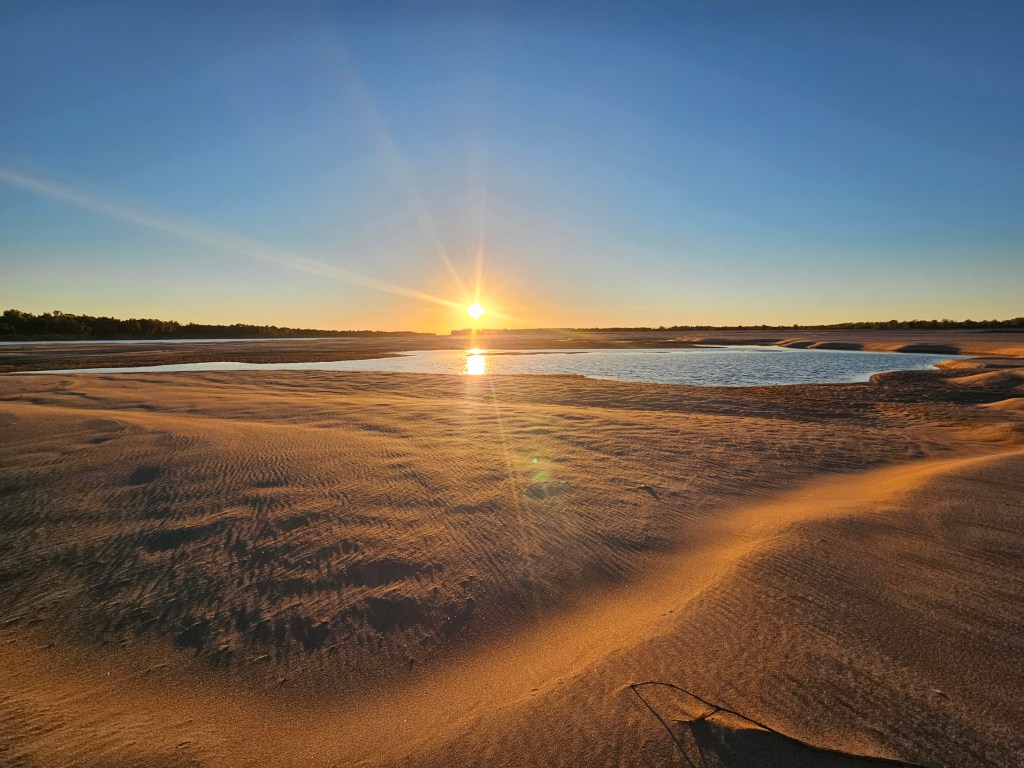
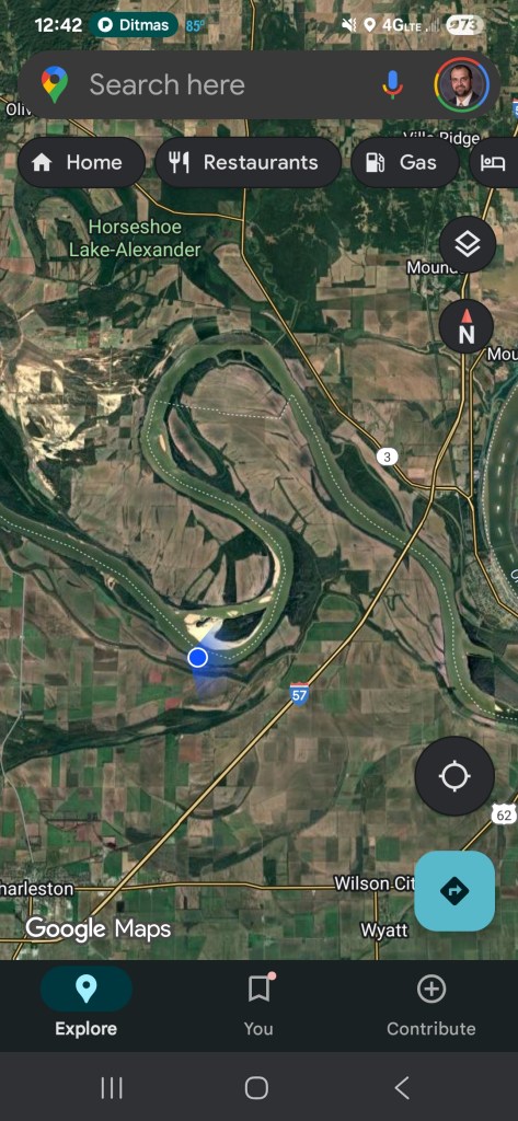
All other nights was sandbar camping on terrific low water/Autumn river levels – specific camp locations are plotted on my google maps account, can share upon request. I did record river levels at various locations during my trip but won’t share that level of detail here. It was very low.

Paddle Partners

Brian Thompson, Justin White of Cape Girardeau, MO – Wittenberg Access to Trail of Tears SP,

Lynn Fingerhut of Peoria, IL – Calumet, LA to Burns Point, LA

Key Clothing/Gear

NRS paddle shorts, Magellan Water Shoes, assorted long-sleeve/hooded SPF tech shirts, NRS splash jacket, Trak Kayak skirt, Merino wool sweater worn almost every night on the sandbars

Tent/sleeping: Marmot 2p – 2 tent poles snapped on trip, but love this tent. Kilos Gear sleeping pad – this thing was comfortable but not built for regular use, cannot recommend – sprung a leak 12 nights in, upgraded to a Nemo sleeping pad in Vicksburg. Sea To Summit Aeros pillow, silk sleeping bag liner

Golf umbrella for sailing, rain, wind block, shade, emergency rain displacement with leaky tent roof

Assorted brands of dry bags, mesh bags

Elastic clothesline for nightly drying out of clothing & gear

Summary Thoughts and Advice

Overall, loved this trip. In hindsight, the mileage and timeframe was pretty ambitious. I thought I’d have no issue cranking out 50 mile days making the just over 1000 mile trip in 30 days very doable. But on days where I did get close to 50, those were generally long days. A solid paddling day I felt good about for me on this trip was around 42 – 45 miles. Had pretty strong current on the MO – probably 4 mph current and paddling was doing 6.5 mph. Upper Mississippi slightly slower, estimating 3mph/5mph. After the Ohio confluence – slower at 2.5 mph/4.5mph. Atchafalaya – even slower at 1mph/3.5-4mph. If I had to do over, I likely would have left a week earlier and spent more time in towns along the way – really want to see more of Vicksburg & Natchez and meet up with more legendary river angels and contacts. Quawpaw Canoe Company – I will return!

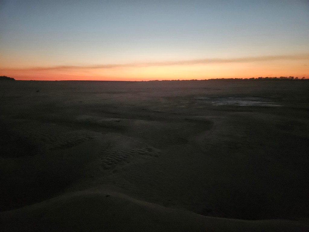
Easily encountered the most expansive sandbars I’ve seen in my life on this trip. And it was incredible to have miles of open sand all to myself nearly every night – open air, pristine night sky, few bugs and pests, wildlife sounds and just the hum of barges passing throughout the night

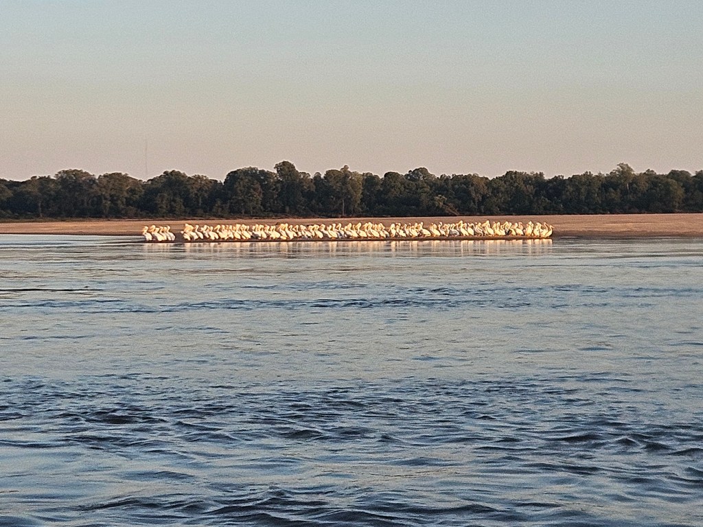
Tons of wildlife: innumerable bald eagles, Herons galore, tons of waterfowl, lots of migrating Pelicans, luckily no jumping carp encounters making contact with my body, coyote, deer, cows, snakes, toads and gators galore down the Atchafalaya to the Gulf

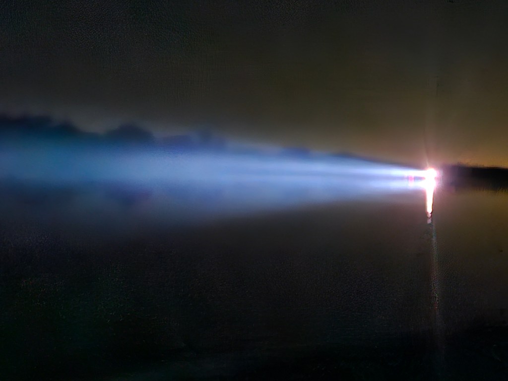
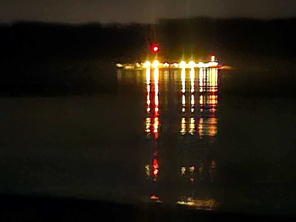
Tons of barge traffic – hard to estimate – passing or getting passed by maybe 20 to 30 barges/tugs a day, I think the largest load I saw was 48, did encounter America Cruise Lines and the UAT NASA cargo transport ship. Only encountered 3 other through paddlers on the trip. Tons of Loopers, though almost all above the Ohio confluence. Fairly easy to know where the barges were going to be and how to position myself well out of their way. Did have to get on my radio to talk to the barges every once in a while to let them know I was there and where I planned to navigate. I usually only talked to the barge captains when I heard them talking about me. If you do this trip, I do recommend learning the phrases “passing you on the 1s” and “we’ll see you on the 2”, etc. And do your best southern/cajun accent when you do get on the radio, you’ll fit in better.

Once again, I appreciate all of you who took the time to follow my journey here, on Facebook and Instagram. If you are hungry for trip photos, I suggest cruising on over there. I shared many stories, others are mine until if and when I decide to share, which I’ll happily do when I see you on or near a river in the future. A huge thank you to anyone who helped me out on this trip, whether I met you out on the river or at a town, or loaned me some gear, or even key pieces of advice. I couldn’t have done it without your support!

mf

Atchafalaya River, Mile 46 – Almost There

Sitting here at the Riverview RV Resort, which is the last vestige of civilization before entering the vast Atchafalaya National Wildlife Refuge. Nothing but swamps from here to the Gulf. No sign of gators yet, we’ll see if that changes. 

The Atch has been very beautiful so far, but it is pretty slow compared to the Mississippi. If there is any current at all, it is maybe half or 1mph. If I ain’t paddling, I ain’t moving. I covered around 26 miles so far this morning from my slopeside campsite. It started out clear this morning, but then the fog rolled in, and I was paddling with around 1/10 of a mile visibility. Barges aren’t really prevalent on this river, so I felt safe enough. And I stayed within sight of the bank in order to make sure I’m still going downstream. Ask me how I know to make sure you are paddling downstream. 

Since I last posted, it’s been a fantastic week of lower Mississippi paddling, Tons of sandbars, even more barges, a fantastic afternoon/evening in Vicksburg complete with food, beer and a hotel room – shower most importantly. A day and a half later, I made it to Natchez, where I spent some quality time at a few establishments “Under the Hill”, the area that in its past was notorious for debauchery, criminality, in other words, where all the fun was happening in riverboat times past. I sat down next to a nice guy named Gene at the Old Magnolia grill, who was heavily invested in the Ole Miss/Oklahoma football game. I cheered along with him to an Ole Miss win, then after, he offered to drive me up the hill to Natchez Brewery where I scored a couple crowlers of their finest swill. Tasted amazing on the sandbar that night. Speaking of that night, I saw storms in the forecast, but didn’t assume anything severe, so I picked a campsite out in the middle of a sandbar instead of somewhere more sheltered. Well buddy. Around 11:30pm, it started storming. Rain, thunder, lightning – luckily the wind wasn’t insane or my tent probably wouldn’t have held. My tent being of quality material, but well-travelled, the roof leaks, so MacGyver over here put up the umbrella inside the tent to deflect water off to the side versus on me. It worked pretty well, I slept for a few hours in the fetal position under the umbrella, and only ended up with an inch of water at the low side of the tent in the morning. 

I entered the Atchafalaya River system yesterday morning when I made a right off the Mississippi and went through the Old River Lock. This system of locks and diversion structures actually channels 1/3 of the Mississippi River flow into the Atch. Hard to tell, as there’s been not a bit of current as of yet. I’ve read a lot about the Old River Lock system, and how massive and critical a piece of infrastructure this is. Without this lock system, the Mississippi River would assume the Atch basin as its natural course, and the Mississippi through New Orleans as we know it today would be reduced to a trickle. The resulting effect on shipping, industry and America’s economy, to say nothing of New Orleans’ fate, would be disastrous. So the Army Corp of Engineers maintains the lock system to ensure the Mississippi stays where it is. In flood years of the recent past, the Old River Lock system has been in serious jeopardy of failing. And there’s no putting the genie back in the bottle. Once the river goes where it wants, there’s no going back to what was. So we hope against hope that the Old River Lock keeps doing what it’s doing, the government budgets a not enough amount to maintain the system, though the river is undefeated so far since the beginning of time. 

In about 50 miles, I will pull off the Atchafalaya and enter 6 Mile Lake, then a man-made diversion channel. Then I’ll get into Hog Bayou, where a meandering channel will take me the last few miles to the Gulf and to Burns Point, where I’ll end my journey. 

As I mentioned previously, I do have a bit of regret that I am on a timetable for this trip. A trip like this should be done open-ended, leaving time to explore, take a relaxing day off on a huge sandbar, stop into towns and learn as much about their rich histories as possible. This has been a paddle-heavy trip for me, probably averaging about 45 miles a day. Just the nature of how the trip came about and other assorted logistics. Alas, any river travel is second to nothing in terms of adventures in my book, but I don’t consider myself a paddle racer first and foremost. I live for long meandering expeditions and deep exploration and spending time with the people and at places along the river. 

Pretty soon, I’ll be at home, it will be freezing outside, I’ll be thrust back into the realities of a civilized existence, so I am going to soak up every second and every paddle stroke of these last few days. I thank you all sincerely for reading. I will likely share some more reflections after the trip. For now, I’m going to drink a few more cold beers, wait for it to cool off, and maybe get back on the river for a few more miles before the Lousiana storms roll in tonight. 

See you all down the river. 

mf

On Paddling into a Headwind – Greenville, Mississippi

Sitting at Warfield Riverfront Park just outside Greenville, MS on a grey misty morning. I wanted to get to this park last night to camp, but in hindsight, I think a pristine sandbar was a better choice. It’s fine, it’s got designated campsites, electric, water and bathrooms, but seems pretty muddy and dank compared to a nice sandy beach. Plus all these trees and pavilions give me a little claustrophobia after living on the wide open sandbars for the last 20ish days. 

I got a bit of rain and some lightning from 4am til about 7:30 this morning, so got a little later start than normal, but the wind promises to be calmer and maybe even a little tailwind today, so am gonna get back out there for more miles after charging up some batteries. 

Wanted to give a bit more description of yesterday’s paddle day with stiff headwinds all day, and what that means to a big river paddler. Three days ago, the headwind was likely 20 – 20mph, which at that point, even with hard paddling, you are unlikely to make more than 1 to 2mph paddling hard, and that’s slower than the current. So best not to be paddling in that. Yesterday, with 10 – 15mph headwinds, I could still make decent progress with hard paddling, maybe 4-5mph, where with no wind, I’d probably be doing 5-6mph. So it was doable, not enough to take the day off. 

When paddling into that 10-15mph headwind, you are going to see whitecaps. In my boat, those waves rarely splash over into my cockpit, so I have yet to don the skirt that would cover my lower body and keep the water out of the cockpit. Most of the time, I am gauging where the wind is blowing from, then try to find the most sheltered part of the river to paddle in to minimize the stiff wind in my face and paddling into waves. If the river is bending, you paddle over to the side that is somewhat sheltered from the wind and you find calmer water, theoretically. Of course the sides of the river tend to be where the slower water is, so there’s that tradeoff. Then once the bend ends, you need to cross the river to the other side, where you might find more sheltered water, and you deal with the worst of the waves and current out in the middle of the river, all while watching for passing barges. 

You also cannot stop paddling, lest your boat turns sideways and now you are being pushed upstream, actually losing miles. My last 3 hours of paddling yesterday was on a straight section of river, thus no curves or banks to block the wind, it was hard paddling straight into the waves. My shoulders and arms were cooked come 5:30pm. 

For better or worse, probably worse, I did put a hard cap on my finish date on this trip, which is Oct. 30th at the Gulf. There I will meet someone to drive me and my boat back to New Orleans where I’ll rendezvous with the national community of Hash House Harriers for some halloween weekend debauchery and running. So I am motivated to get miles each day, minimize time off the river wherever possible and keep making progress. 

One other interesting phenomenon I noticed the last couple days. When paddling, what seems like very far of in the distance is a huge mid-river sandbar. Not that unusual, the from what seems like a distance of 5+ miles, the sandbar looks immense – like 8 – 10 feet high and a perfectly rounded shape. After a couple minutes of paddling, you soon realize that sandbar is only about 1 mile away, and it’s only about a foot high. Barely out of the water. Not a great idea to camp on these guys, as you’re likely to get swamped by a big barge wake, or heaven forbid you get a foot rise in the river level overnight. 

My next town I plan to stop at is Vicksburg, MS, around 98 miles downstream. By then I will have left Arkansas and will be in the great state of Lousiana. Onward and downward, with hopefully a nice tailwind. 

PS – as I was sitting here typing, a friendly camper came over and handed me a bag of sandwiches, donuts, snacks and drinks and told me God bless when I told here where I was headed. Doesn’t look like any beer, but I’ll take what I can get. River angels provide. 

mf

A Windy Day for Hunkerin Down

I’ve been back on the river for 6 days since my visit to St. Louis. In that time I’ve paddled 216 miles from Caruthersville, MO down to my spot on this island near Fair Landing, AR. 

Other than my time in Memphis, my days have been filled with paddling from sunrise to close to sunset. The sandbars have been massive and plentiful, so no lack of great campsites. The weather has been pretty good, fairly hot during the day, not a ton of wind, and when I’ve had it, it’s been a tail wind, which is great. The nights have been calm, cool and sometimes a little breezy to provide an amazing atmosphere to sleep. Of course the sunrises and sunsets have been indescribable, and my pictures barely do them justice. I spend about an hour each night just staring up at the stars, watching the occasional plane go by and spotting satellites as they cruise across the heavens. The glow of one band of the milky way is ever present.

Today was the first day where I had a really sustained headwind, close to 20 to 25 miles per hour. So after hard paddling for eighteen miles this morning, the wind was only picking up. I picked the next sandbar island up ahead that had some trees to block the wind to stop. Plenty of time to set up camp and hunker down for the expected storms overnight. And plenty of firewood.

One of the reasons I’ve been putting in so many miles on this trip so far is to build in time for days like this. Better to put miles in the bank early and relax on the back end versus having to really rush towards the end. And when the weather is good, why not paddle the whole day?

For food, I’ve mostly been cooking some of my dehydrated meals I prepared ahead of time. But if there’s an opportunity to stop at a town and grab some food and cold drinks there, I won’t pass that up. Like yesterday in Helena Arkansas, I spent 1 – 3pm in an amazing barbecue place. I ate enough so that I didn’t have to eat dinner later.

The barge traffic has been constant, though I mostly paddle out of the main channel to avoid them and their wake. They rumble by at all hours of the night, but at this point, I can sleep right through the noise, and it’s kind of a feeling of comfort to have that presence. I think the biggest load i’ve seen yet is 48 barges with one tugboat. I hear myself mentioned as that kayaker coming down the river on the radio once in a while, and sometimes I chime in with where I will be, but mostly it’s listening to the captain’s chat back and forth with their incredible southern accents.

I’m used to traveling like this solo, so it’s pretty comfortable. At times I think it would be nice to have someone to peddle and camp with, but the advantage of doing it solo is that I can paddle when I want, and not paddle when I don’t. Every decision I make is mine and mine alone. I put on the occasional podcast, audiobook or playlist, but try to use those sparingly to conserve battery. Most of the time, it’s great just to be on the river with its natural sounds and scenes.

By my estimate, I have about 476 miles to the Gulf, and 12 days to do it in. There’s still some towns I want to stop and check out and hopefully some cool river people to meet. That should be quite doable if the weather and river cooperate.

mf

Taking a Break for the 24 Hours from Home Challenge

Back in July, I had the idea of this St. Louis to the Gulf paddling trip within the first minute of hearing I had been laid off. Pretty quickly, I knew the only big conflict I’d need to deal with was the 24 Hours from Home Challenge.

This event was something I started back in 2021 in the depths of Covid. A chance for my runner/hiker/adventure friends to take part in an event, not necessarily together, but competing towards a common goal of getting outside, covering miles and experiencing a heck of an adventure. In our sixth iteration of the event, I was in danger of missing it while out on the river.

As I dug into maps, mileage charts and trip planning, I had the thought of potentially taking a break from the river and somehow travelling back to St. Louis where the event is mainly based – though we have participants from all over the world. I don’t really need to be involved in the logistics or administering the race, as my friend Jon Marble has done amazing work with his app RaceOwl to allow participants to easily track their progress. I truly am in debted to Jon for his help with this, and the troubleshooting that goes on behind the scenes.

On Sunday of every challenge weekend, I’ve organized an awards and after party. Outdoors at a local park, participants who are local and able to make it come to celebrate their achievements. For many, these are some of the longest miles they’ve ever run/walked. It’s in incredible physical and mental challenge, and the stories people share from their adventures are often hard to believe. The Sunday of 24hfh every year might be my favorite day of the year, and I really didn’t want to miss it this year.

So after a few days of paddling on the Mississippi, it got a bit more clear where I could make a stop – potentially Caruthersville, MO. Then had to check if that stop had the right logistics for me to store my boat and gear, and arrange transportation home. I looked at Amtrak, Greyhound and UHaul, and even considered vagabonding by sticking my thumb out on the side of a highway. Luckily, I found an Enterprise rent a car in nearby Dyersburg, TN. I had the amazing assistance of Bob Pierce of Caruthersville Gin, Inc. to help me out with boat storage and a ride into Tennessee.

It’s all gone according to plan so far, I arrived back in St. Louis Friday afternoon. The first thing I did was take my first shower in 10 days – I highly recommend experiencing that feeling, if you can. Yesterday and today is a lot of logistics and errands, prepping for the big party tomorrow, cleaning up my river gear, charging batteries, stocking up my food supply, catching up with my wonderful and tolerant wife Sara, and cuddling with my kitties Omar and Kima.

I plan to soak up the positive and inspirational vibes at the party tomorrow and take that inspiration with me Monday morning, back down I-55 to Caruthersville and my waiting boat. Back on the river heading south.

mf

Rivertime – 9 Days Down

Sitting here on a massive island sandbar just above the city of Caruthersville, MO, cold beverage sitting on my crate table. Yep, 4th one of the trip. The first part of my journey has come to a close, 379 miles paddled or sailed over the course of 9 days. Tomorrow, I’ll paddle 3 miles down to Caruthersville, meet my friendly river angel Bob, who is going to store my boat and gear, then drive me into Dyersburg, TN, where I’ll get a rental car and drive back to St. Louis for the 24 Hours from Home Challenge. 

How I connected with Bob is a true illustration of the type of river magic that happens on a long trip like this. When I popped into Port Cape in Cape Girardeau, MO a few days ago, I started chatting with a friendly local named Jan. I told her what I was doing, and mentioned how I planned to get to Caruthersville to travel back home for the weekend. Before I was finished explaining, she was on her phone texting her friend Bob in Caruthersville. Within 2 minutes of meeting her, I had a river angel lined up 150 or so miles down the river. Magic. 

How’s the trip been so far, you ask? On the whole, delightful. Being on the downstream side of the Ohio these past few days has really opened my eyes to the scale and majesty of this river. The width, the endless bends and meanderings, the powerful yet seemingly silent creep of a tug pushing upwards of 40 barges by my tent in the middle of the night, the endless number of bald eagles I see day after day, the family of deer coming down to the water at sunset, the flocks of geese in formation on their way south, and the sandbars – my home for every night on this trip so far. It’s hard to tell where they start and stop, no doubt they are happy to be out in the sun rather than under 6 feet of muddy water. 

I knew the familar feeling of long distance paddling would return, I just didn’t know when. The daily cycle of waking up before the sun, religiously placing all gear in its appointed place in the boat, getting out on the water as the sun cracks the horizon. Getting the first hard paddle strokes in while I crack open my thermos of warm coffee. Whiling away the morning into early afternoon, picking out a nice sandbar on which to take a mid day stretch. Then looking at my maps downstream for where I might find an accommodating place to set up my tent. Pulling in and religiously setting up camp, cooking dinner, maybe have a fire, sip a little whiskey and read a little Mark Twain before falling asleep. That’s it, that’s all life is out here. The “real” world of big city life drifts away, and you’re on rivertime. 

Rivertime, that’s why we do it. Everything slows down. Distractions are few. I feel myself present in every moment. Feeling each paddle stroke, watching every tiny crest of a wave. Noticing the detail of every river bank or bend of a riverside tree branch in the wind. 

While paddling today, I put on a podcast – Dean Klinkenberg’s wonderful Mississippi Valley Traveler, where he interviewed author, artist, river guide and really a spiritual guru for me (who I intend and hope to meet further down river) – John Ruskey. Dean asked John – for those who aren’t able to get out on the river to experience it, how would you go about describing or conveying the feeling of travelling the big rivers? I sort of expected the answer to go in a different direction, when John replied, “You can’t.”

So after attempting to descibe it for you, rambling on an on, posting photos and video clips meant to capture bits and pieces, I’m gonna go ahead and agree with John. 

After the 24 Hour Challenge awards and wrap up party on Sunday, I’ll make my way back down to Caruthersville, enlist the help of Bob or some other river angels to get me back out on the river to continue the journey. Rivertime. 

mf

3 Miles from the Ohio

Yesterday’s experience of paddling with a couple buddies, then having the chance to somewhat randomly meet up with two old river pals, along with sharing my story with some local Cape Giardans in a pub on Sunday night, really filled my soul. I love days like that on the river. I draw energy from those days when you have a day like today.

Not a bad day at all, in fact a pretty good day, just a lot different from the warmth of yesterday. Started out cloudy with some drizzling here and there, but I made my way out of Cape amid the morning barge rush. I soon passed Thebes, IL, then set my sights on a pin I’d marked on my google map. A few years ago, a friend showed me a picture he took of a petroglyph that illustrated several rivers and confluences, carved into a massive boulder. An ancient Native American map for past river travelers. I was intrigued and my friend guarded its location closely. After enough pestering, I finally got him to tell me where it is, him knowing I’m an avid river traveller and will also keep its location secret.

I pulled into where I thought it looked promising, then explored the boulders strewn around the banks. I scoured each stone, looking for carvings or figures. Finally, I thought I found it – it certainly looked like a system of rivers and tributaries.

After I departed and had reception again, I sent my buddy the picture – and apparently it was not it. Alas, more adventures to be had in the future. But just having this petroglyph exist causes me to acknowledge what a tiny drop of water I am in this massive river that’s been flowing for thousands of years. The river I am seeing today bears no resemblance to the river even 100 years ago, it’s constantly changing, despite the Army Corps’ best efforts. People have been travelling this river for thousands of years, yes even before it was “discovered” by Hernan DeSoto in 1542. Me and the loopers aren’t really novelties doing long distances on the Mississippi, it’s been done, like for forever. And a map carved into a boulder proves it.

Anyway, I churned out a few more miles through the afternoon, passing and being passed by quite a few barges and loopers. Cloudy, intermittent drizzle and headwinds seemed to prevail most of the day. At one point, I was paddling to the Northwest, with Illinois on my left, and Missouri on my right. The river is pretty crooked like that.

Later in the day, slogging along and getting pretty hungry, I passed under the I-57 bridge, then set up camp after a couple more miles, just north of the confluence with the Ohio – mile 3 of the upper Mississippi if you’re keeping score at home. About 46 miles on the day.

Tomorrow, I’ll take on the confluence, where the Ohio more than doubles the volume of the Mississippi. Today was the first day of this trip that I paddled new-to-me river!

mf

St. Nicholas Landmark – Dinking with Legends

Currently sitting inside of St. Nicholas Landmark, which is my favorite place in Chester, IL. Why? 12 of their own beers on tap, solid food, and most importantly, they are about 100ft from the boat ramp (just watch for the trains walking across the tracks). I can’t quite see my boat from my window seat, but hopefully it will be fine for the time it takes to drink a few beverages. 

Sidebar – I once tried to walk here from my house in STL city. 24 Hours from Home Challenge #1 in 2021. #6 starts in 6 days – 24hfhchallenge.com! Alas, my 24 hours expired 3 miles short, after 74 miles I could barely stand, let alone stay awake so didn’t make it on that occasion. 

Spent last night on a massive sandbar – Magnolia Hollow Conservation Area. Although it’s an island, apparently there is a road connection as there was a farmer plowing his field over the trees as the sun went down. Plenty of driftwood for a blazing fire, and found bones and pieces of petrified wood scattered around. I was set up on kind of a promontory in the middle of the curve of the river, so all night I had massive tugboats rolling by, the low hum of their engines revving to get up or downstream. I woke up around 11:30pm to a growling beast, looked out and saw a monstrosity of a barge with pilons and construction equipment. This tug was pushing as hard as it could, maybe getting 1mph upstream. I momentarily questioned if I pulled my boat high enough out of the water to not be swept up in its huge wake, and even ran down to the shore in my skivees just to check. It was fine. 

Woke up with the first light on the eastern horizon and what do I see, some fresh paw prints next to the door of my tent. As my friend Bill told me a bit later in the morning, probably a coyote sniffing around late at night, all stealth like. So the reason I had the chance to meet Bill again, well. Arriving at Magnolia and unpacking, I realized I was a bag short – my cookware. I shot a few texts to my wife Sara to check at home, and Bill who shuttled me back home from the arch on Thursday. Luckily it was in Bill’s truck, under some other gear. 

As luck would have it and River Angels being the saviors they are, Bill drove it down this morning to Modoc Ferry in St. Genevieve where he even brought me breakfast and coffee. Bill, I love you. 

Last night, with my limited cel service – it worked standing up, but not sitting down, go figure – I saw the the opening time of St. Nick Landmark was 11am so that’s where I planned to be. A beautiful morning coming down about 20 miles brought me into Chester and delightful refreshments. Afternoon plan is do bank a few more miles and find another sandbar, coyotes or not. 

mf

Two Days on the MO

Resting in some sweet air conditioned at home. An advantage of starting upstream of your home is to use your own place as a River Angel domecile on a big trip. Two days of paddling was enough to let me know what gear I might be missing, or what I don’t need at all. I was fairly spot on, only thing I need to procure is a bit more battery power.

Left Paddle Stop Brewery in New Haven yesterday around 8:15am after a previous evening of boat cleaning and touch ups. I know, it’s a sin to let that work of art collect dust, but that’s the life of owning 8 or 9 boats, all of which have their purpose. And the Mostar, Shane’s hand-crafted masterpiece, is 100% perfect for expeditions. She performed well in the MR340, fully unloaded and sitting much higher in the water, but she really shines fully loaded, doing long days out on the big rivers. I forgot how amazing this boat was, but two solid days in it was enough to refresh my memory.

Five miles in, I got a call from Shane that I’d left my sleeping pad back in New Haven. Not to worry, Shane drove ten minutes to Dundee Bottoms, where he was able to meet me to hand it off. From there it was some pretty solid paddling, a quick stop on a sandbar across from St. Albans, then the slog into St. Charles. I passed under all the St. Chuck bridges around 5, feeling pretty gassed. I knew there was one more sandbar to consider before Pelican Island, which was my goal for the day. I decided to blow by the sandbar with an hour and a half left of sunlight and pulled onto the gravelly sand at Pelican around 6:45ish.

I set up camp in the waning light, and what a spectacular sunset it was – pics on IG – @paddlestlouis. A quick dinner over a blazing fire to keep the mosquitos at bay and I was snoozing by 9pm. Nice.

65 miles the first day was way ambitious, and not a distance I expect to keep up on the Mississippi, but that left a relatively easy 32 mile day today to get to the Arch and a ride back home. I got on the river at 7:18am under an absolutely insanse sunrise and liesurely paddled the last 17 miles of the Big Muddy MO. I completed the MO mid-morning then entered the Mississippi. I made my way under the very active Chain of Rocks bridge construction site and had to adjust my route for crossing work tows. I portaged the 200 yards river left of the Chain, churning and boiling and sure to chew up any wood craft to sawdust.

Made my way into the Port of St. Louis, and barge traffic was heavy. I have a short wave radio with which I can communicate with barges and had a chance to use it today.

Barge Captain to other Barge Captains: “We got a kayaker coming down out of the Old Chain of Rock Lock” (incorrect, I was not)

Me: “Kayaker here, I’m going to hug the right bank.”

Barge Captain: “Ok, thank you for having a radio.”

I did not carry a radio on the Missouri, as barge traffic is quite minimal. But it’s pretty much required gear on the much busier Mississippi. I’m sure this is the first of many interactions with my fellow captains on this trip.

Soon I was under the familar sight of the Eads Bridge then the Arch, and my good friend Bill welcoming me into the fishing ramp with a couple cold ones on a hot day. Super duper thanks to Shane for your craftmanship and running my sleeping pad down to Dundee, my sleep under the stars was spectacular. And to Bill your ever-present willingness to River Angel.

Plan is to get back in at the Arch tomorrow morning and get heading Southwards!

mf

A New Adventure: Trak Piloting

Back in the fall of 2024, I saw an email from Trak Kayaks. As a certified kayak instructor through the American Canoe Association (ACA), I was on their mailing list. I was familiar with the company, maker of high-end collapsible, packable sea kayaks. I had looked at their kayaks a few years ago, but didn’t really look too much deeper, with generally plenty of room to store my sometimes excessive boat collection. Space wasn’t a big issue, so I wasn’t too interested in adding a foldable boat to my fleet, especially at a premium price.

Anyway, Trak was looking to add Trak Pilots in select cities/regions. Trak Pilots are basically like product ambassadors, paddling veterans who become experts on Trak Kayaks, and offer test paddle opportunites and act as a quasi-sales rep for their boats. I opened the email, then clicked the link to see the list of locations. Scanning the list, it was almost all coastal cities around the globe, with a couple Great Lakes locations sprinkled in. But nothing near me, in St. Louis. In fact, no locations that were around big rivers. In the email was also a link to apply to become a Trak Pilot. I went ahead and filled out the form, maybe with a little midwest flyover attitude, explaining what a vibrant paddle community we have here at the confluence of the two longest rivers in the USA. I told them about our wonderful rivers, the big ones, the pristine Ozark streams and everything in between. I also told them about our paddling community, the racing, the expeditioners, whitewater and everything in between. I didn’t really expect to hear much after that, but was satisfied I stood up for midwest paddling!

A couple days later, Nolin Veillard, the Founder and Managing Director of Trak reached out, and we had a nice 45 minute phone call, him at the office in Vancouver, Canada and me walking the streets of my neighborhood. He asked about my experience, the paddling community and culture here in Missouri and what my future paddling plans and goals were. It went well, and he told me they’d be happy to include me in their consideration for future Trak Pilots. A few more emails and conversations with some Trak staff and I was invited to join as a Trak Pilot. What this entails is pretty wide open.

First, I had the opportunity to buy a brand new Trak 2.0 kayak at a steeply discounted rate. I’d be included as a Trak Pilot/point of contact on their web site. I’d be listed as the go to guy for people interested in Trak kayaks in the midwest/St. Louis/Missouri area. Then it’s pretty much up to me to make of it what I want. A few weeks ago, after a short hangup in customs, my Track kayak arrived on my doorstep.

The wife and I then left on a planned vacation to Vietnam and Thailand for a couple weeks. You don’t know me that well if you think I didn’t consider bringing my new boat along to paddle the incredible waterways of Southeast Asia. But alas, it would have added a certain level of logistics, not to mention some serious eye rolling from my wife that frankly I wasn’t prepared for. Ah well. Fast forward a couple weeks and a 65 degree Sunday offered my first opportunity to hit the water in the new boat.

I loaded my kayak in a bag into the back of my car and headed out to Chouteau Claim access, at the confluence of the Meramec and Bourbeuse Rivers. I got there a little earlier than my buddy Shane, so I had some time to unpack it for the first time and read the instructions on how to put together the boat.

It took about 30 minutes, and that included some studying of the instructions and images, a few quick corrections, and a whole lot of learning of this technological wonder. It’s a skin-on-frame kayak, with an anodized aluminum frame, carbon fiber ribs and a polyurethane skin with three hydraulic jacks that add the needed rigidity. I managed to get it assembled just as Shane was arrving and unloading his SUP. It wasn’t too difficult at all, I have confidence I’ll be able to do it in the promised 10 minutes in the future.

Shane and I headed a few miles upstream on the Meramec, having to really power up some swift riffles, swing into some eddies for a breather, and navigate some shallow spots and submerged trees. We stopped on a sandbar to chat, then turned around and headed back downstream. At the Bourbeuse, we hooked a left a went upstream for a mile or two in the hardly noticeable current.

My first impression: this is a sweet boat. It’s only around 40 pounds, so is super light and glides across the water. It’s fast and responsive. There’s no rudder or skeg, but steering with paddle strokes and some leaning/bracing is super easy. Its draft is quite shallow and I glided across a few shallow spots and surprisingly didn’t drag. A couple spots I did drag, I felt fully confident the skin would hold up fine without any dings from rocks, logs or gravel. It did. The freeboard is minimal, so if I paddle this boat on choppier waters, I’ll certainly use a skirt.

I can’t wait to paddle this in varying conditions, and get it out on the Missouri and Mississippi. As the weather and water warms up, you’ll certainly see me out there cruising in this Trak 2.0. And if you want to take a look at the boat or take it for a test paddle, you know how to find me, just head to the river!

mf