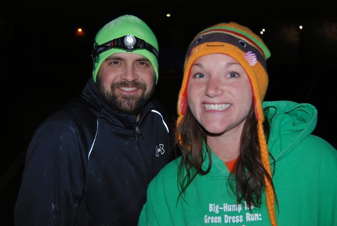
A risk I was aware of starting my trip when I did was the possibility of colder weather. May in St. Louis is generally pretty darn nice. Warm with a thunderstorm here or there, but generally good weather for being in the outdoors. I didn’t think Montana would be too far behind. I mean the day I dropped my boat in on the edge of Yellowstone, it was 75 degrees and sunny. I’ve learned over the last 12 days that Montana weather is second to none, including St. Louis, in terms of predictability and forecasting. Turns out, this last two weeks has been colder and rainier than normal. I’ve been told by multiple people that the weather in Montana is two or three weeks behind normal.
I camped for the first 4 nights along the Madison River. It was a little chilly maybe down into the low 40s at night, there was some rain here or there, enough so that my gear was wet in the morning, but no sustained downpours or frozen things. It started to get more uncomfortable down near the start of the Missouri in Three Forks. I spent a cold night on an island in the Headwaters State Park. The forecast for the coming week from there wasn’t too good. Continued cold – upper 40s to low 50s as a high during the day then down into the low 40s or upper 30s at night, along with rain scattered throughout. When Jim picked me and Norm up after our paddle from Three Forks, I didn’t expect that he and his wife Vicki would graciously host me for the next 4(!) nights at their amazing home outside Helena. It worked out that each day, I could paddle a pretty good stretch of the river (or the series of lakes that is the Missouri River in this part of Montana) then get back to Jim & Vicki’s house for an amazing dinner, a hot shower and a warm bed. I followed the advice I heard early on in my planning for this trip – never turn down a cold drink or a warm place to sleep.
Fast forward a few days. I bid farewell to Jim in Craig, MT, after paddling with him for 3 days and camping for two nights. The weather was much better. From Craig, I paddled an additional 20 miles to get to Cascade, MT by about 4pm. Having heard there was a boat ramp for the town right under the bridge, I was a little suprised to not see a boat ramp. As I passed by a few houses after the bridge, I saw a gentleman looking through binoculars down towards the river. I waved and asked him if I missed the boat ramp. He asked me where I was headed and when I responded St. Louis, told me I could stop there. I pulled in and soon found myself talking with Terry and Pam Curnow, river angels who’ve hosted many other MO River paddlers in their 44 years in Cascade. They quickly assured me I was more that welcome to stay at their amazing house, directly across a channel of the river from a pristine island on which we observed deer, pelicans, and lots of other wildife as we enjoyed some cold beverages. They fed me an amazing dinner of pork chops and corn, entertained me with a ton of stories, and Terry showed me his sprawling woodworking shop, where he’s built some amazing boats – see my Instagram post. Him seeing me paddle up in my wood kayak had to seem like fate. (Actually even more amazing, I had gotten a text earlier in the day from Norm Miller that said if I make it to Cascade, I need to find the “wooden boat maker” – well holy shit, guess who was the first person I saw in Cascade!)
I am continuing to follow the advice of not turning down a cold drink and warm bed tonight. I am enjoying the hospitality of River Angels once again, as I know eventually on this trip I won’t be so fortunate.
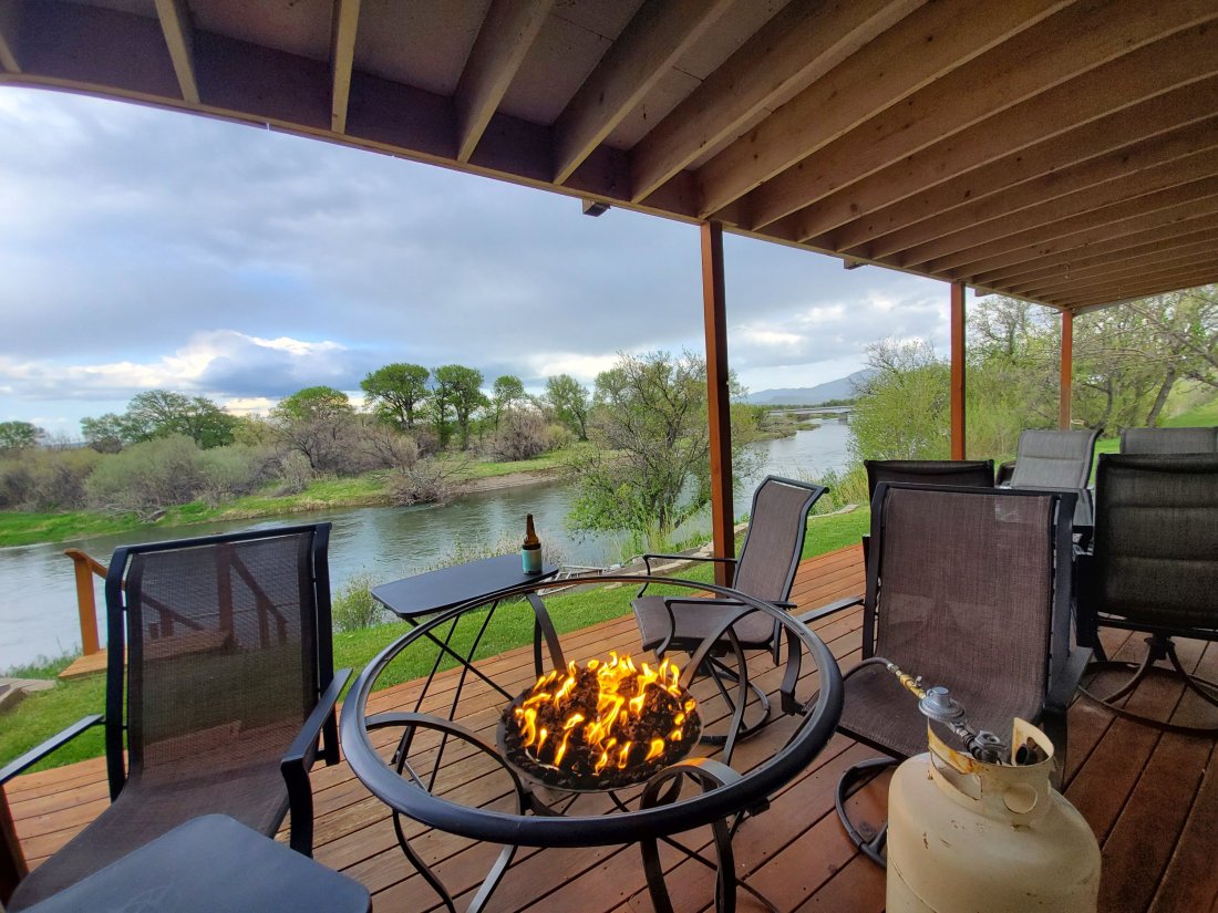
By the way, Terry invented this. A patio table that converts to a fire pit. Amazing
Overall, strong and successful first week. The 100 miles of the Madison River and the first 70 or so miles of the Missouri River presented your craft with various challenges and hurdles to overcome. Hydrodynamic classifications encountered include but not limited to: open calm lake water, wind-disturbed lake water, quickly flowing river, quickly flowing river with distrubed flow caused by obstructions, braided channels with tight turns, lazy river (not the water-park kind). Non-hydrodynamic features included a shit- ton of portaging a heavy-ass load on a questionable portage cart over pavement, rocky/gravel roads at various slopes and elevations.
Happy to report that watercraft exceeded all expectations. Some contact with rocks early on on the Madison, no significant scraping or damage to the boat. Kevlar layer on the bottom of the boat was a stroke of genius. Quite maneuverable when needing to navigate tight turns or corners. Some light cosmetic damage to top of boat due to repeated loading/unloading on top of vehicles for more significant portaging.
Cockpit comfort is nothing short of perfect. Captain did not attach seat to actual boat until 3rd day of paddling. Once that was done, no further slippage encountered. Perfect fit on cockpit skirt to aid in warmth and dryness on cold/wet days. Some issues with rudder not fully deploying, Captain having to manually deploy rudder in certain situations, though not an issue with Timber Longboard Co. but with rudder maker. Hatch stowage capacity has been satisfactory. All gear accommodated with no issues, Captain still trying to find out where the 30 rock of beer will be stowed.
Many compliments given by third party observers of watercraft in action. Craft able to be conveyed at upwards of 5mph in slack water, 10mph in short stretches in swiftly flowing water. Deck rigging, handles and other cosmetic work has been ideal as well.
Overall, 10/10 for initial performance of virgin watercraft. Would paddle again.
Seven days of paddling completed. I’ve descended the Madison River, and nearly the first 50 miles of the Missouri River. An absolutely unforgettable week, no doubt, and an incredible beginning for what is sure to be an epic summer.
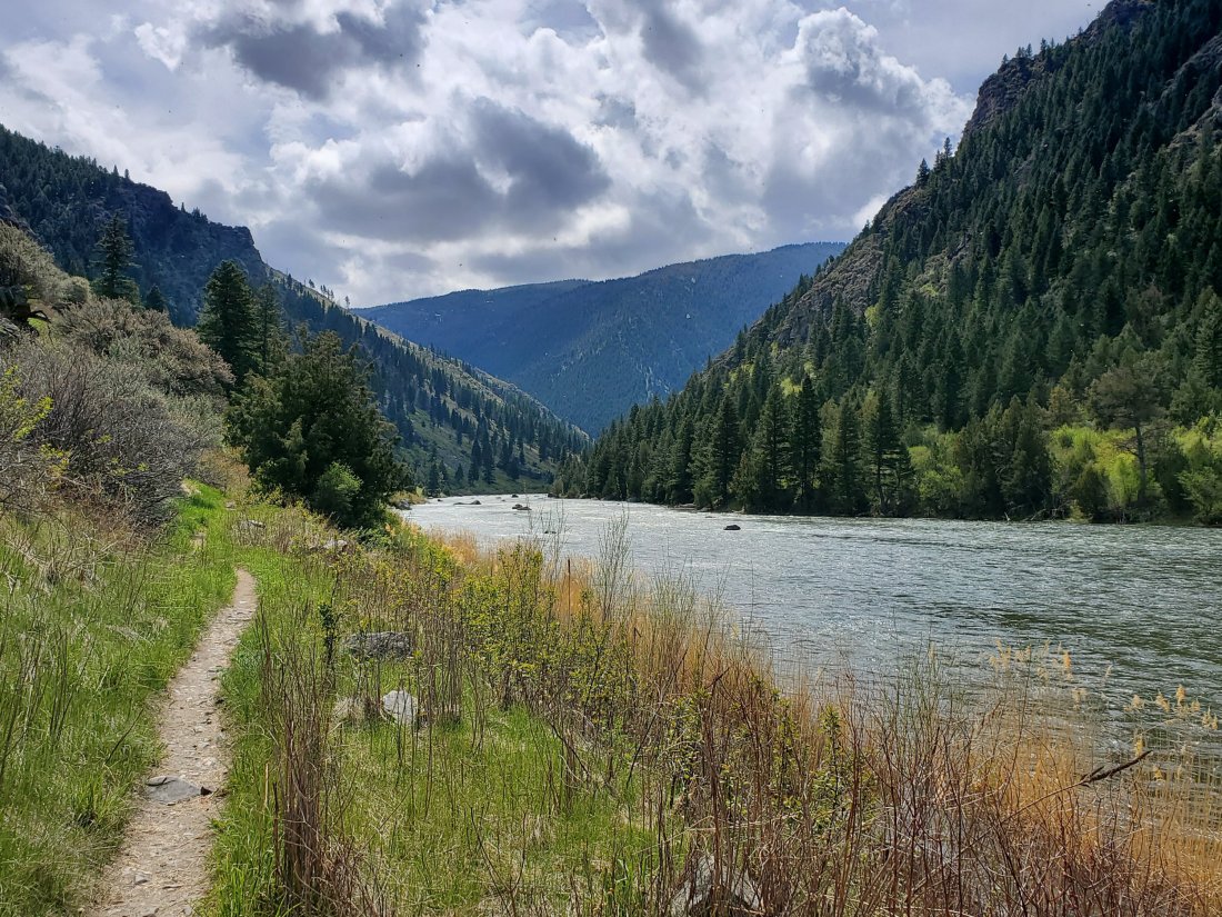
Picking up where I left off, Friday afternoon, I left the coziness of the lobby of the Sacajawea Hotel and walked the two miles back to where the Madison River goes under the I-90 bridge. In my mind, I was either going to set up camp under the bridge if it was raining hard and there was a good enough spot, or I was going to buck up and paddle another 4 or 5 miles into the Missouri River Headwaters State Park and set up camp in the rain. Well, it was raining, although not too hard, and sleeping under an interstate was not something I was willing to do this early in the trip. It was a good decision. The 4 to 5 miles was some of the most incredible I’d seen up until that point. So much wildlife – a dozen different waterfowl species, two deer swimming and running across the river in front of me, a moose staring at me from shore, the stunning meandering of the last miles of the Madison and the confluence with the Jefferson.
Immediately after the confluence, I headed to the backside of an island that Norm recommended for camping. As quickly as possible, I erected my tent in the drizzle, put all the bags I would need within arm’s reach of the tent, secured my boat then settled in for the night. It was 5:15pm. I spent the next 3 hours or so just organizing things, constructing a clothesline inside my tent, listening to some podcasts, snacking, reading, journaling, generally just lounging around within a 4 x 6 ft area that happened to be dry and somewhat warm.
I was meeting Norm at 7am at the boat ramp in the Headwaters State Park, about a mile down from my camp. Although only about 40 degrees, the rain had stopped so I packed up camp and headed downriver. Soon enough Norm was there with hot coffee and some breakfast for me. Before we got on the river, we walked up to the top of nearby Lewis and Clark Rock. Norm explained that this exact spot was where Lewis and Clark climbed to get a view of the confluence area, and to determine which of the three rivers might be the one that would eventually lead to the Pacific. Spoiler alert – none of them. Norm did a live video for the Missouri River Paddlers Facebook page, and I tried not to look like I was half frozen.
We got back down and soon enough were paddling the first few miles of the Missouri. The plan was to go from Three Forks down to Toston Dam, about 23 miles. Norm couldn’t have been a better tour guide. He pointed out spots along the way, some with historical significance like campsites for the L&C expedition, features mentioned in L&C journals, abandoned railroad towns, or where other MO River paddlers had camped. Even an insane story where Norm retrieved a paddler’s lost bag of $5k in camera equipment, located three months later based on a weak tracking beacon and GPS coordinates.
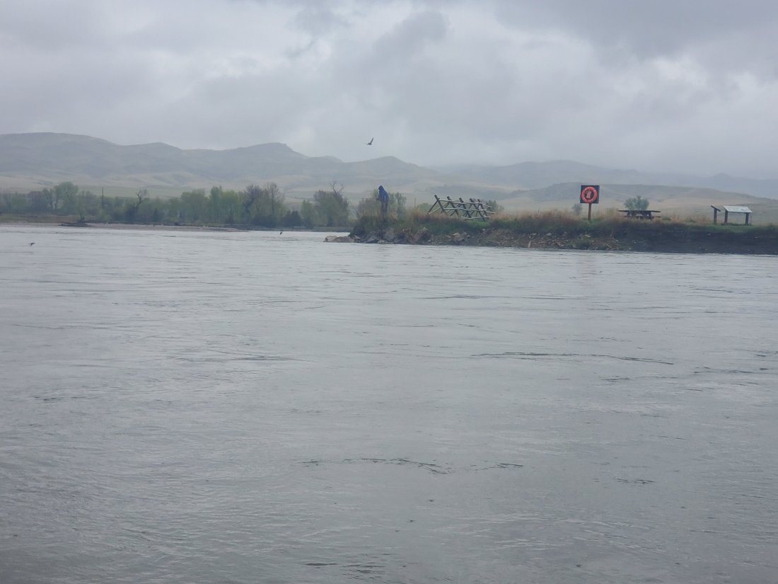
It was a cold an cloudy day, but it really didn’t rain all that much. We managed to stay somewhat dry and warm. After a few hours and many stories, we got to Toston Dam. We unloaded our boats and gear then walked over to check out the dam. A worker regaled us with tales of pulling bodies from the water intake as well as finding and attempting to remove a Youtube video of a kayaker going over the dam successfully. Eventually, a truck pulls around the corner, which is where Jim Emanuel enters the story.
Jim is a converted Montanan via North Dakota originally, who spent many years as a firefighter in San Diego. He caught the paddling bug a few years ago and last spring left his home in nearby Helena to paddle the entire Missouri. Then when he got to St. Louis, he decided to go all the way to the Gulf. Norm had let Jim know our plans, and with Norm needing to leave to guide a youth group on a river trip further down on the Missouri, it was Jim’s turn to be my river angel. He wasted no time in sharing his Montana hosptality, he hopped out of his truck with a bottle of whiskey – the warm up – along with a couple cold beers in celebration of a successful paddle that day. We shared river stories, finally loading our gear and two boats onto Jim’s truck to give Norm a ride back to his car at Three Forks. After dropping Norm off, we made it back to Jim’s amazing house outside Helena, where he showed me his two! boat sheds (take note, Sara). I was extrememly grateful for my first shower in 6 days and a filling meal of venison and potatoes.
Up early again today, Sunday, Jim loaded me up and drove me back to just below Toston Dam. Knowing I was heading back to Jim’s place tonight, I didn’t need all of my gear so I was travelling a little lighter. Before we even got in the water, Jim spotted an object floating in the river near the boat ramp. So mission #1 for the day was retrieving a scuttled cooler. I loaded up and paddled over to the empty, yet still in pretty good shape cooler. I went downstream a bit and threw it up on the bank for Jim to pick up on his way out. Just a small token of my appreciation for him hosting me.
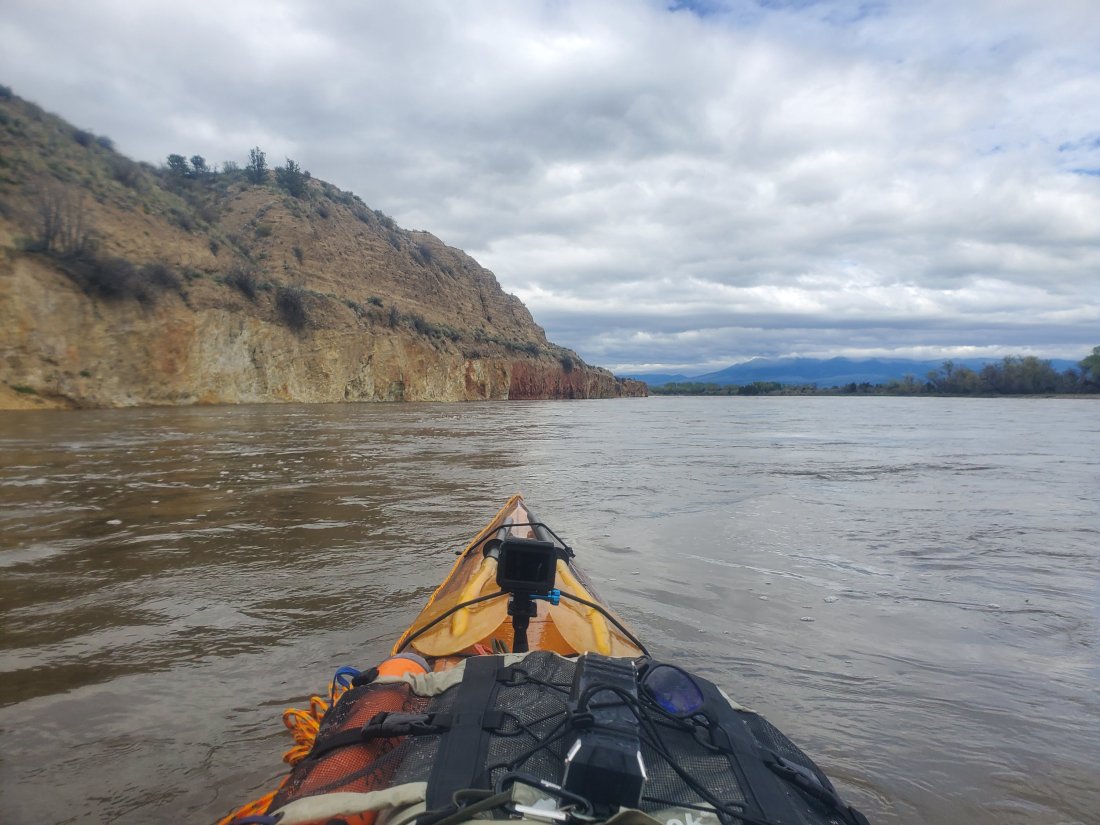
I paddled about 25 miles from Tosten to Townsend, a beautiful stretch of river which included York’s Islands, named after Meriwether Lewis’ slave York who accompanied the expedition, and Crimson Bluffs, so noted by L&C for the colorful cliffs still seen today. At Townsend, I stopped for a snack and gathered my wits in order to enter the first huge lake of the Missouri – Canyon Ferry Lake. Where a river enters a lake, there are always splits in the channel, a maze of streams breaking off and splitting and eventually all leading to the lake. However, you have to choose wisely in order to avoid running aground in shallow water, or possibly encountering dangerous snags from trees and branches under the water. In this case, I picked as best I could, ended up dragging the kevlar-coated bottom of the boat a couple times, but nothing too bad. Once I finally got into the lake, the fun really began. Even though the wind was relatively calm, maybe 5 to 10 mph, the sheer size of the lake means any wind at all is going to lead to some big waves. Wanting to avoid waves crashing over my boat or even worse, a capsize very far from shore, I feverishly paddled through the rollers trying to keep my balance and my boat positioned not to take the brunt of the waves. After a short while, the waves died down a bit, and I was able to dig in to do some serious paddling. I was moving at a pretty good pace. For about the next 4 hours, I paddled pretty hard. I stayed somewhat close to shore for safety and for some shelter from the wind and waves. I also played music for extra motivation, knowing I’d be able to recharge all my gear at Jim’s house later on.
I made it about halfway up the lake – to a spot called White Earth, where I met Jim at about 5:15. Added to the 25 river miles earlier, 10 or 12 hard miles on the lake had me exhausted. It was only appropriate then, that back at Jim’s house, with his wife Vicki, we dined on Perch tacos from fish he had caught while ice-fishing on Canyon Ferry Lake.
I’m certain my arms will be sore tomorrow, the weather promises to be crappier than today, and Jim’s offered to paddle the last half of the lake with me. So 7 straight days and 150 miles of paddling does not earn you a day off, try 7 more! I’m loving every minute of this.
Currently, I’m camped on an island in Missouri River Headwaters State Park. About 2 hours ago I finished paddling the last 4 miles of the Madison river. It flowed into the Jefferson River and I soon pulled out to set up camp on an island. However, this is not yet the Missouri River as the Gallatin river comes in about a 1/2 mile downstream from here.
Even though it was 45゚and raining, I think the last 4 miles of the Madison might have been the most beautiful. There are long, meandering curves, the water is generally calm and I think I saw more wildlife than I had on the entire Madison before. I saw pelicans, cranes, countless ducks and geese, other waterfowl I couldn’t identify; I saw 2 deer swim/run across the river right in front of me. I came around a curve to see a moose or elk sitting on the bank and staring at me. Plus, hundreds of small birds flying an inch or 2 above the water picking off flies for dinner. It was another spiritual experience not just for the natural aspect, but for the historical significance as well. Tomorrow morning, I will climb a rock that Lewis and Clark climbed as they reached the end of the Missouri River, and saw 3 rivers coming together. They also saw the forbidding rocky mountains in the distance. They knew their opportunity for making it over those mountains was short as the Winter was closing in. I on the other hand, huddled in my tent shivering, can’t wait for Winter to be over.
As the Madison and Jefferson converged, I snapped a quick photo of the spot that you see in the smaller picture at the top of my blog. Little did I know that one and a half years later, I wouldn’t be posing on that bank, but paddling by.
All in all, I paddled just short of 100 miles on the Madison. From the edge of Yellowstone Park, I tackled the first 2 lakes on the upper Madison. I skipped the dangerous sections below Earthquake Lake to Pine Butte and from Ennis to the end of Bear Trap Canyon. The scenery was unforgettable; the river was gorgeous. I feel like the varying conditions of the lakes and the different personalities of the river were an excellent primer for what is to come on the Missouri river. Tomorrow, the journey begins.
Waking up at Varney Bridge, I only had about 10 miles to paddle to arrive at Ennis, MT, probably the biggest town along the Madison. It was pretty uneventful paddling, kind of a grey day and nothing too treacherous, just a few braided channels to navigate. The river is relatively high during the spring right now, so I luckily don’t have to worry too much about running aground in the shallows. And the river moves at a pretty good clip, so I don’t really have to do much paddling. Arriving at the boat ramp in Ennis, I hoofed it over the bridge and into town and stopped in the first fly fish shop/outfitter/guide service I came to. I had a decision to make. After a few more miles, the Madison dumps into Ennis Lake, then enters Bear Trap Canyon. Researching the Madison, I knew I wasn’t going to paddle through Bear Trap. There is Class III thru Class V whitewater. I thought I’d be able to portage around those rapids on a hiking trail. After my first rough day of portaging on pavement, not to even consider off-road portaging, I changed my mind. I was going to get a ride around the Bear Trap.
After talking to Jess at Troutstalkers, she called to their other shop and soon enough, a gentlemen was on his way to pick me up and shuttle me down to Warm Springs, the start of the lower Madison. Joe Dilschneider pulled up in his big truck. Turns out, he’s from Ladue, MO, is a MICDS grad (the high school question, obviously) and has owned and operated Troutstalkers fly shop, outfitter and guide shop for 26+ years. He said he fell in love with the Madison Valley when he first saw it and never left…I can’t blame him. He found my trip fascinating and we shared stories on the 10 mile drive to Warm Springs. He snapped a couple photos of me for Troutstalkers’ facebook page so look for me on there…
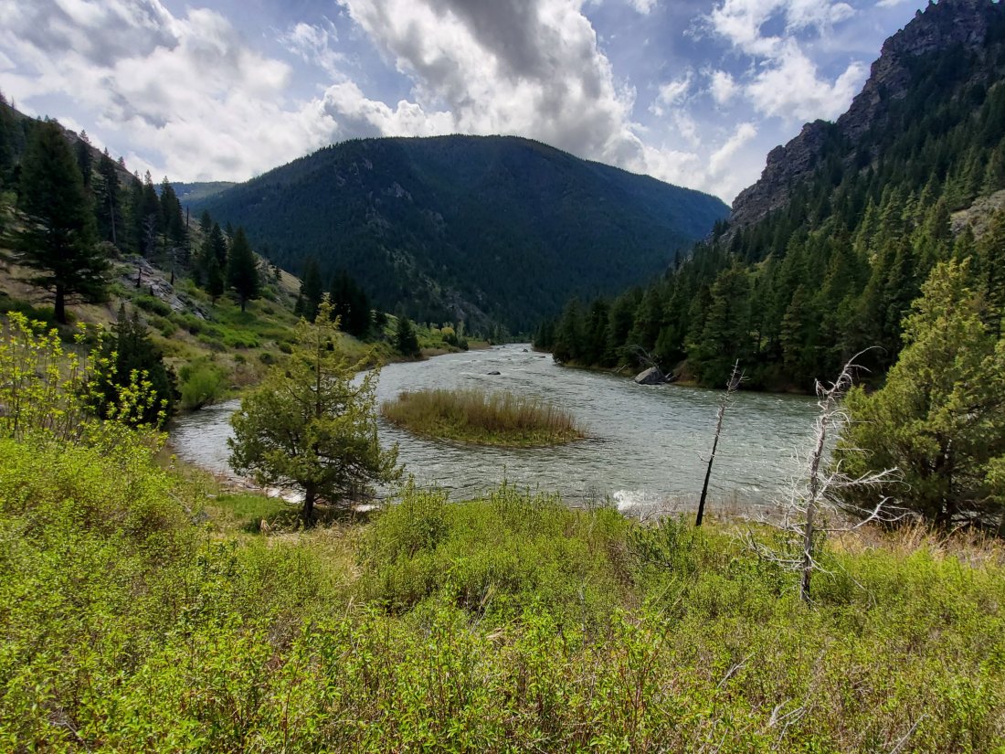
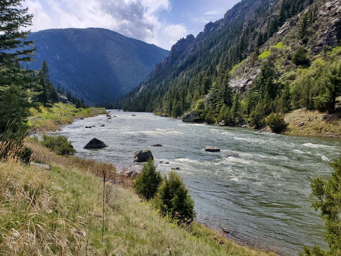
He dropped me at a busy flyfishing boat put in, I had to wait my turn to get on the water. When I finally did, I actually didn’t head downstream. I crossed to the other side of the river, where a hiking trail starts that goes deep into Bear Trap Canyon from the downstream side. I secured my boat and hiked up the canyon for about 3 miles. The canyon was spectacular, with 2 or 3 thousand foot mountains rising up on each side of the cascading Madison.
I know religous folks experience moments of transcendence under certain circumstances; hiking alone up this canyon is about as close as I’ll come to those types of feelings. Nature is my church and this is one spectacular cathedral. I ignored the blisters forming on my feet due to my ill-equipped- for-hiking sandals and eventually made my way back to my boat. I bypassed a small school group who was stopped to observe a rattlesnake beside the trail.
Back on the water, I was enveloped in a cloud of flies. Landing on me, my boat and all my gear, I wondered where all the fish were to gobble up these bad boys. This stretch of river is a popular flyfishing spot, and I passed at least a half dozen drift boats. I pulled off to wait out a brief thunderstorm at a campsite, then paddled about 15 miles downstream, to the white cliffs section of the Madison, where my buddy Norm Miller recommended I camp for the night. I picked a spot opposite the cliffs and set up camp in what was obviously a cattle pasture, though the manure wasn’t so fresh as to expect any visitors that night.
It was a bit windy, so I had to use my tent as a wind break as I made a delicious turkey, edamame and rice dinner. I even broke out the fishing pole for the first time, with no luck. Ducks and other waterfowl that occupied the cliffs opposite my camp squaked well into the night and early on in the morning, but I was able to sleep through it. No angry bulls found their way into my campsite and I was packed up and on the water by 8:15.
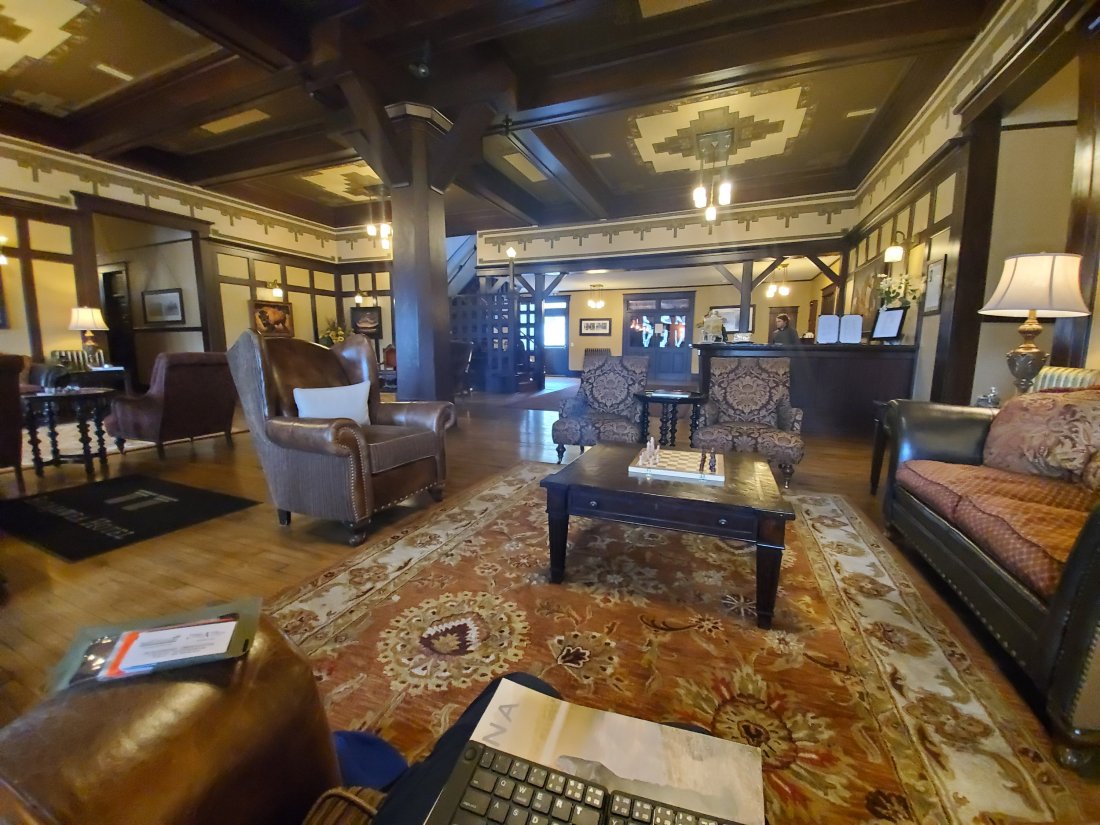
Immediately, it began raining and got colder and hasn’t let up since then. I paddled the remaining 15 miles on the Madison to the I-90 overpass and pulled my boat out. The last 15 miles was a maze of twisting, turning channels and sloughs. My object was to try to stick to the channel with the most water, and least chance of running aground or hitting a snag. I pretty much managed to do it. At the bridge, I changed into some semi-dry gear from the waist up and walked the two miles in the rain into Three Forks. Once again, my golf umbrella really saved the day. I had a leisurely lunch at a local cafe, the fish and chips special and two local beers, along with a couple coffees to warm the body. The forecast for the coming week is not looking promising for paddling down the top of the Missouri – cold, wet and some snow mixed in.
I left the cafe and headed down 2 blocks to the Sacajawea Hotel, where I am currently enjoying the warmth of their spectacular lobby and using a few nearby outlets to charge my batteries.
The rain is supposed to continue all day and into the evening. My plan is to at some point walk back to my boat, and either paddle down a few miles and camp at Missouri River Headwaters State Park, or what I may end up doing is going hobo style and pitching my tent under the insterstate bridge and try not to get run off by the cops. Time will tell how things turn out, the adventure continues.
Yesterday started pretty early. I packed up camp at the marina, then liesurely paddled the last two miles of Hebgen Lake while enjoying a day old egg and sausage bagel. Near the dam that is the reason Hebgen Lake exists, I pulled my boat out, unloaded all my gear, put the boat onto my C-Tug cart, pulled the boat up a rocky slope to a gravel parking area, then loaded all my stuff back in it. (No this won’t be the first time I do this today…)
My google map scouting told me I should be able to roll my boat about a mile down the road to a campground where I could put back in. After 500 feet of downhill rolling, the wheels on the cart started screeching like a banshee. This can’t be good. I took the boat off the cart, disassembeled it and examined the wheels. Sure enough, the weight and pressure on the axles was causing some of the plastic to get scratched and worn down. I wasn’t going to make it very far at all with this development. In my best McGyver impression, I pulled out the vaseline I had packed for the purpose of relieving paddling induced chafing throughout the trip and generously applied a coat to the axle. Back on the road without even a squeak! Fantastic.
I made it to the campsite and the appropriately named Ghost Village Road. The road parallels the Madison as it enters Earthquake Lake and looking across, sure enough there were a few old dilapidated houses, abandoned after the earthquake of 1959. I could put my boat in here, but there were some pretty hefty rapids and boulders in the water. I walked about a mile ahead, scouting a way through. My mind went back and forth; should I put in and risk it? Should I painfully portage another mile and play it safe? After a quick bite for lunch, I decided to go for it. I put in the rushing water and made it about 200 yards, I didn’t really hit anything and wasn’t in danger, but I felt like I wouldn’t be able to 100% control the fully loaded boat safely down these rapids. I was able to pull out, unload all my gear, mount the boat, then reload all my gear. Second time.
I got back in the water at the upper end of Earthquake Lake, not before hitting a rut and rolling my boat and cart over on its side, much to the amusement of some onlooking fly-fisherpeople. Earthquake Lake formed when a 7.5 quake hit in 1959, the largest quake to ever hit the Rocky Mountains. The ensuing landslide killed 28 campers at the height of summer tourist season, and dammed the Madison River. Engineers eventually cut a new pathway for the water to escape before the lake became too full, thus averting even more catastrophe downstream. One effect of such a relatively young lake is that the lake is full of dead tree trunks. It was very eerie paddling through dead forests, while keeping an eye on the water for what could be a disaster waiting to happen if I did hit a submerged trunk. The first 1/3 of the lake was calm and enjoyable. Then the wind came up. I paddled the last 2/3s of the lake, probably 8 miles, into a 30 to 40mph headwind. The waves were large and I really had to put some effort into it to make any progress.
I finally made it to the end of the lake. The take out is conveniently located about 10 yards upstream from where the lake gets funneled into the narrow man-made channel, which leads to about 3 miles of boat crushing, and often fatal class 5 rapids. I was pretty terrified of getting too close to the suction, so I stopped well short of the spot, then pulled my boat with a rope along shore til I got to the take out. What should have been relief turned to more bad news, as google maps failed to show the 150 – 200 ft elevation change to get back up to the road from the take out. Portage sequence, queue the music. Unload boat, load on cart, haul gear up the hill, haul boat up the hill. Repeat. Ugh. I finally made it up to the road exhausted, and was really crossing my fingers someone would stop and offer to load everything on their car for the ride down the mountain. It didn’t happen. Not all too bad though, this was a pretty steep decline down into the valley past the crazy class 5 section of the river. I stopped two more times to apply a fresh coat of vaseline lube to the cart, and to let it cool down as to not overheat the critical components. My plan had been to portage everything about 3.5 miles to another put-in on the free-flowing Madison. Luckily, as I got to the bottom of the hill, about 2.5 miles into my portage, I saw an oasis and my stop for the night – the Slide Inn. I quickly got a campsite, a couple beers and made my first dehydrated meal in the rain. Back in my tent, I cracked open my journal to record the day’s events, only to pretty much fall right asleep due to the exhaustion from the day.
Today, I was up early and after speaking to the staff at the Slide Inn, recommended for me to put in the Madison about 3 more miles downstream from where I had planned. They told me there were quite a few rocks and rough spots still and with my boat, I should play it safe. Who am I to disagree? A fly-fishing guide Wyatt helped me load the boat onto the roof of his truck and hauled me, my gear and the MOstar down to the Pine Butte put in. I quickly unloaded and reloaded and was off at around 11am. It’s now 6:30 and I’ve been off the water for about an hour after making about 32 miles today. The river was fast, rough, with just enough boulders that I had to keep my head on a swivel the entire day. Luckily, I didn’t hit anything major, the rudder only got stuck once resulting in me having to jump out waist deep into the cold water to unjam it. It was a little cold and rainy later in the day, but I’m sitting comfortably in camp typing this so all in all, a pretty darn good day. Just got a message that Sara made it home safely after a 24 hour return trip, so very thankful there as well.
Instead of posting photos of the past two day’s events, I uploaded quite a few shots to my Instagram. They roughly correspond to yesterday’s and today’s events, sorry I can’t be bothered to integrate them into my narrative. As always, please enjoy.
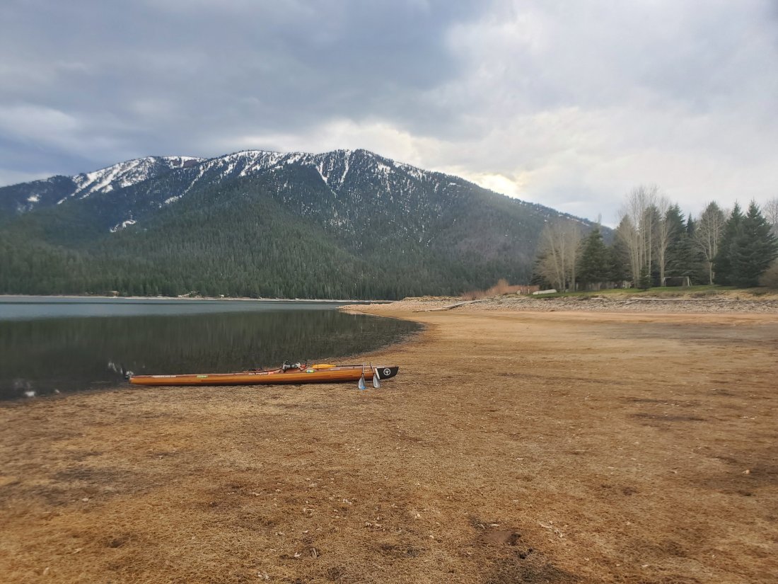
It’s the end of the first day on the river. I’m tucked into a dirt beach next to the Kirkwood Marina on the lower end of Hebgen Lake. What a time to be alive when I can have cel service while camped at a mountain lake in between two large mountain ranges.I made it about 16.5 miles today, first mile or two on the Madison as it exited Yellowstone then the rest on the lake. Other than a brief pop up shower with some wind which forced me to the bank, the weather was excellent, mostly sunny and in the upper 60s and 70s. Sara dropped me just upriver from the rte 191 bridge near the town of West Yellowstone. A young fly fisherman was surprised to be witness to the start of the journey and obliged us by snapping a photo. My gear was mostly packed and organized, so I was fairly quickly able to get everything loaded. We said our goodbyes and soon enough, I was paddling.Some key takeaways and learnings today:
Gear storage and organization will be a work in progress. For example, I had to scramble to locate rain gear when it started raining so that process will need to be more efficient.
I got the feel for sticking to the sheltered side of the lake to stay out of strong winds and big waves. This will be an ongoing theme throughout the trip.
I managed a couple crossings of the lake, being quite far from shore, yet completely comfortable and in control. Timber Longboard’s boat was incredible and I am extremely happy with its performance on the first day. It really moves when I want it to.
I made 16.5 miles in about 5 hours, most of it on non-moving water. So I know I will be fully capable of cranking out high mileage days on this trip. I will have to continue to remind myself to take it easy, enjoy the ride, stop and explore. The MR340 racing mindset is going to have to go by the wayside.
I got my first experience navigating a braided channel, where a river dumps into a lake. It’s like a maze and you have to pick the correct channel or you end up stuck in sand or mud. I managed to do that twice today, but luckily was able to jump out of the boat and pull it a few feet over to deeper water.
The indescribable beauty of an alpine lake surrounded by snow covered peaks was just as amazing as it sounds. Pictures hardly do it justice, so I tried to just take it all in.
Tomorrow will be interesting. I’ll paddle the remaining mile on Hebgen to the dam, after which I’ll load the kayak on my cart and portage her about a mile along a two lane state highway to the put in on earthquake lake. I am somewhat disappointed, as I found or from a couple locals that the Earthquake Lake museum and visitor’s center doesn’t open until memorial day. I was really looking forward to learning more about the tragic 1959 quake that killed about 30 campers and accidentally created the lake through which i’ll be paddling tomorrow.Bonus funny story from today: I’ve been in touch with another long distance paddler, Ellen Falterman. She did the entire Missouri River two years ago and is doing the Mississippi this summer. On the drive up this morning, she messaged me a picture of the Mississippi headwaters and said, “where you at?” A little confused, I responded, Montana, on my way to the Madison river. Apparently we’re are starting our journeys on the same day, just a few thousand miles apart, to her surprise.mf
Hey there! You might know me from blog posts such as “The Patient Wife” and “She Who Knows Dehydrating.” Well, that’s me! Mark and I thought it would be interesting to share my perspective on his adventure, since a lot of the questions he’s gotten have been about how I feel and what my plans are.
First, a little background. Mark and I started dating around the time of his first MR340. My friend Susan and I drove to Jefferson City to see him and Norman at one of the checkpoints. We were armed with Subway sandwiches and a dashboard jesus and were completely blown away by how many people were out there racing and supporting racers. It was amazing. We saw them for about 15 minutes, they passed on our sammiches after being tempted by fast food burgers courtesy of Mark’s cousin and were off. I went on to be ground support for the next three MR340s that Mark did, and even one last year that he didn’t. It’s exhasuting and exciting and I love it.
Before the last 340 he did, in 2017, I tried to talk him out of it. I thought that he should try something new; a different river or a more challenging race. I can barely do the same 5k or 10k more than once, I couldn’t imagine 340 miles of the same river (and yes, I know the saying about the river and changing, so I’ll stop you there). On our honeymoon, we stopped in Three Forks, Montana, home of the Missouri River Confluence. Mark was so excited and told me that one day he was going to paddle the entire thing. I believed him, because he’s that kind of guy, but I had NO IDEA it would be so soon.
In the summer of 2018, Mark asked what I thought about him doing it in 2019. I told him to go for it, but was cautious that he might not get everything planned or work wouldn’t give him time off or that something would come up. Nothing did, obviously, we’re here in Montana getting ready to cook the last homemade meal he’ll have for weeks. Everything fell into place. We talked about financial needs and boring stuff. And scary stuff. But we came up with a plan and the rest played out pretty much how you’ve read up until now. However, I got so many questions. So. Many. Concerns. Mark thought he had a lot, but those were about logistics and maps and food. So let me answer a few.
1. Are you going too? No, I never, EVER thought about going with him.
I’m a land girl. I love water, but only for swimming. I get sick on boats and I hate them for long periods of time. I got sick on the lazy river once, AS AN ADULT. So no, it never crossed my mind.
2. What are you going to do for four months? The same thing I do every night, Pinky…
This has probably come up the most. “You can do whatever you want!” “It will be like a party every night!” “The Summer of Sara!” I mean, that sounds like a blast, but I still have a job, the truck, two cats, and a boat (haha) load of new chores to take care of…looking at you, yard. So while I’ll have plenty of alone time to go out and get crazy, realistically I’ll be at home a lot, most likely playing Zelda (finally!) because one thing I don’t get to do a lot with one TV is play video games.
3. Aren’t you worried/nervous/scared? Yes? I have to say yes, right?
All joking aside, of course I’m nervous, but not about Mark. He knows what he’s doing and has a solid plan. I’m worried about stuff like my packages getting lost in the mail and him not having resupplies or one of the cats going missing or a tree falling on his car while I’m out of town for the weekend. You’re welcome, because now you have those same fears.
4. How often are you going to go see him? Maybe once.
Most of his trip will be far away from StL and I can’t take a ton of time off to go do that. Besides, we’ll be in contact and talking enough that the months will fly by. And I’m encouraging others to go find him along the way, he will love to see friends along the river!
I plan to post updates about Mark and will plan on an event closer to when he’ll finish. It’s important to both of us that so many friends have reached out and asked us these questions about the trip, it just means that you care! And it means so much that he has your support and love.
Happy blog reading and following, feel free to shoot me a message if there is anything you’d like to know about where to find him.
My initial arrival in Montana got off to a little bit of a rocky start. A missed boat inspection point and subsequent pull over by the cops, plus a pop up wind and rain storm just outside Billings that pushed my car and boat all over the road had me a little nervous about what I was to experience in Montana.
But I am happy to report that it has been smooth sailing ever since. Norm Miller and Chris were fantastic hosts in Livingston. We talked for hours about my trip, my plans, challenges, Norm’s experience and a lot of other subjects. After Sara’s delayed arrival, we made our way to Butte and then on to Wise River. We met our old time hasher friends Bereth and Barry and had an impromptu mini pub crawl through Dewey and a few other local dives. It was fantastic catching up with old friends, laughing, telling stories, and sharing some drinks together in a beautiful place. We had a relaxing evening around the fire pit and a great dinner before turning in for the night.
Bereth and Barry had to catch a 6:00 a.m. flight back to the East coast leaving Sara and I on our own for Sunday. We went into the nearby town of Anaconda for a late breakfast enjoyed inside a Herbie car then headed out to some local hiking trails.
After one mountain road proved to have too much snow and mud for my trusty Subaru to navigate, we headed to another spot called Echo Lake. Driving up a mountain road brought us to more snow and a tree that had fallen across the road. Not to be deterred, we parked and then had a lovely 5 mile hike up to the mostly frozen lake and around the lake. On the way back, we stopped and grabbed some groceries for dinner for my last meal before the trip starts tomorrow morning. Sara has found a way to watch Game of Thrones soon, and this is my view as I enjoy a beer and dictate this post into my phone.
I am incredibly excited to start the trip tomorrow. Montana has been amazing and I can’t wait to experience it for about another month. All systems go for a Monday launch!
Thursday morning I departed St. Louis fully loaded, the MOstar securely strapped on the roof, and tied down in both front and back. I promised to swing by my office on the way so that coworkers could check out the boat. My big boss with lots of outdoor and fishing experience laughed at my tacklebox that I packed for when I get the inclination to cast a line in. He promised to send me pictures of the bait and lures he recommends, and he’s actually floated and fished stretches of the Madison, which was coincidental.
Planning the 22+ hour route to Livingston, Montana, the main challenge is interstate 29 between Kansas City and Omaha. The entire route is closed due to Missouri River flooding, go figure. So my alternate route took me up through Hannibal, MO, into and diagonally across Iowa, through South Dakota, Wyoming and finally Montana.
It was a pretty grey and uneventful first day. As I approached Eldon, Iowa, I started seeing signs for the American Gothic House. With a big nice boat on the car and all my gear to live off of for 3 months in the car, I planned on sticking to the road with little or no detours or stops. Conveniently, the American Gothic House was only a mile off the road so I was able to pop in for a couple quick photos.
I grabbed a Jimmy Johns sandwich for the road and blasted through Iowa and into South Dakota. The ground in SD was obviously saturated with so much recent rain. Almost every farm field I passed had standing water, all the ditches were full, and the creeks and rivers I passed were out of their banks. All this water will eventually drain to the Missouri, ensuring flooding and high water levels well into the summer. Later afternoon brought out a welcome sight of the sun and I eventually made it to my day 1 goal, Chamberlain, SD – about 12 hours and 750 miles. The boat held steady the entire way.
A quick dinner of a South Dakota specialty, Chislic, and then I set up camp at a simple roadside spot. I woke up to frost on my tent and had to fish the gloves out of my bag in order to avoid finger numbness while I packed up. I loaded up on gas and coffee and was on the road by 6:30 for what promised to be a bright sunny day. A couple hours in, I decided to take a short detour and drive through Badlands National Park. It’s probably my favorite National Park, so I swung through and took some pretty good photos and videos with the boat and the Badlands as a backdrop. I knocked out the rest of SD, the Northeast corner of Wyoming and entered Montana before I saw my first flashing red cherries.
With a boat prone to being blown by the wind strapped to my car, I was doing close to the speed limit almost the entire trip. From South Dakota, through Wyoming and into Montana, the speed limit is a generous 75 or 80 mph. So I was kind if confused as the police SUV pulled in behind me. The polite officer informed me I had passed by a mandatory boat inpection station for invasive species. He had me double back to the station and a couple of guys looked over my boat, filled out a form and had me on my way. Just a warning for failing to stop at the inspection.
At Billings, MT, a rainstorm blew in and I really had to fight the wind from pulling my car and boat out of my lane. Out of 22 hours, that really was the only time I was a little concerned about the security of my tie down job. Soon enough I made it to Livingston, MT and the home of Norm Miller and his girlfriend Chris. Norm is the defacto Missouri River paddling community historian, expert, collector of information and artifacts, and an excellent host. in 2004, Norm paddled UP the Missouri River from St. Louis to Montana, then crossed over the Rockies then down the Columbia, retracing Lewis and Clark’s journey. He and Chris showed me a few cool sites around Livingston, including the nearby Yellowstone River and the only existing statue of Sacajawea riding a horse. Norm was part of the committee to erect the statue in 2016.
We had a fantastic meal at a local Florida themed restaurant, and I was able to exchange life stories with Norm and Chris and gather more information about the trip ahead of me. Sleep came quickly and I was ecstatic to be done with such a long drive.


 mf
mf