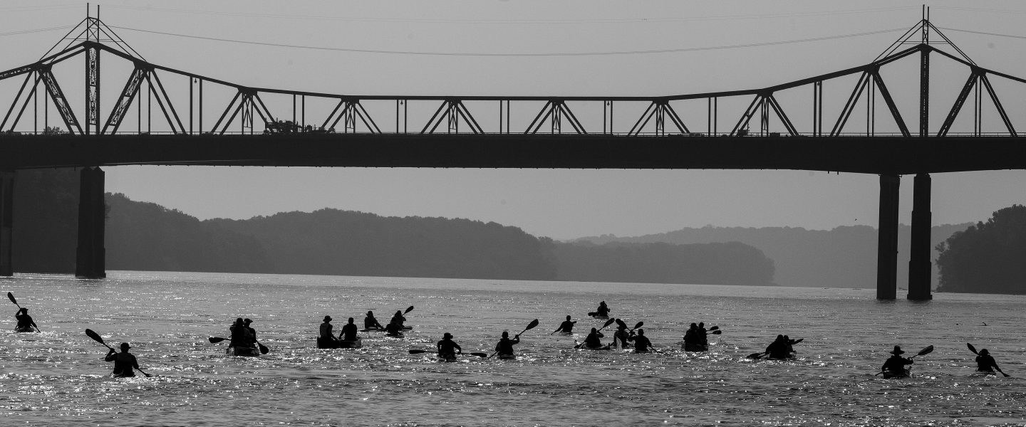
Currently, I’m camped on an island in Missouri River Headwaters State Park. About 2 hours ago I finished paddling the last 4 miles of the Madison river. It flowed into the Jefferson River and I soon pulled out to set up camp on an island. However, this is not yet the Missouri River as the Gallatin river comes in about a 1/2 mile downstream from here.
Even though it was 45゚and raining, I think the last 4 miles of the Madison might have been the most beautiful. There are long, meandering curves, the water is generally calm and I think I saw more wildlife than I had on the entire Madison before. I saw pelicans, cranes, countless ducks and geese, other waterfowl I couldn’t identify; I saw 2 deer swim/run across the river right in front of me. I came around a curve to see a moose or elk sitting on the bank and staring at me. Plus, hundreds of small birds flying an inch or 2 above the water picking off flies for dinner. It was another spiritual experience not just for the natural aspect, but for the historical significance as well. Tomorrow morning, I will climb a rock that Lewis and Clark climbed as they reached the end of the Missouri River, and saw 3 rivers coming together. They also saw the forbidding rocky mountains in the distance. They knew their opportunity for making it over those mountains was short as the Winter was closing in. I on the other hand, huddled in my tent shivering, can’t wait for Winter to be over.
As the Madison and Jefferson converged, I snapped a quick photo of the spot that you see in the smaller picture at the top of my blog. Little did I know that one and a half years later, I wouldn’t be posing on that bank, but paddling by.
All in all, I paddled just short of 100 miles on the Madison. From the edge of Yellowstone Park, I tackled the first 2 lakes on the upper Madison. I skipped the dangerous sections below Earthquake Lake to Pine Butte and from Ennis to the end of Bear Trap Canyon. The scenery was unforgettable; the river was gorgeous. I feel like the varying conditions of the lakes and the different personalities of the river were an excellent primer for what is to come on the Missouri river. Tomorrow, the journey begins.
It’s the end of the first day on the river. I’m tucked into a dirt beach next to the Kirkwood Marina on the lower end of Hebgen Lake. What a time to be alive when I can have cel service while camped at a mountain lake in between two large mountain ranges.I made it about 16.5 miles today, first mile or two on the Madison as it exited Yellowstone then the rest on the lake. Other than a brief pop up shower with some wind which forced me to the bank, the weather was excellent, mostly sunny and in the upper 60s and 70s. Sara dropped me just upriver from the rte 191 bridge near the town of West Yellowstone. A young fly fisherman was surprised to be witness to the start of the journey and obliged us by snapping a photo. My gear was mostly packed and organized, so I was fairly quickly able to get everything loaded. We said our goodbyes and soon enough, I was paddling.Some key takeaways and learnings today:
Gear storage and organization will be a work in progress. For example, I had to scramble to locate rain gear when it started raining so that process will need to be more efficient.
I got the feel for sticking to the sheltered side of the lake to stay out of strong winds and big waves. This will be an ongoing theme throughout the trip.
I managed a couple crossings of the lake, being quite far from shore, yet completely comfortable and in control. Timber Longboard’s boat was incredible and I am extremely happy with its performance on the first day. It really moves when I want it to.
I made 16.5 miles in about 5 hours, most of it on non-moving water. So I know I will be fully capable of cranking out high mileage days on this trip. I will have to continue to remind myself to take it easy, enjoy the ride, stop and explore. The MR340 racing mindset is going to have to go by the wayside.
I got my first experience navigating a braided channel, where a river dumps into a lake. It’s like a maze and you have to pick the correct channel or you end up stuck in sand or mud. I managed to do that twice today, but luckily was able to jump out of the boat and pull it a few feet over to deeper water.
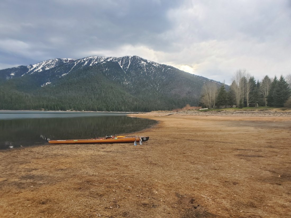
The indescribable beauty of an alpine lake surrounded by snow covered peaks was just as amazing as it sounds. Pictures hardly do it justice, so I tried to just take it all in.
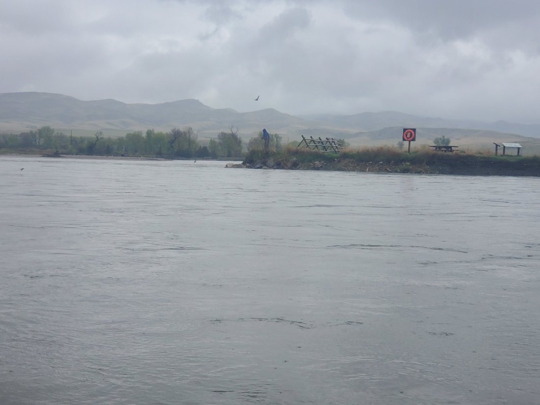
Tomorrow will be interesting. I’ll paddle the remaining mile on Hebgen to the dam, after which I’ll load the kayak on my cart and portage her about a mile along a two lane state highway to the put in on earthquake lake. I am somewhat disappointed, as I found or from a couple locals that the Earthquake Lake museum and visitor’s center doesn’t open until memorial day. I was really looking forward to learning more about the tragic 1959 quake that killed about 30 campers and accidentally created the lake through which i’ll be paddling tomorrow.Bonus funny story from today: I’ve been in touch with another long distance paddler, Ellen Falterman. She did the entire Missouri River two years ago and is doing the Mississippi this summer. On the drive up this morning, she messaged me a picture of the Mississippi headwaters and said, “where you at?” A little confused, I responded, Montana, on my way to the Madison river. Apparently we’re are starting our journeys on the same day, just a few thousand miles apart, to her surprise.mf
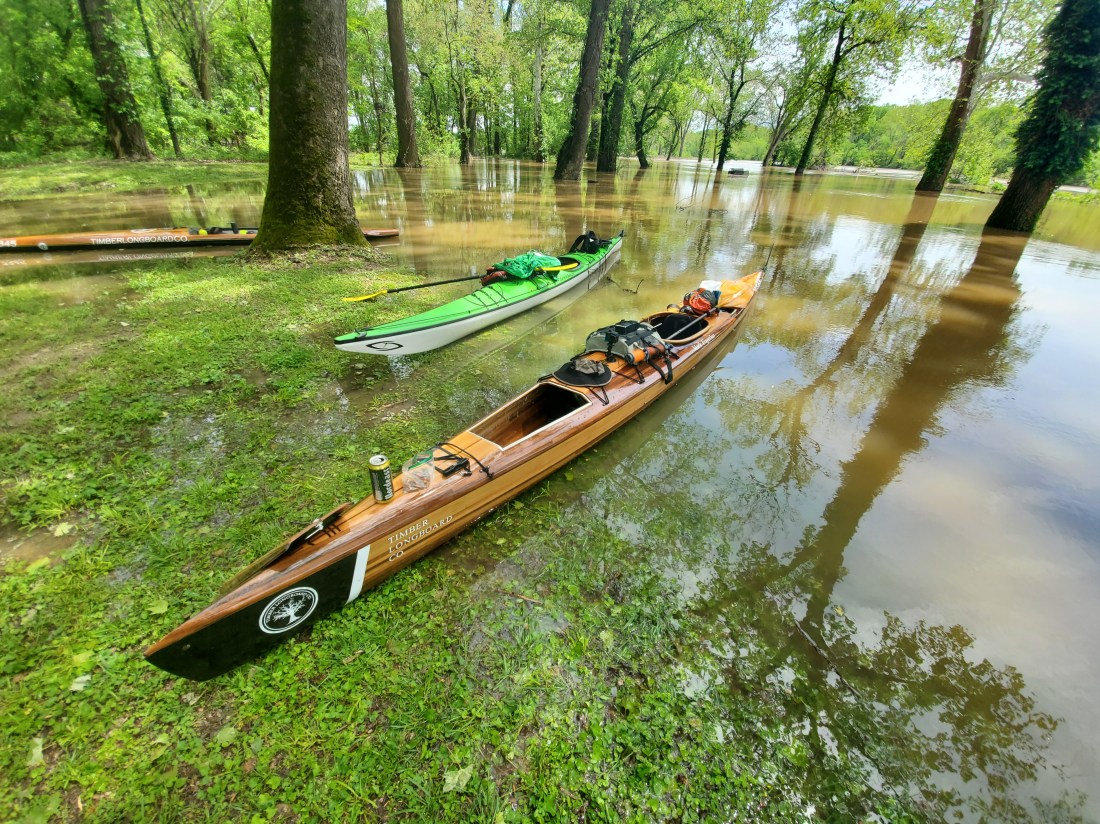
Departure from St. Louis in about 85 hours. I am currently catching my breath, rooting for a Cardinals comeback against the Cubs and thinking about what I am still missing. It was a whirlwind weekend. Saturday morning, Shane of Timber Longboard Co. joined myself and another friend to paddle the flooded parks and greenways of lower Kirkwood and Valley Park. The Meramec River is running at about 24 feet after a week of heavy rain. The primary purpose of the trip was to get a first paddle in on my new kayak, with all the anticipated gear I’ll bring on the trip, as close to a dress rehearsal as I’ll get.
Before setting out into the flood waters, we christened the newly completed MOstar with a St. Louis appropriate beverage and one of my summer favorites, Busch Light. After weaving in and out of partially submerged pavilions, soccer goals, baseball backstops, mailboxes, electrical boxes (hmmm), and even the remote-control car track, we got into the main channel of the Meramec for some serious upstream paddling. The current was probably moving 3 – 4 mph so we really had to dig in to make progress. After a brief stop to take care of our barley and hops deficit, we surfed the rising river back downstream to the put-in.
Overall, the first real run on the MOstar was successful. My main takeaways and lessons learned:
Super comfortable cockpit. Lots of room for in-cockpit storage and ability to move. A few minor seat and kneepad adjustments and I should be good for 2,400 miles.
The rudder with which I’ll rely on to steer the boat in high winds or crazy currents works well when it’s in the water. We did have an issue with getting the rudder to fully deploy into the water so we’ll work on that. But the foot pedals and controls were perfectly place for my comfort and control.
I was absolutely delighted with the amount or storage space. It is a 20 ft kayak, but up until yesterday, I didn’t have a solid grasp on if what I was planning on packing would fit in the boat or not. It does, with lots of room to spare. This will allow me to pack a few more luxury-type items I normally would have left at home. I do have to keep an eye on my total weight though.
Overall, the yak is sleek, cuts through the water well, sits on the water at an ideal level when fully loaded, is able to be controlled (as long as the rudder is doing its thing).
It’s a fucking beautiful boat. You all need to get yourself a Timber Longboard boat.
The MOstar with my emergency backup boat – Current Designs Nomad, and a Timber Longboard stand-up racer
I spent the rest of Saturday reorganizing gear, classifying and packing all of my food and re-supply packages, as well as cleaning and storing my 6 other kayaks (my aforementioned problem). Sunday morning continued more gear optimization and packing based on the new space capacity. Spent the afternoon with my family, enjoying a birthday dinner about 3 months ahead of my actual birthday. It’s an afternoon I am certain I’ll think back on during my long river days, laughing with my mom and dad, siblings, nieces and nephews, shooting some hoops, hitting whiffle balls and generally enjoying the fantastic whether. I even taught my dad how he’ll be able to track me on the Garmin map site. Family goodbyes for a 3 or 4 month absence are certainly hard, but I feel incredibly blessed to have support and love from them.
The next three days will also be a whirlwind. Last minute prep, more goodbyes, all while working 8 hours a day. Tomorrow night, I am incredibly excited to head to the lovely river town of New Haven, MO. My friend and boat maker, Shane Camden and his wife Stacy will be presenting a plan to convert an older workshop/warehouse space to the new world headquarters for Timber Longboard Co. to the city council of New Haven. My new kayak will be there on display to show those in attendance the kind of work they do and plan to continue to do with an expanded space. I’ll lend my voice and plans for my trip with the group if I can. The proposed shop and Timber Longboard’s future plans will absolutely connect more people to the Missouri River, which is an essential objective and motivation for my trip. It’s a message I’ll take pride in spreading, highlighting the amazing resource that’s at the doorstep of all in attendance. I hope for the best for Shane and Stacy and hope to provide an update after the meeting.
It’s not looking good for those Redbirds, can’t win ‘em all, I suppose.
One of the most common questions I’ve gotten from folks is tracking and communication during my trip. As I explain in a lot more detail in my technology-focused post, my primary link to the outside world will be my Garmin InReach Explorer+. A device of many uses for me, anyone with access to a specific web link will be able to track me at any point during the trip. Every 10 minutes or so, my location will be pinged via satellite to the map on my website to indicate my location.
Also, from the same website, anyone will be able to send me a text message. Just click the message button on the page, put in your phone # or email and send a message. The updates will begin when I put in on the river, projecting to be the morning of May 13th or 14th.
At any time, click the button over on the right side of my site – with the lounging Buffalo River turtles. The trip is long and I am certain I’ll be eager to hear from family and friends along the way.
Less than a week before departure, I’m focused on final preparation of gear, the boat, completing my professional duties, in-trip re-supply and a whole lot more. Very excited to hit the road!
Over the years, I’ve probably owned around 10 or 12 canoes and kayaks. Currently, I have 6 (do I have a problem? Probably). I’ve never thought about giving any of my boats a name. I thought that was for old rich guys with sailboats or at least boats with motors and electronics and steering wheels and all that stuff.
As the boat I am planning to take on my journey this summer started to take shape, I could tell it was going to be beautiful. Less of a utilitarian watercraft to get me from point A to point B, more of a floating work of art. And that’s exactly how it’s turned out. Shane and Stacy at Timber Longboard Co. have built a wonderful business and kayak building is their next step in their evolution as a successful watercraft maker. I am absolutely honored to have them build me their first kayak and allow me to captain this incredible ship down the Missouri River.
I felt giving this amazing boat a name is a necessary step to make my journey impactful and memorable for myself, friends, family and strangers alike. At my kickoff barbeque and fundraiser yesterday, I asked all in attendance to submit ideas for a boat name. I may not have been 100% transparent, as I had a name in mind, but would be totally willing to forego that name if someone came up with something better. As I read the submitted names last night, I laughed out loud several times and was also impressed by some significant and apt ideas (as well as some that shouldn’t be repeated). The full list of submitted names is below – I really had to think hard about Shark Fingerboat. Thanks to everyone who submitted ideas!
Alas, none of the names lived up to my original idea:
MOstar
May 16, 2016 – One of all-around best days of my life. Sara and I were in the middle of an amazing two-week trip around Croatia, Slovenia, Italy, Montenegro and Bosnia-Herzegovina. We started the day setting out from our Croatian seaside vacation rental. Not a cloud in the sky as we headed East over the mountains, crossing the border into Bosnia. Both the elevation and the potholes per mile increased significantly as we entered the country. Our destination for the day? Mostar, Bosnia. It may be the most well-known town for tourists in Bosnia, and for good reason. It’s a picturesque town on the Neretva River. It’s got a rich history, but also has obvious scars from the horrific war in the 90s. Walking down the streets of Mostar, you’ll pass an incredibly historic and architecturally beautiful building or church, and the very next building is a bombed out shell of a facade pock marked with artillery divots. There are historically Christian and Muslim parts of town separated by the river and connected by an incredibly beautiful bridge called the Stari Most. Sadly, the bridge was blown up by bombs during the war, but was rebuilt shortly thereafter.
The beauty of Mostar can make any old schlepper seem like a photographer.
As luck would have it (and based on some careful research), the Mostar Diving Club allows daring tourists to jump off the bridge into the waters 75 feet below. As a longtime jumper from tall heights into bodies of water, I immediately went for it.
(Sara…wasn’t operating the camera, it was like, somebody else, right Sara?)
My two weeks of posterior soreness notwithstanding, it was the exhilarating highlight of my trip to Bosnia. We then drove the couple hours back to Croatia and sat down for an amazing twilight seafood dinner on a patio overlooking the gorgeous waterfront and promenade in Makarska. Halfway through dinner, I knew today was the day. We sped back to our shack; I got a couple glasses of wine then proposed to Sara on the dock as the sun was setting over the Adriatic. I wonder if it was as perfect as I see it in my mind. Well, she said yes and we got hitched 16 months later.
Drašnice, Croatia
Our experience in Mostar was incredibly memorable, just for being there, but also for the significance of that day for me and Sara. As she’s been a huge part of my trip down the Missouri River so far and will continue to be, I wanted to choose something that’s significant for us. The name connects a wonderful memory for us with the state we call home and the life-giving river that cuts through the middle. It’s also appropriate in that my eventual destination and lifelong home of St. Louis has a large Bosnian community, so there’s that connection as well.
In 15 days, I’ll set out on the MOstar for a 2,450 mile trip.
A huge podcast listening friend referred me to a podcast a couple months ago called Dirtbag Diaries. She sent it my way because one episode was about a guy who paddled a lot of the Missouri River. I’ve been sort of listening to the podcast off and on when I can. Each episode typically is a story about a trip, and experience or event that happened to its subject in the outdoors. I popped on the most recent episode called Solo She Rides. Its focus is on two adventurers who undertook epic adventures solo.
The first 6 minutes or so is the introduction by the writer, Fitz Cahall and tells a short story about one of his early solo adventures. His masterful telling of a story from his youth highlights the challenge of undertaking an adventure solo, but also why people do it and why it is so rewarding. His explanation for the thoughts of a solo adventurer couldn’t describe my feelings about my upcoming river trip any more aptly.
One quote that really struck a chord with me. On a solo adventure, “it’s pretty hard to BS yourself, you define the parameters, you define the terms of success, and that’s a pretty rare thing in life.”
Leading up to my trip, I’ve had a lot of people ask my why I would do this alone, why not do it with others and it’s been tough to put an answer in to words. I’m of the school that someone has probably already said it better than myself, and Fitz certainly did just that in the first 6 minutes of this podcast. I highly recommend listening to the rest as well, it’s about some pretty rad women.
One more quote from this episode I thought was especially poignant: “You don’t have to be amazing at something to do it, you just gotta get out there and do it.”
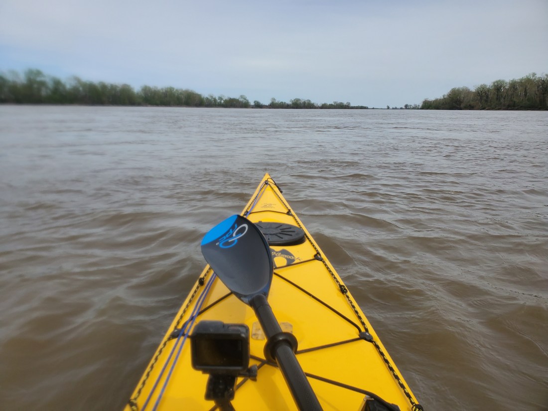
After some necessary trip prep this morning, I took the opportunity to get out on the Missouri River for the first time in 2019. A sunny day in the 60s was too good to pass up. I headed up to Sioux Passage Park in deep North St. Louis County. As I approached the parking lot and boat ramp, it was evident all of this was recently underwater, but they did a great job of plowing the mud and making the facilities usable.
The river was still pretty high. There were a few fishermen around and a couple guys metal detecting in a large pile of flood deposited detritus. I wonder what they expect to find. I dropped my boat at the ramp then parked the car and geared up. My objective for today was threefold: to get an idea of what the swollen Missouri River might feel like for me this summer, to test out my technology setup (more on this in an upcoming post), and working out my paddling muscles along with starting to develop hand callouses in the right places.
I put in at the muddy boat ramp, luckily didn’t really sink into the mud and even managed to get in the boat without getting my legs or feet wet. My goal was to paddle up the side channel that separates Pelican Island from mainland St. Louis County, then once in the main channel of the river, paddle with the current around the curvy backside of the island back to the boat ramp. About 10 miles total.
Pelican Island, St. Louis County, MO
After dealing with some tricky current where the side channel enters the main channel, I was on my way. I quickly realized this was going to be more physical than I had envisioned. The side channel was moving quite quickly. I was paddling at probably 80 to 90% race pace, and was barley making progress relative to the land. At a couple points, I paused to grab water or to change my music selection and started drifting backwards with the current as soon as the paddling stopped. I find it absolutely insane that better people than I have paddled the entire length of this river upstream! Unreal.
Can you tell where I went from paddling upstream to downstream?
A good two hours of hard paddling had me within sight of the end of the island and the main channel. I saw a barge pass by and used the opportunity to check my FindShip app to get the details on the barge. I swung very wide into the main channel to avoid getting pulled back into the side channel from where I just emerged. Immediately I felt more comfortable and relieved to be going with the flow. Surprisingly, it was not very windy way out in the wide-open space of the main channel, pretty shocking considering the weather we’ve been getting lately.
Missouri River, approximate mile marker 15
It took about an hour of relatively leisurely paddling to make my way back to the park boat ramp. As I pulled up, a group of 4 kids wrestled in the thick and creamy mud on the banks while a reluctant mother watched them knowing they were about to wreck the minivan into which they soon piled. I pretty much did the same. With gummy legs, I fell getting out of the yak and managed to muddy myself, the boat and most of my gear. I didn’t mind very much at all, knowing that I’ll be getting a lot more Missouri River mud in my life in short order.
All packed back in the car, I headed to the top-secret workshop of Timber Longboard Co. where I met with Shane and took a look at the progress on the cedar craft that will propel me down the river. I am delighted with the boat so far and look forward to sharing the finished product as it nears completion.
Saddle time in a boat on the river is a critical part of the preparation for this trip. Not only testing gear, fine-tuning the paddle stroke, monitoring physical needs, but all the time to think about additional gear I might consider, or ideas about storage of gear, logistics and plans. With little to no distractions on the river, my mind is left to wander about what is to come shortly as I embark on this adventure.
I’ve gotten so many questions lately about the trip. It’s fantastic that people are taking an interest. I realize I’ve shared some details of the trip but haven’t really provided a real step by step narrative of what I’ll be doing. Here I’ll try my best to provide the overview.
***Disclaimer: the following details are certainly my best guess as to how things will progress based on my planning and from what I have learned from others who’ve undertaken this journey. I’ve tried to make this as accurate as possible, knowing full well I may have some of my facts wrong on a few minor details here. That being said…
Starting around May 4th, I’ll begin packing all the items I’ve been gathering for my trip for transport to Montana. I will pack up my Subaru with everything I will need during the trip as well as food for about the first 2 or 3 weeks at least. The boat goes on top, strapped down securely for the 1,400-mile drive. I plan to leave St. Louis on Thursday, May 9th and driving to Bozeman Airport, where I will pick up Sara who is flying in on Saturday. We’ll then head to Wise River, MT where we’ll stay at a friend’s mountain cottage for a night or two.
Madison River
Sara will drop me and send me on my way down the river somewhere outside West Yellowstone, MT, on the edge of Yellowstone National Park. From there she’ll take off for the long drive back to St. Louis. This is the Madison River, one the three major rivers that forms the Missouri 100 miles downstream. For the first 100 miles on the Madison River, I will encounter 2 large lakes, several stretches of class III – V rapids which I will portage around, and world-famous fly-fishing territory. Descent of the Madison to the start of the Missouri River in Three Forks should take 6 to 7 days. There are established campsites along the way, so I’ll either stay at those, or set up camp at other public areas along the river.
Once I reach Three Forks, MT, I’ll likely stay for a night at the Missouri Headwaters State Park, where the Jefferson, Madison and Gallatin Rivers come together to form the Missouri. I will likely try to coordinate a meetup at that point with a few Montana-based veterans of the MO River descent, picking up some good advice and stories.
For the next two weeks or so, I’ll be paddling the very upper stretches of the river through dramatic mountain valleys, flat agricultural lands, expansive and wind-swept lakes and meandering curves in the river with the goal of getting to the first significant town along the way – Great Falls, MT. On this stretch, there are a handful of dams that I will have to portage around. Some will be short enough to load my boat and gear onto my two-wheel kayak cart and pull it downstream to the put in. Others may require a longer distance portage, loading my boat and gear onto the vehicle of an obliging river angel to have them shuttle me down. There are campsites here and there, but likely I’ll be scouting out spots along the side of the river that offer some shelter, comfort or facilities for the basics. There is one pretty large lake on this stretch, Canyon Ferry Lake, that is notorious for being very windy and in turn, very choppy. I must be prepared to exercise much caution on when it’s safe to proceed, and when to pull off and wait until calmer conditions prevail. The water in this stretch will likely be very cold still – recent melting of snow and ice will ensure that. It’s still too early to tell if river levels will be at or above average, time will tell.
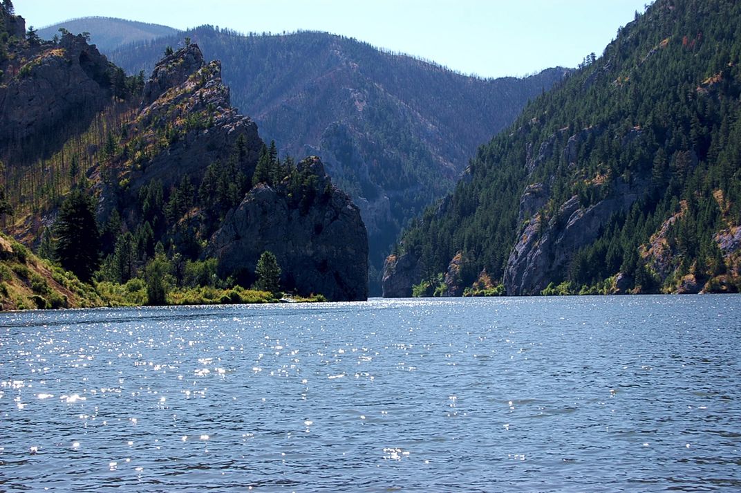
Canyon Ferry Lake, MontanaGates of the Mountains, Montana
Great Falls is a pretty large town, with all the facilities and amenities that come along with it. I’ll probably rest for a day or two, get a good night sleep in a proper bed, get a few good meals, buy more supplies, and pick up a box of dehydrated meals I will have shipped ahead to supply me for the next couple weeks. I’ll talk to a few local outfitters who run trips on this stretch of the river to get intelligence and advice for what I can expect to encounter. There are 5 significant dams and some stretches of potentially dangerous white water just downstream from Great Falls, so I will arrange a portage around the dams, either by paying an outfitter to shuttle me and my boat, or possibly enlisting friends of friends or river angels to help me along.
After Great Falls, it’s a relatively short stretch to Fort Benton. After Fort Benton, I’ll quickly enter the Upper Missouri River Breaks National Monument. This stretch of about 150 miles was designated as a National Monument in 2001 and will likely be the most beautiful and natural section of river during the entire trip. There are spectacular mountains, walls, overlooks, table tops and valleys that surround the river in this stretch. It’s very popular for floaters and paddlers and I’ll likely encounter the most traffic here.
Upper Missouri River Breaks National Monument, Montana
Passing through Upper Missouri River Breaks, I will quickly enter the first of three very large reservoirs – Fort Peck Lake. The three major lakes, Fort Peck, Sakakawea and Oahe were formed when the Army Corps of Engineers was tasked with building massive dams from the late 40s, completed in the early 50s, to generate power and help with flood control and irrigation along the river. The dams at the end of each of these lakes, as well as Gavins Point dam further downstream, have a huge effect on the flow along entire length of the Missouri River, as well as any person or entity who has any kind of connection to the river. All of the recent (and past) flooding issues circle back to the Army Corps’ management of river flows via these dams. There are endless debates and controversies around river management that all tie back to these structures, and I am eager to learn more firsthand.
The first difficult aspect of these large lakes is actually getting into them. Where the flowing river dumps into the massive pool of stagnant water, there are many braided channels that are constantly changing. What I see on Google maps (or any other map I have) may be totally outdated and inaccurate. I may be paddling in what looks like a main channel, only to suddenly run into sloppy mud and with much difficulty, have to navigate, sometimes walking in hip deep mud, back into open water.
Braided channels entering Fort Peck Lake, Montana
The second major consideration and potential danger on these large lakes is weather conditions. Wide open spaces with little to no natural wind breaks mean more often than not, conditions on the water are less than ideal. Even a light wind can lead to large waves when the lake is 1 or 2 miles wide. Keeping control of your boat and being able to paddle where you are planning to becomes a tiring exercise. Navigation-wise, there are many large coves and fjords that look and feel like they are the continuation of the main branch of the lake. Unless you keep a close eye on your maps and navigation tools, you can easily get off track and on a lengthy and costly detour. And finally, not being able to see for a long distance over hills and mountains means storms can approach very quickly. Being stuck 1 or 2 miles away from land or shelter when a massive upper midwestern thunderstorm blows up is a dangerous proposition. I am fully expecting that due to weather, I will be shore bound for potentially days at a time waiting for conditions to improve.
Fort Peck Lake is 134 miles long. Covering that amount of distance in non-moving water, in potentially rough conditions will take a while. Fort Peck is located at the end of Fort Peck Lake, I’ll portage around the dam there then gladly get back into to flowing water. From Fort Peck to the eastern edge of Montana and the border with North Dakota, the river meanders and makes its way through various Native American reservation land. I will have to remain aware of where it’s permissible to stop and camp and where it is not.
Crossing into the second state on the journey, North Dakota, I will quickly enter another massive reservoir/lake – Lake Sakakawea. I’ll encounter all of the same conditions and dangers on this lake, and it is 177 miles long. I’ve been in touch with the owner of a lovely resort in this lake at Tobacco Gardens. I imagine I’ll stop to refresh and recharge for a few nights there.
Garrison Dam, Lake Sakakawea, North Dakota
After Lake Sakakawea, it’s back into moving water for a relatively short stretch which will get me all the way to Bismarck, ND. I’ll likely use this as another chance to get a good night’s bed rest, a shower, a couple square meals and some shopping for necessities, and possibly a food resupply. Because shortly after Bismarck, it’s back into yet another lake – Lake Oahe which checks in at an unbelievable 231 miles in length. It’s the longest of the three major lakes. On the upper end of Lake Oahe is the site of the protests over the Dakota Access Pipeline in recent years. Many of the lands around Lake Oahe are also Native American lands, hence the need to plan out where it is permissible to pull off and camp.
Completing Lake Oahe will take multiple weeks and will push me to my physical and mental limits, I am certain. Once completed, however, I will have crossed from North to South Dakota and will be done with the three major Missouri River reservoirs. Unfortunately, the next few hundred miles is also mostly on lakes – Lake Sharpe, Lake Francis Case and Lewis and Clark Lake. Though not as wide or difficult as the three big boys, these will still be challenging, nonetheless. I’ll get to consider doing fun things, like cutting off 20 miles of paddling by portaging my boat and gear up and over a narrow ridge at a huge bend in the lake.
The big bend on Lake Sharpe, South Dakota
At Yankton, SD, the Missouri River reverts back to a free flowing, undammed and hopefully quicker mode of transport. Unfortunately, much of the flooding that’s taken place this year has occurred near Yankton, which is where Gavins Point Dam is located, or further downstream into Nebraska, Iowa and Missouri. One major challenge I may face is the aftermath of the calamitous flooding that’s already occurred or will continue to into the Spring and Summer of this year. Time will tell if this stretch of the river will continue to be at flood stage by the time I get there. Even if it is not, I am certain I will experience its after-effects, including more trash and debris in and around the river, riverside sites and campgrounds no longer open or accessible, sloppy mud everywhere and a general lack of facilities. And a recent headline mentioned flood induced raw sewage pouring into the river at Omaha for possibly months to come, so I got that goin’ for me.
Gavins Point Dam, South Dakota
The Missouri River forms the border between South Dakota and Nebraska, then Nebraska and Iowa further down. I will pass through Sioux City, IA and Omaha, NE before finally seeing my home state of Missouri coming up on my left. I’ll pass through Atchison, KS, where my parents first met at Benedictine College. Kansas City will represent a major milestone, as everything downstream of there are waters I am pretty familiar with as a MR340 veteran. From Kansas City, I hope to take a leisurely 7 to 10 days to make my way back home. The final stretch, from St. Charles, MO, through the confluence with the Mississippi, over the Chain of Rocks and finishing at the Arch, I hope to paddle with as many of my paddle buddies who are willing to finish off the trip with me.
With about 6 weeks to go before my planned departure on the Madison River in Montana, there are so many question marks around weather conditions, river levels, availability of facilities along the river, and other important factors that will affect the outcome of my expedition. As I have absolutely no control over any of that, I can only focus my attention elsewhere: my preparation for the trip.
I have almost all the gear I need for the trip. The big things have mostly been procured: tent, sleeping bag, cooking gear, hydration system, dry bags, first aid gear, communication system. I’ve been dehydrating food almost non-stop since the new year and I have over 60 meals ready to go as well as snacks like fruit and jerky. I’ve arranged drop points for shipping re-supply packages during the trip. Still working on my sleeping pad and pillow, and oh yeah, the boat.
At this point, the kayak I will be taking on the trip is not currently in my possession. Weird, yes, I know. The plan is that Shane at Timber Longboards is currently constructing a custom-made kayak for me based on the specifications and ideas we’ve discussed. He stopped by yesterday to go over some measurements and ideas. He feels confident he’ll be able to finish the boat in time for me to get some critical saddle time in to get used to how she performs on the big river. My backup plan is currently being touched up at the Alpine Shop in Kirkwood. I purchased a Current Designs Nomad from a friend last summer, a nearly 19ft touring kayak that will more than meet my needs. He’s fixing a few scratches and touching it up. I’m hoping once the temperature starts cracking 70 consistently, I’ll have that back in order to start getting in a bit more prep. For now, I am paddling my trusty 16.5ft Eddyline Nighthawk, later today I hope to get out on Creve Coeur Lake for a few miles.
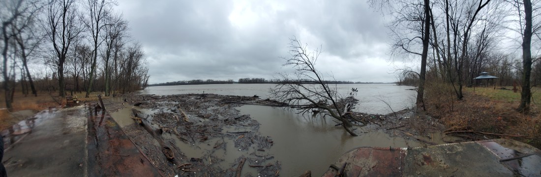
I tried to get out on the lake yesterday, but the heavy rain filled the lake to flood-level and the icy wind swept up some whitecaps something fierce. I had to adjust my plans and did a little exploration along the banks of the Missouri River near St. Charles.
Missouri River just below St. Charles, MO. Panorama shot taken from a small moored barge.
Too early to tell how this will affect my trip this summer. My hope is that the first month or so of the trip will be in Montana, which is out of the flood risk area. By the time I hit the Dakotas, I am hoping the water levels will be normal. But will every shore I camp on be a soggy mess? Will I be carried away by floodwater-borne mosquitos? Will there be any facilities or campgrounds left open? Time will tell, and adventure awaits, no doubt.
 mf
mf