Missouri Man in the News

Just wanted to have a post to keep track of articles/news coverage during my trip. There should be a few more to add to this when it’s all said and done so I’ll post updates here. Once again, thank you all for your support and for following my journey!

Owl Creek Gazette – September/October 2019

Creekside with Don and Jan Podcast – September 1, 2019

St. Charles County Community News – August 28, 2019

e-Missourian.com – Washington, Missouri – August 23, 2019

KRTV – Great Falls, Montana – May 29, 2019

The River Press – Fort Benton, Montana:

Fort Benton Press

New Haven Independent News – New Haven, Missouri:

John Fingerhut

St. Louis Arrival +4 Days

It’s hard to believe how quickly time has passed since my arrival at the Arch on Saturday. Time on the river seemed to really slow down. I was in awe of that my first week out on the river and that feeling didn’t change throughout the trip. Back in St. Louis, I luckily haven’t really been rushing around to do a bunch of stuff, see a lot of people or places. I’ve been able to relax for the most part, and really pick and choose where I spend my time. Sunday, I was able to do a bit of trip/gear cleanup then spend the rest of the day at a big Hash (running) event, where I most certainly did not run, just enjoyed some cold beers and reveled in the misery of friends running 12+ miles in 95 degree heat. Monday, I spent almost all day catching up on stuff around the house, more gear and boat cleaning, grass cutting and other little maintenance things. Then yesterday, I loaded the MOstar up on my car then drove out to the Paddle Stop New Haven. Shane, who built my kayak, just opened a pretty fantastic workshop and store. I’ll be storing my boat out there for the time being as there’s a ton more space.

Because PSNH is regularly running shuttles on the Missouri River, all I have to do when I want to paddle my boat is to get the pickup in St. Charles, then put in at New Haven or Hermann and paddle back. I also assisted Shane (more learning techniques than actually helping) in his building of a cedar strip canoe that will be raffled off around the MR340 to benefit Missouri River Relief. The rest of the week will be more cleanup, house maintenance stuff, catching up with friends and family, talking to some folks at work to lay out my return, then believe it or not, heading down to the Meramec River for a float trip this weekend. I’ve been guaranteed I won’t have to do a lot of paddling.

I had a few things that didn’t really fit in other posts that I wanted to share:

Early on during my trip, I had the pleasure of staying with Jim and Vicky Emanuel near Helena, MT. Jim completed the entire Missouri River, eventually going all the way to the Gulf last summer. He showed me his spare wooden paddle he took on the trip. All along the way, Jim had his river angels who helped him along the way sign his paddle. I thought about doing something similar, and decided the best option I had was for people to sign the inside of my rear hatch on my kayak. So here’s the end result. Just a bunch of amazing people, some names are known up and down the river as legendary helpers of paddlers, as well as some close friends and family who really helped me on my trip. This is not a completed work. Unfortunately, I didn’t get one of the most instrumental characters in making my trip a success – Norm Miller. Don’t worry Norm, I plan to hit the reunion next summer and we can get you added. (And apologies to Missouri River Relief’s Steve and Melanie – I just had a couple too many beers at Cooper’s and just forgot. I’ll make sure you sign it at some point.)

Another amazing keepsake from my trip – this one crafted with love and creativity by a good friend Susan. When I pulled into Sioux Passage Park in St. Louis County the night before my finish, Susan handed this to me. I was blown away at how so very cool this thing is, as well were all my friends. The image is based on a photo taken of me by either Peggy or my friend Dan when I was paddling out of Tobacco Gardens in North Dakota (I think). Missouri Man I suppose has become my nickname after a few news articles referred to me that way, I’ll take it.

My final reading on my Garmin InReach. The time and mileage refers to what we covered on the final day, then the odometer includes the total mileage incurred from the very start of my trip. I was surprised it is not too far off from the offical river mileage for what I paddled, 2,456 miles. There were several times where I forgot to turn off tracking at the end of the day so it included me walking around a bit, or even riding in a couple cars. It also doesn’t include portage miles. I had my wife Sara make one of those corny cardboard signs that people put in their pictures at the top of a mountain. I suppose the Missouri River is my Mount Everest (someone mentioned to me on the trip that more people have climbed Everest than have paddled the whole Missouri River).

Friday afternoon, I paddled into St. Charles and was sure to get a photo by the not so life-sized statue of Lewis and Clark and Lewis’ dog Seaman. One of the many L&C sites along the river, this one really meant a lot. I have walked (and run a marathon) by this statue many times, never really stopping to pause and really examine it. Having retraced part of the route of L&C’s 1804 – 1806 expedition, I have a very small sense of what they saw and the challenges they faced. Of course I had all the modern conveniences that made my trip much easier, but throughout my trip, I relished the chance to walk where they walked, climb hills thay they climbed, and paddle meandering river bends that they navigated so long ago.

mf

Finish Line

Just thinking of yesterday’s experience brings back the tears to my eyes that were flowing so liberally when I hit the bricks under the arch. Fortunately, I have weeks to process, recover, review, decompress and readjust to “normal” life. But I felt I needed to capture some of the moments and feelings from the last day of my journey while they are still fresh.

I’d be remiss not to first thank each and every one of you, whether you waited in the 90 degree heat by the river yesterday, or gave me a shoutout on the web, followed my blog, or even just sent prayers or positive vibes my way. Seeing the shore packed with friends, family, coworkers, relative strangers was very emotional for me as I’m sure many of you saw. I’d venture to guess that few, if any Missouri River paddlers ever had that kind of reception. It’s unreal, the highest of highs, easily one of the best days of my life. THANK YOU ALL!!!

I was so happy to share the final 20 miles of my journey with some close friends.

What you’re seeing is a beautiful mix of people – some with years of experience on the rivers, some with none. One of the main objectives of doing this trip and being so active in writing about my experiences was to connect more people with the river. There is no better way to do this than to take a few folks out on the river who’ve never experienced it, help them navigate the experience and enjoy it, and also relive my first time through their eyes. We dealt with some fast water, swirly whirlpools, strongs winds, big waves, shooting the chain of rocks, passing barges/tour boats and many bridges – in other words, the full river experience. Everyone did great, and I was happy to have the company.

Once on shore, I was at a loss as to what to do. Luckily, cold beverages were placed in my calloused hands, my wife, nieces, nephews, mom, dad, sisters, brother, uncles, cousins started the longest round of hugs I’ve ever had in my life. People didn’t even seem to mind the sweat, river funk, and the overpowering Missouri Man beard essence as they embraced me. It was unreal. So many photos, I did a quick interview with Fox 2, and it barely registered with me that there was a Corvette car show going on right above our gathering. Eventually we pulled the boat up the arch stairs to just below the arch for some pretty cool photos.

To put into perspective just how incredibly diverse the gathering of people were yesterday: quite possibly a person who’s known me the longest in my life (family excluded) – my kindergarten teacher Susan Federspiel! Susan taught not only me, but each of my three siblings as well. She’d been following my journey and made the trip out to see my arrival. On the other end of the spectrum – I camped at the boat ramp in Klondike Park three nights ago and got to talking to an interesting character, Austin, who was fishing for catfish. I told him about my trip, then sat and enjoyed a few beers with him late into the night after some visiting friends had left. As I was hugging friends and family, there was Austin, having known me all of 3 days, coming to welcome me home. Indescribable.

When I pulled into Sioux Passage Park the night before my finish, I also had a pretty large group of people awaiting my arrival, as the park was also hosting that night’s run of the Hash. Of course some people where taking photos of me as I paddled onto the beach, but I thought later that night that I should have taken a quick photo of them standing on shore and waiting my arrival. I had a second chance to do it yesterday, and though you may have to zoom a little, you can see the crowd of people waiting on the levee cheering me in below the iconic arch.

I woke up this morning in my soft bed in my air-conditioned house, then got up and glanced out the back door. There lay the MOstar, sitting in the morning sun, ready and waiting to take me thousands of more miles if I were to demand it. Future adventures await, but now it’s time to clean up, reflect, share, love, pack back on a few (but not too many) pounds and try to take every moment from this trip with me as I move forward back into “normal” life.

There will certainly be more updates, recaps, stories and other fun stuff in this space. Thank you for continuing to follow my journey!

mf

Coming Home

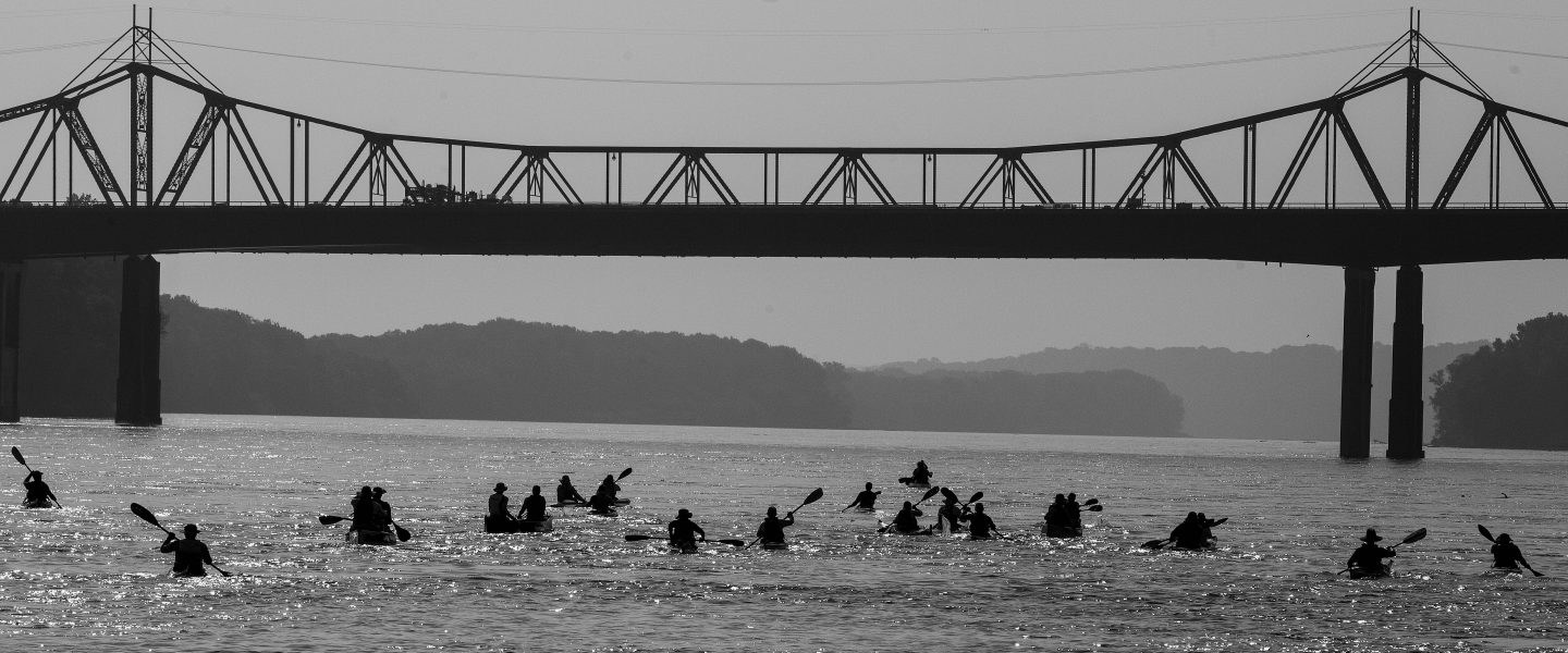
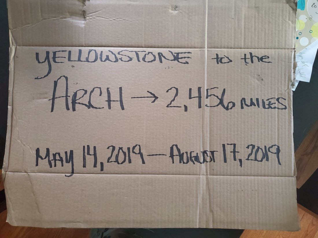
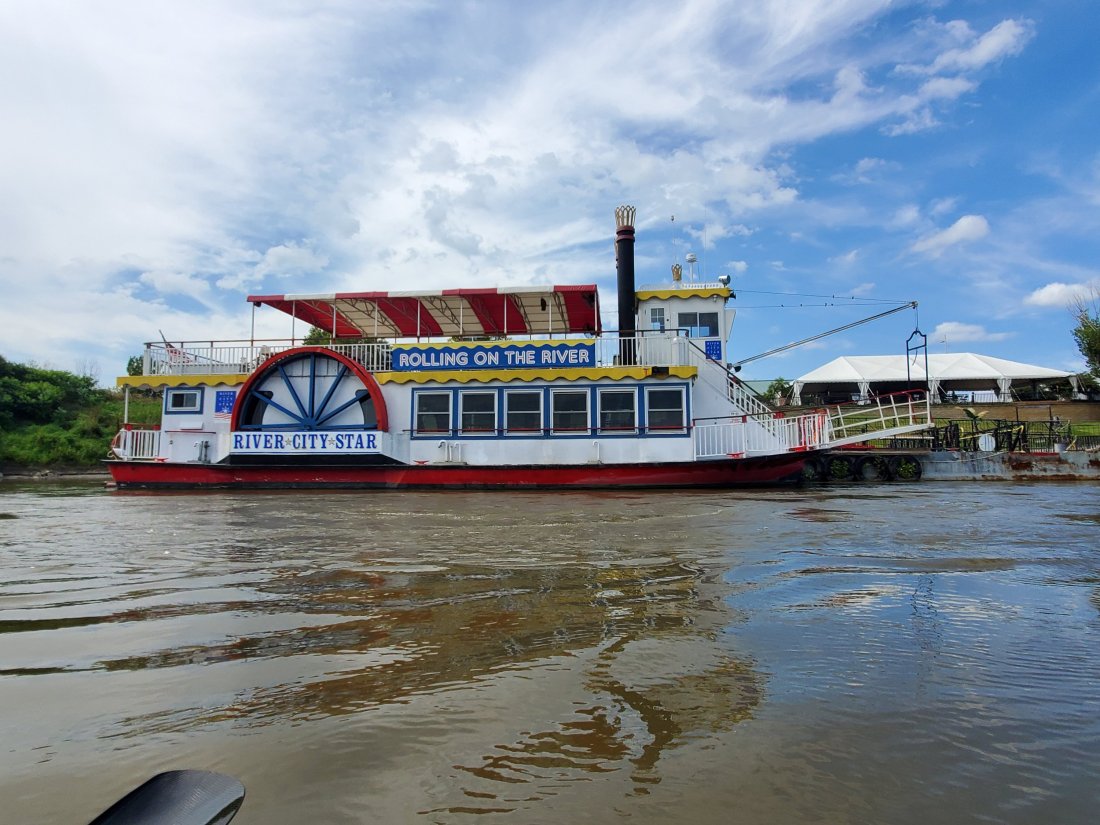
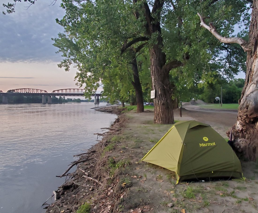
I’m currently up early after working late on my kayak with my friend Shane at Timber Longboard Co. at his amazing new workshop/world headquarters – Paddle Stop New Haven. There were no major issues with the boat, just a lot of sun damage that needed to be sanded out and re-touched with varnish. Shane wants my rig to look good for the masses as I paddle up to the Arch! In terms of blog posts continuity, for now I am skipping my experience from Omaha to Kansas City. I’ll circle back on that after the excitement of the next few days dies down. Today I will paddle with one of my previous MR340 partners from New Haven to Klondike Park with a stop in Washington, MO. Tomorrow I will paddle into St. Charles where the Festival of the Little Hills is happening, then continue on to Sioux Passage Park, where I’ll spend my final night camping with a group of friends. Then Saturday, some hearty souls will paddle the final 20ish miles or so with me to the Arch.

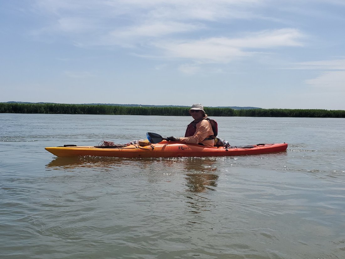
I set out from Kansas City last Saturday morning. My amazingly generous friends Dawn and Ken dropped me at Kaw Point, where there were 4 other paddlers getting their boats ready. I paddled the whole day with Anqi and James, then Kim and Al were in fast surfski kayaks, so they were ahead of us most of the day. It was great paddling the 74 miles from KC to Waverly, exchanging stories, life experiences and getting to know eachother. I knew Anqi only from Facebook and from seeing his paddling pursuits on various groups. However, we both did the 2017 MR340, him in a 10ft Pelican kayak, the kind you can get from Wal Mart for $150. To race 340 miles in a boat like that on the Missouri River, and to finish, you instantly achieve legendary status in mine and many others’ eyes. Anqi has only been into paddling for the last few years of his life and I am inspired by his boundless energy, eagerness to be on the river all the time, and just his general positive attitude and warm personality. If you get a chance, paddle with him.

I’m connected with James in the small-world, crazy coincidence-but not really in our connected world-kind of way. James is married to Tracie, who in her work for the Japanese Consulate of Kansas City, was instrumental in both my and my brother’s interview process and eventual selection into the JET Program – the Japanese Exchange and Teaching program that allowed both of us to teach English in Japan for three years earlier in our lives. Tracie has been pretty close to my brother since then, and I’ll see posts from her here and there. Probably a year ago, she posted that her husband was going to sign up for this crazy paddle race across Missouri – of course I chimed and and offered my services on any advice or recommendations. James and I had exchanged messages here and there but never met. When Anqi posted on the MR340 page that he was going to paddle the KC to Waverly stretch, I coordinated with him, then also invited James to join us. Little did I know that this would be James’ first time paddling on the Missouri River! He did great throughout the day, luckily making an adjustment to his foot pedals halfway through the day that provided much needed relief. I don’t know many people who would have the wherewithall to paddle 74 miles on their very first day on the big river. James – good luck in this year’s MR340, you’ll do great!

We pulled into Waverly around 6:30pm after averaging nearly 10 mph all day on a swiftly flowing river. There to meet us was James’ wife Tracie as well as Rob Kalthoff. Rob is one of the many river angels and legendary names that I learned as I was researching and planning my trip. I was told over and over by people that when I get close to Waverly, I’d be in great hands. Rob had previously sent me a very useful list of contacts/river angels up and down the whole river, which came in very handy on my trip. I finally had the chance to meet Rob on the boat ramp at Waverly as he pulled us in. He brought us a plate of award-winning fried chicken that his wife Connie had made, though she couldn’t be there to meet us. He also had a basket of fresh homegrown tomatoes and box of peaches, both of which were just about the juiciest things I’ve had the pleasure of having drip through my man-beard.

We hung out for about an hour, talking, eating, drinking, visiting, sharing stories, all as the sun went down over the river. I will cherish nights like these from my trip, sitting by the river with river people, talking and laughing like old friends. Eventually, I pitched my tent and turned in for the night.

The next day, it was pretty cloudy with some rain throughout the day, and I wanted to make it to Glasgow, MO, where I was told the campground was reclaimed from the flood aftermath and was open with water, showers and camping. I made the 68 miles and pulled into Glasgow around 6pm. I set up my tent on the edge of the bank, then made my way into town, where unfortunatley all the establishments were closed early on a Sunday. Not to worry, the local Casey’s gas station was open and serving their pretty darn good pizzas. I grabbed one, the the young clerk let me enjoy a cold beer and use their wifi while I waited in their lovely air-conditioned store.

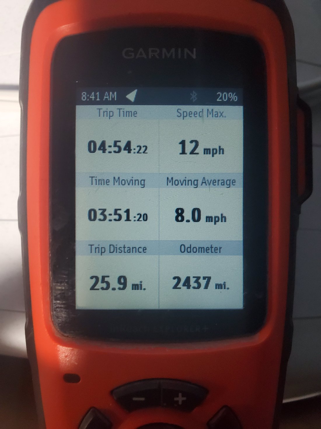
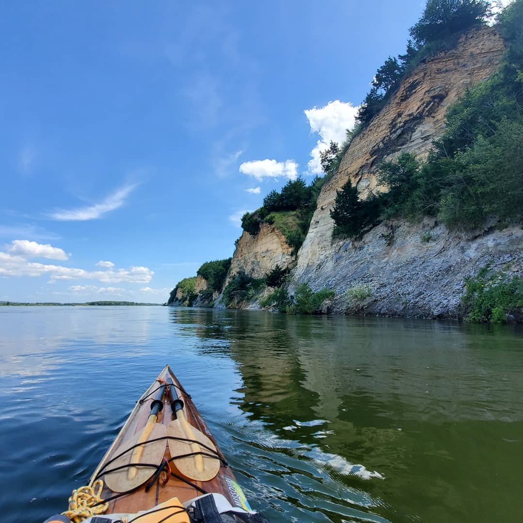
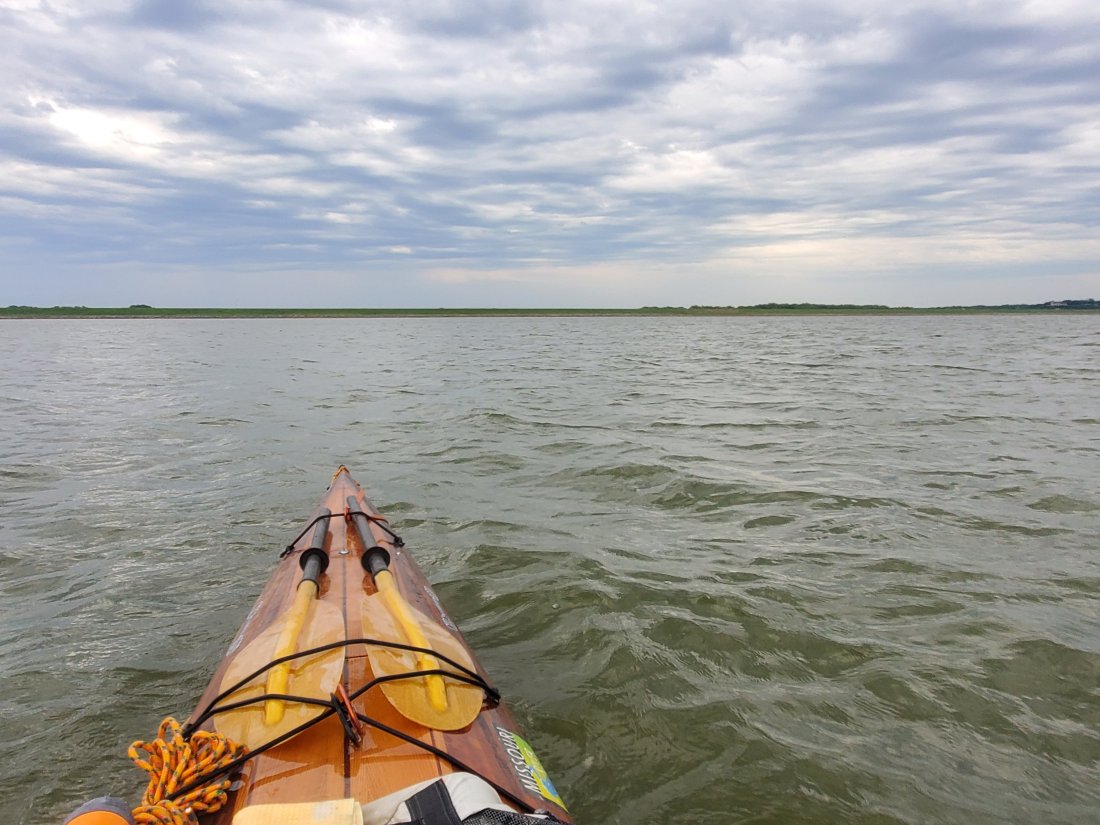
Their were thunderstorms for a lot of the night, not quite strong enough to blow away my tent, but enough to ensure things were wet and muddy in the morning. I packed up and got on the river for what I expected to be a hot day. The plan was for about 56 miles to get to Cooper’s Landing. I passed through Lisbon Bottoms, an interesting series of bends and a little bit of rough water, taking reconaissance photos of some potential challenges and pitfalls to share with the MR340 paddling group. It was a hot day, upper 90s perhaps, but luckily there was a pretty good wind all day, which provided some relief and but wasn’t strong enough to kick up any substantial waves.

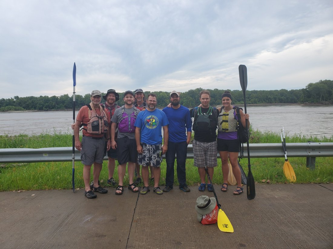
Pulling into Cooper’s Landing around 5:30, I met Rodney who has been doing a ton of work to get Cooper’s back into shape after the flood. Although the tradition at Cooper’s is to get an amazing Thai meal served out of a food truck, they unfortunately haven’t returned since the flood. Soon enough, a couple friends from the Columbia, MO chapter of the Hash showed up with some beers and Shakespeare’s pizza. Steve and Melanie also showed up. Steve is the Executive Director of Missouri River Relief, and Melanie plays a huge part in all that they do. Missouri River Relief is the organization I chose to raise money for leading up to and during my river journey. We had a wonderful evening of once again, eating, drinking, sharing stories and getting to know eachother, all the while enjoying an epic sunset from the docks of Cooper’s Landing. Sensing any kind of theme here? Storms once again rocked my tent all night, bending but not breaking my shelter.

I once again packed up early and got on the water, depite the sluggishness of one too many beers and an ill-advised nip of Fireball the night before. I met an interesting guy on a self-made houseboat who was travelling at a very low rate of speed down the river – eventually to make it to New Orleans. I stopped at Wilson’s Serenity Point under the bridge in Jefferson City and was given a tour by caretaker Tom. While still getting back into shape after the floods, WSP is names after Joe Wilson, who was a river legend and who did incredible work to turn this otherwise sandy, muddy riverside spot into a must-stop attraction on the river. Multiple races on the river use this spot as their start, their finish, or a key checkpoint. It is normally beautifully serene, green and shady relief from the river heat. Right now it is kind of a muddy mess, but with Tom and others’ help, it will soon once again be everything that Joe Wilson loved and worked so hard on.

I kept paddling from Jeff City, running into two canoeists camped on the river just below the Moreau River. Then in another internet-enabled interaction, I met a St. Louis hashing friend down by the river where he was working at the nearby National Guard armory.

I paddled on to Portland, MO, where I was welcomed by my former co-worker Pat. Pat retired back in May and has been enjoying life. He lives in nearby Washington, MO and has on multiple occasions, brought me warm breakfast sandwiches on my MR340 races. He took some great photos as he usually does. My brother Joe also drove out from Fenton me meet us, we stopped into Holzhauer’s for a burger and some beers. Great conversation and catching up ensued, and I was once again renewed in body and spirit, spending a great evening with good friends and family.

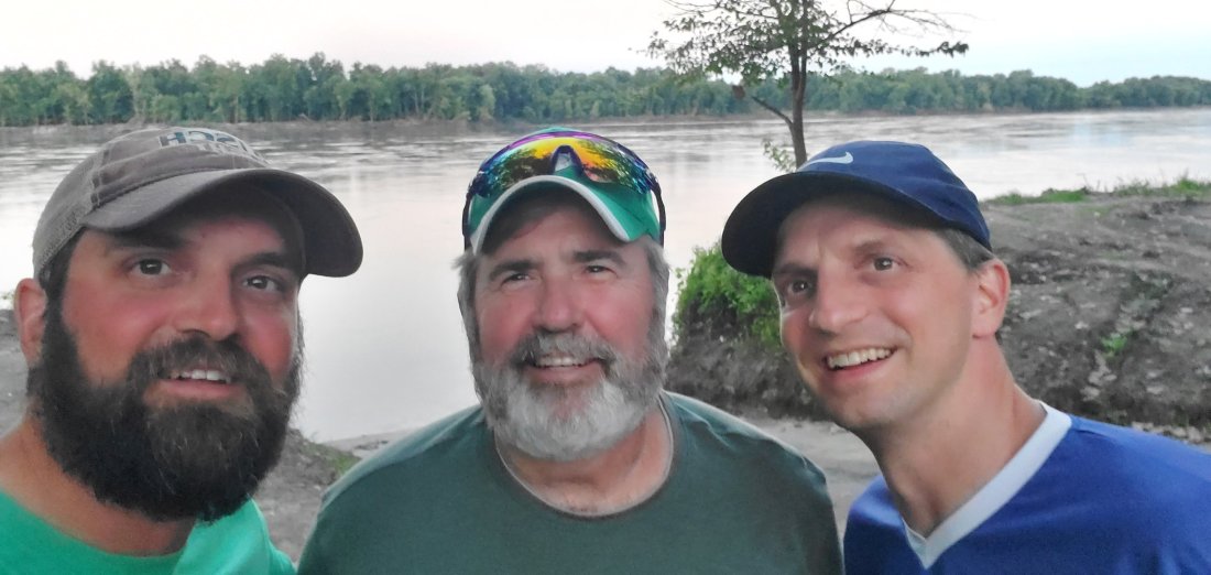
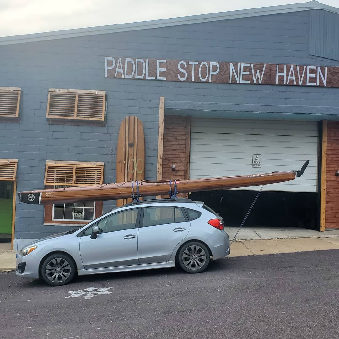
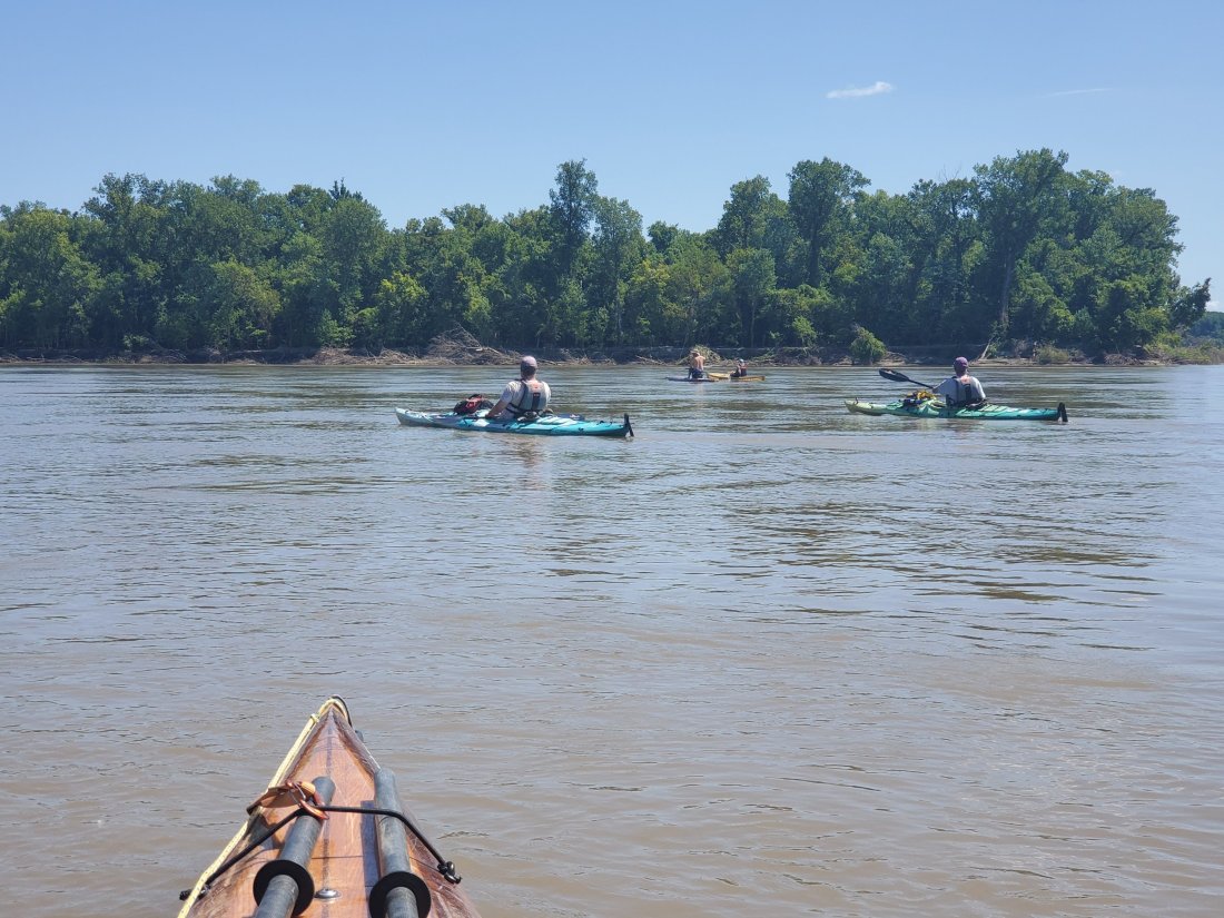
The next morning, I paddled the short 17 miles into Hermann, and had time to grab a coffee and a breakfast sandwich from a local shop. Pretty soon, my paddling partners arrived – pulling up in a 12 passenger van and boat trailer hauling 3 boats and a stand-up board. This is Paddle Stop New Haven’s new operation! Shane and his wife Stacy recently opened their amazing shop in New Haven, MO and have also started shuttling paddlers up the river to certain points between St. Charles and Hermann. Joining Shane were New Haven staples and river legends in their own right, Gary and Lance along with Jay. Gary and Lance paddled the first half of the Missouri River in 2015 and will finish the rest of the river next summer. They also own and blow glass at Astral Glass in New Haven, stop in when you’re out here! I know Jay from a few Missouri River Relief events, where we worked one rainy morning in north county, removing invasive honeysuckle from the banks of the upper River Des Peres.

We had a terrific paddle yesterday, doing the 16 easy miles from Hermann down to New Haven, where we met a reporter from the local paper who took some photos and did a quick interview with me. Another St. Louis hasher, Mike was also there with some cold beers. We eventually moved our gear and boats back to Shane’s shop where we got to work on my boat, not before a delicious pizza at Lancito’s.

I am currently sitting at Missouri River mile 81. I will count down the miles to 0 – where I will enter the Mississippi River and paddle 15 miles to the Arch. My trip is winding down. I have a lot of feelings, too many and too complex to describe in this space right now. I am going to savor every remaining moment, each mile and paddle stroke, every interaction with friends and family and just flat out enjoy the hell out of it.

mf

The Straightening of the River and Weird State Borders

I got this text from my wife as she was tracking my progress:

“Can you explain what’s going on with the border there?”

In talking with my parents who visited me in Sioux City and stopped for a night in Omaha on their way, they remarked that they stayed in a hotel that was near a neighborood that was west of the Missouri River, but a part of Iowa (Carter Lake).

How about the lower Mississippi – ever seen that mess?

Why, in the 1980s, did a group of 5 guys spend 4 months digging up a steamboat wreck from the 1850s in the middle of a cornfield?

What’s going on here? Well, here is your answer. (Thanks for sending this my way, Anna Wenger.)

Over thousands of years, rivers, especially ones that generally flow over flat, muddy ground, will shift channels. The river constantly cuts through dirt and mud to form a new channel, obeying the laws of gravity to find the most efficient path towards lower ground. Banks erode. A horseshoe bend develops, then over the years, the river cuts into the start of the horseshoe until it erodes the bank completely, cutting off the horseshoe bend from the main channel and forming a lake – often called a horseshoe or oxbow. Left unchecked, a river like the Missouri will meander all over the plain between its bluffs, cutting a new path with each high water or flood event.

Certain portions of the Missouri I’ve paddled are still free-running, natural states of the river. The Missouri River Breaks section in Montana is the most natural and closest to its original state, then a few stretches of river between some of the larger dams and lakes, and a 50 mile stretch below the last dam on the Missouri, Gavin’s Point. Sioux City, Iowa generally marks the beginning of the channelized lower portion of the River. From Sioux City all the way down to St. Louis, the Army Corps of Engineers works to maintain a navigable, stable, 6 to 9 ft deep channel for barges and other watercraft. They do this by reinforcing the banks of the river with wooden piers driven into the mud, tons of crushed rock piled on the banks to prevent erosion, or wing dikes also made of crushed rock that point out into the river and ensure a fast current and prevention of sediment settling that would cause shifting in the channel of the river.

In the 1950s and 60s, in addition to building the 13 dams on the Missouri, the ACE also worked on shortening the main channel of the river. Where there may have been a long, curvy bend in the river, they simply dug out the shortcut between the start and ends of the bend to eliminate the extra miles for boat traffic. In doing so, they shortened the total length of the river by 72 miles!

One other result of the shifting of river channels was its effect on the geography of state borders. In many cases, the river acts as the border between states. When state borders were originally drawn, the river was in its natural state, and thus, continued to shift until channelization and stabilization occured. The borders did not shift with them. So a farmer farming his land on the East side of the river in Missouri may tomorrow be farming land on the west side of the river, but still in Missouri.

Today I got the chance to tour the Steamboat Arabia museum in Kansas City. Similar to my story of the Steamboat Bertrand in Nebraska, the Steamboat Arabia wrecked just upstream from Kansas City in the 1850s, then was recovered from the middle of a farm field in the 1980s, under 50 feet of mud and sand and a half mile from the river.

River channelization and meaures to control the flow and natural tendencies of the river vary in their success. Recent years have seen 100 to 500 year floods occuring with shocking regularity. Engineers designing dams, levees, dikes and other control structures on the river based their calculations on data that was 50 to 100 ears old and prior to the extreme effects of climate change. It seems the more we try to control the river, the less control we really have. I am certainly of the belief that the river be allowed to retain or in some cases, revert to its natural state when feasible. I don’t advocate for the destruction of the dams on the river, or letting all floodplain farmland be once again consumed by the river. But seeing the rampant development that’s occuring on floodplains just in the St. Louis area is very scary. The Missouri River is alive, it is powerful. It may live in its man-made channel today, but it will not forever.

I am certainly new to the issues surrounding the river and a big reason for taking this journey was to learn more. I hope to continue to do so, and also to educate others around these issues.

mf

To Omaha

After saying goodbyes to family in Sioux City, it was back to the high, fast river. Below Sioux City is really where I started seeing a lot of evidence and damage from the floods that started in the spring and kept up until recession of some of the really high water in the last few weeks. I had rain off and on all day, and I wore a jacket as I’m not sure the temperature climbed much above 65 degrees – on July 31st! I’d get out the golf umbrella I carry with me for the heaviest downpours, usually only for about 10 minutes in length, and just drift with the current and watch the millions of drops hitting the muddy water, kind of mesmerizing.

I passed what would be the last Native American reservation land I’d encounter on this trip, the Omaha Reservation that starts just below Sioux City and ends just short of Decatur, NE. I paddled by a group of young men fishing on the banks and waved. They asked me where I was going. Replying St. Louis, they told me good luck and gave encouragement. One guy exclaimed in pride – Native Omaha! I pumped my fist and gave them thumbs up, a welcome encounter as opposed to some of the nerve racking experiences further up the river.

After about 43 miles, I paddled under the bridge at Decatur, NE and pulled onto shore to camp at the nice riverside campground. The water was high here, but not high enough to damage the campground. A friend shared an article with me that explained how the bridge over the river here was built sometime in the 1950s and was actually built over dry land! The story was that the Army Corp of Engineers, who control many aspects of the river including channelization, had plans to shift the channel of the river, so the bridge was built over the anticipated path of the new channel. However, after the bridge was completed, priorities shifted, funds were diverted and for years, the bridge sat unused as the river crossed the road a few miles away. Finally, the ACE circled back to the project and shifted the channel to pass under the Decatur Bridge. Today, it provides an efficient (yet noisy when one is camped under it) crossing to those passing between Nebraska and Iowa.

The next day, I covered roughly 43 miles again and made it to Blair, NE. Along the way, I encountered a lot of evidence of the flood. Massive deposits of driftwood along the shores, vacation homes or cabins that either were sandbagged successfully to save them from flooding, or obviously given up to the rising waters and muddy aftermath. I was exchanging messages during the day with a member of the Missouri River Paddlers group who had their cabin flooded along the river on this stretch. When I encountered the string of cabins and campers she indicated, I saw some pretty devastated sites:

Then, of course, in the true sense of resilience and suggested debaucherousness of a recent visitor or resident, encountered this heartening message. America!?!

I pulled into the riverside park at Blair later in the afternoon and decided to set up my tent behind some piles of sand that were either part of the flood prevention, or perhaps the result of the cleanup. They provided some good cover from the procession of cars that would pull into the park, face the river for about 20 minutes, then pull back out and leave. I didn’t expend any amount of energy or thought on what the hell these people were doing there. I took a short walk over to the Blair Marina – which I learned was no longer a true functional marina, but still a pretty amazing restaurant. I opted for the 4 piece fried chicken dinner which was substantial to say the least. After polishing it off, I got to talking to the owner of the place, Steven. He gave me the rundown on the history of the place, how there was at one point an inlet that led to the marina, but had been filled in over the years. He gracioulsy picked up the tab for my meal, while I paid for my beers, then offered to drive me back to my tent at the park. Wonderful hospitality in Blair!

The next morning, I packed up and paddled around 6 miles downstream to the DeSoto National Wildlife Refuge. A former 7-mile long oxbow lake (more on oxbows and river channelization in a separate post), the wildlife refuge also contains the site of the recovery of the Steamboat Bertrand. I pulled off the river and walked the mile to the excavation site. The story of the Bertrand involves the steamboat running into a snag on a bend in the river near here in 1865. A tree hidden below the water busted a hole in the hull. The captain was able to get the boat to the shallows and offload all the passengers safely, before it sank. Fast forward around a hundred years, the wreck and its location was pretty much forgotten (among the roughly 400 wrecks up and down the river – no wonder train travel quickly replaced the risky, yet romantic steamboat industry). A couple archaeologists/researchers theorized the location where the wreck might be and started taking samples. They located the wreck below dozens of feet of mud and began the painstakining recovery process. Much of the material on the boat was well-preserved under all the mud, so they managed to recover almost everything except for the original hull of the boat, which they left submerged under a pond and a few layers of preserving sand:

The visitor center for the DeSoto Wildlife Refuge apparently houses the recovered items from the steamboat, but I opted not to walk the additional 3 miles to get there. I was back on the water and headed to Omaha!

Approaching the outskirts of Omaha, I planned to stop and camp at Dodge Park, what would otherwise be a nice campground and marina just north of Omaha. Upon arriving, I encountered a muddy mess. Water still covered the parking lots, the docks were twisted and broken. I paddled between submerged park benches and light posts and pulled my boat up into a (car) parking spot. I got out and walked around. The campground was a muddy pit, rusty fire pits littered the ground, the roads and camping pads were barley visible. The only patch of decent grass I found under a nice shade tree was covered in duck/goose poop. I was the only person around for a mile. Once again, it was the depressing aftermath of devastating floods. I got back in the boat and headed into central Omaha.

Omaha airport is nestled into a large bend in the river, and I was somewhat disappointed that no airplanes flew directly over my head as I paddled by the very beginning of the runway. I passed by another flooded park/campground, the Narrows, before covering the final couple miles to get to downtown.

There is a small “marina” downtown, otherwise a small parking lot for boats that had been closed and fenced off due to the flood. I stealthily parked my boat, tied her up and grabbed essential gear before hopping the fence. I rolled my eyes at the sign saying the charge for parking a boat overnight was $50.

A few minutes later, river angel Scott Redd walked down from his downtown office at Union Pacific to retrieve me. I stayed in Scott’s beautiful 7th floor condo overlooking the river and the rest of downtown.

After we grabbed dinner and a few beers nearby, we hit a popular ice cream stand, later learning that Bill Murray and Warren Buffet stopped in for a scoop and I’m sure some pretty riveting conversation a few hours before Scott and I. Back at Scott’s condo, he baked me a loaf of fresh bread and some hummus to take with me on the river the next day. We talked about his pursuit of sailing, not only as a hobby, but potentially someday a lifestyle, taking his Laka Manawa, Iowa-based boat all over the world.

After a groggy morning thanks to a couple Scotch nightcaps, I packed up, took some of my gear back to my parked boat then visited the nearby regional National Park headquarters/Lewis and Clark visitor’s center. I guess I expected a more substantial museum, but turns out this is just a pretty small visitor’s center as opposed to a full-fledged museum. In terms of Lewis and Clark history and artifacts, nothing I’ve encountered yet holds a flame to the museum in Great Falls, MT, although Sioux City is a close second. I spent the next few hours ripping around downtown Omaha on one of them Lime scooters – really the first time I’d experienced one. After hearing about horror stories of scooter injuries from careless riders, I was very nervous about the prospects of having to postpone or cancel my trip after falling off a damn scooter and injuring a body part critical for paddling. I luckily avoided any calamities and checked out the Old Market area as well as doing a lap around the baseball stadium where the College World Series takes place. Unfortunately, I was unsuccessful in hunting down a Nebraska-shaped decal to add to my kayak after completing the state.

Around 1pm, I was back on the water and passed under a train loaded with wind turbine blades crossing the river as I made my way out of town.

My next city of significant size: Kansas City in my home state of Missouri!!!

mf

From Yankton, SD to Sioux City, IA

After covering the 5 miles from Gavin’s Point Dam to the boat ramp at downtown Yankton, I spent the rest of the day having a few beers at Ben’s Brewing while catching up on some blog posts, then went around the corner to Cheers/the Blue Pig for a New York style pizza. Of course I couldn’t say no to adding my new favorite ingredient on to the pizza, sauerkraut. I talked with the owner for a few minutes about my trip, and his story about being a Wall Street guy who moved to South Dakota after the 2008 crash to open a NY pizza joint because there was none here was pretty interesting itself. I then got a message from another local paddler, Chuck, who picked me up, then had me join him and a buddy for a late dinner and sharing of river stories. Chuck dropped me back at the riverfront as the sun was setting, and I stealthily erected my tent behind the outfield fence of a baseball field among some trees. I’m pretty sure camping is not allowed there, but I took my chances.

After getting nailed with the sprinklers from 5:30 to 6am, I packed up and got on the water. As I was getting ready to paddle away, I heard someone calling to me. Turns out it was Jarett Bies, who had been coordinating river angels for me the past few days. Coincidentally, he was at the boat ramp helping his boss do some repairs to his boat. We talked and made tentative plans to meet up later before I took off. It was a warm day but I made good miles on the flowing river. I was getting close to Ponca State Park in Nebraska and exchanging messages with Jarett. I paddled on past Ponca until about 7pm to make 53 miles on the day and take out on the South Dakota side of the river where Jarett could easily reach me. He brought my boat and me back to his house where him and his wife Laura offered food, a shower and some cold beers.

With only about 20 miles left to reach Sioux City, IA, I slept in a bit at Jarett’s then enjoyed a good breakfast from my last SD river angels. Jarett and his wife are frequent paddlers and organize two races on the Missouri – the Fort to Field 50 and the South Dakota Kayak Challenge. Although next year is the last year he will be organizing the SD Kayak Challenge, I hope to come back to do one or both of these races in the coming years.

Being a beautiful Saturday afternoon, the 20 miles of river to Sioux City was packed with rec boaters, pontoon boats and wave runners. The river was a little wavy as a result, but not a big deal. I stuck close to the shore to avoid any close calls, and made crossings when I had plenty of clearance. As I got closer to town, there were some massive houses built on the shore, apparently unaffected by any flooding this year. Looking at the map, there was one last tiny strip of South Dakota, where the Big Sioux River joins the Missouri and which forms the border between South Dakota and Iowa. I stopped to get a picture on it:

Sioux City was going to be a rest stop for me – taking 2 full days off. My sister and two nephews were coming to see me as were my parents. I arrived in Sioux City a day before I had been projecting so the first thing I did when arriving at the marina around 4pm was to call around to a few hotels. My sister Lynn and two young nephews Henry and Clayton were going to get in late Saturday night after the delay of tire problems and the long drive from Peoria, IL. I found a relatively basic hotel downtown and walked over. After a shower, I got a quick dinner and had a nice chat with interesting local Sioux Citian and juvenile probation officer, Moon. He gave me a few ideas for how to spend the next couple days with fanily around town.

As I was winding down for the day in my nicely cooled hotel room, my sister and the kids arrived around 11pm. Two young boys after 7 hours cooped up in a car – wow! Their rambunctiousness could hardly be tamed but eventually they settled down.

The next morning, we headed over to the Sergeant Floyd River Museum then next door to the very cool Lewis and Clark Museum. The Sergeant Floyd Museum is on an old riverboat and has many cool aritifacts from early civilizations, the exploration of the river and the west, the steamboat era and modern uses of the river. The highlight for the kids (and me) is going to the captain’s bridge where you can ring the bell on the top of the boat.

The Lewis and Clark Museum right next door to the boat was excellent as well, complete with animatronic likenesses of Thomas Jefferson, Sergeant Floyd, and Lews and Clark. The museum does a good job catering to kids as well, allowing them to collect various stamps in a mini-passport as they hit different exhibits.

My parents arrived in the afternoon. After a nice lunch as it started to rain a bit we went to a different hotel on the east side of town. I had my kayak tied up securely at the marina. They told me it would be $15 a night to keep it there. I paid for the first night and told them I might make alternate arrangements for the other two nights. I thought I might load the boat on my sister’s or my parent’s vehicle but decided it wasn’t worth the hassle. (Eventually when I departed SC on Tuesday, the marina was closed, so I unfortunately couldn’t pay the balance…sorry guys, I.O.U.)

The kids got to enjoy the hotel pool, then later in the day we all drove up to the nearby Sergeant Floyd Monument. Sergeant Floyd was a member of the Lewis and Clark expedition who got sick 98 days into the trip. Eventually, he died near present day Sioux City. He was the only fatality on the entire 3-year journey, which is pretty amazing itself. It’s likely he died from a ruptured appendix, untreatable during the early 1800s. The sandstone obelisk sits on the bluffs above Sioux City and provides some pretty nice views of the town and the Missouri River valley:

The next day, we all drove out to Stone State Park just north of Sioux City, checked out a couple overlooks and hiked a trail around a nice lake. We then went to War Eagle Park – where a beautiful statue pays homage to a Sioux Chief named War Eagle who as ‘friend of white man’, ensured good relations between early explorers and settlers and was generous enough to offer two of his daughters in marriage to an early fur trader. Please, enjoy my daughters.

Back to the hotel for more fun at the hotel pool with Henry and Clayton, then we had plans for my birthday dinner then a Fingerhut family vacation tradition – go to the local minor league team’s stadium to watch a game. I learned that there was a nearby establishment that was, get this, a combination toy store/bar and grill all housed in the same building, which turned out to be a medeival castle for some reason. The kids loved the toy store and it was hard to pull them away so we could head next door to eat. The bar and grill portion was pretty underwhelming, but we enjoyed all being together and catching up.

Afterwards, the minor league game was entertaining, with former Cardinal Jeremy Hazelbaker making his Sioux City Explorers debut, and flamethrower Pete Tago throwing a complete game shutout 3-hitter for the Explorers. Henry and Clayton were delighted to run the bases after the game.

The next morning we said our goodbyes. Lynn and the boys dropped me back at my boat at the marina where I loaded up my gear. I had found a baseball where I had camped behind the field in Yankton a few days ago and had that in my kayak. Of course the kids found it and wanted me to autograph it for them. Wow – their hero Uncle Mark, doing an amazing paddle journey on the Missouri River – sure I’ll autograph the baseball. But, wait: “Uncle Mark, could you sign Jeremy Hazelbaker so our dad thinks we got the ball from the game???” So of course I signed Jeremy Hazelbaker’s name on the ball. Disaster was averted after Clayton dropped the ball off the dock into the water which I then retrieved as I paddled out.

I left the marina cove and hit the open water of the Missouri and was on my way once again. I couldn’t resist exploring a tunnel before leaving town:

A few more days of paddling would get me to Omaha. More updates to come.

mf

The Last Lake on the River – Lewis and Clark

Getting caught up after making it to Omaha and couch crashing at a generous river angel’s high rise condo overlooking the downtown area.

Waking up at the North Point Campground, I didn’t have a solid plan as to how I was going to portage my boat and gear the 2.5 miles to the put-in below the dam. I had the phone number of the superintendent of the state park where I was camped and was told he’d probably be able to help me. I was going to wait until after 8am to give him a call. Around 7:30, I saw a truck driving through the campground with kayak racks on the roof. Sure enough, Jon Corey pulled up to my campsite and offered to drive me down. I packed up my gear then we loaded my boat onto his convenient rollers on the roof of the truck. He drove me down below the dam, where normally there’s a hopping campsite, but it hasn’t even opened this year after the flooding earlier in the spring.

As I paddled into the main channel from the boat ramp, I was delighted to once again be in moving water. My boat moving without me paddling? Wonderful. I paused to take a look back at Fort Randall Dam:

I had a fairly relaxing day, letting the current do a lot of the work.

Around 4pm, I paddled up to the Verdel boat ramp, tucked in among some modest vacation homes just out of reach of the high water. I sat in the shade cooling down from the afternoon heat. I decided to go ahead and push on another 10 miles to get close to the town of Niobrara. I also reached out to a river angel named Jarett Bies who lives in the area. He told me to look for a gentleman named Bob when I made it to the Running Water take out. I made the last 10 miles at a good pace, having to navigate some shallow water, sandbars and braided channels where the Niobrara River joins the Missouri. Just upstream of here on the Niobrara in the spring, the Spencer Dam was totally destroyed by ice flows and high water, which also took out a highway bridge. As I passed the mouth of the Niobrara, I saw the cranes a few miles upstream where they are working furiously to reconstruct the bridge.

I pulled into what I thought was the boat ramp at Running Water, no Bob to be found. I walked up the gravel road to the main road and the next car to drive by pulled over and introduced himself as Bob Foley. He’s a member of the local South Dakota Canoe and Kayak Association, a pretty active group of paddlers in this area. I had actually pulled out at the old ferry landing, rather than go a few hundred yards further to the boat ramp. Ah well, we loaded my gear into Bob’s car, got the boat secured to the roof, then drove up the road where Bob treated me to a good greasy dinner and some cold beers. He then drove me into the nearby town of Springfield, where Jarett had arranged for me to set up my camp inside a screened in porch of a friend’s riverside cabin.

The next morning, Bob picked me up, drove me to his hometown of Tyndal, SD, where he took me to the local bakery for some snacks and then breakfast. He knew pretty much everyone we saw and introduced me as kind of a local celebrity, the guy paddling the whole river. After a quick stop in another town to grab some jerky from a local meat shop, we hit the river. Bob was going to paddle with me for the day. We put in and immediately had to navigate some pretty confusing channels as the Missouri starts braiding out as it enters the top of Lewis and Clark Lake.

Many of the big lakes on the Missouri have the issue of silting: As the typically muddy river enters the upper end of a lake, the current ceases and the silt in the water will tend to settle to the bottom. Constant settling build islands, sandbars and mudflats and creates new channels where the river meanders before hitting the open water of the lake. Many of the lakes are so large, that the mudflats stretch for perhaps a few miles before open water. But Lewis and Clark Lake is today only about 25 miles long. As Bob and I paddled among the islands and mudflats, he told me all of this was open water just 25 or 30 years ago. The lake is filling up from the back end and it’s a big problem. It’s estimated that possibly within 100 years, the entirely of Lewis and Clark Lake may be fully filled with silt. Nobody really knows what would happen if that occured. The Army Corps of Engineers, who control the river, lakes and the dams, are looking at some solutions to the issue, including possibly dredging and pumping mud and silt to the river below the dam. Another solution is to completely re-engineer the dam at the end of Lewis and Clark Lake to allow silty water to pass through. Any solution will be costly both financially as well as environmentally, so it will be interesting to see what happens.

Bob and I eventually emerged into the open water of Lewis and Clark Lake. We pulled in at the Navritil boat ramp – where we walked up the road to a local bed and breakfast, Cogen House, where Bob of course knew the owners. We visited with the owners briefly before they dropped me back at my boat and drove Bob back to his car. I battled some pretty big waves for another 6 miles to get to the Tabor boat ramp. The road into Tabor had been impassable since the spring so I encountered a vacant and slightly overgrown campground, but it was perfect to pass a windy, rainy evening.

There were still waves in the morning, but I was excited to finish the final 8 miles of non-moving water I would encounter on the entire 2,450 mile trip. As I passed around the point the dam is named after, Gavin’s Point Dam came into view, and I paddled by the crowded campgrounds full of people just getting up for the day.

I pulled into the marina at the dam and met Kasi who asked around for someone who could load my boat up for the short ride below the dam. I celebrated finishing the lakes with a cold beverage, even if it was only 9:30am. I got a ride from a manager at the marina, Heath, on a flatbed truck to the put in on the swiftly running water below the dam. I decided to go ahead and paddle (or pretty much float in this case) the short 5 miles to the town of Yankton.

There are 810 miles of river between the final dam on the Missouri River and its confluence with the Mississippi just above St. Louis. Every mile of this river is moving and it’s moving faster than it normally does, with water levels being higher. Things are about to get faster, indeed, but also muddier and more challenging to locate a decent spot to stop or camp. I know the last few weeks of my trip will go quickly, so I will be savoring every minute and every mile. I am approaching the home stretch.

mf