I got this text from my wife as she was tracking my progress:
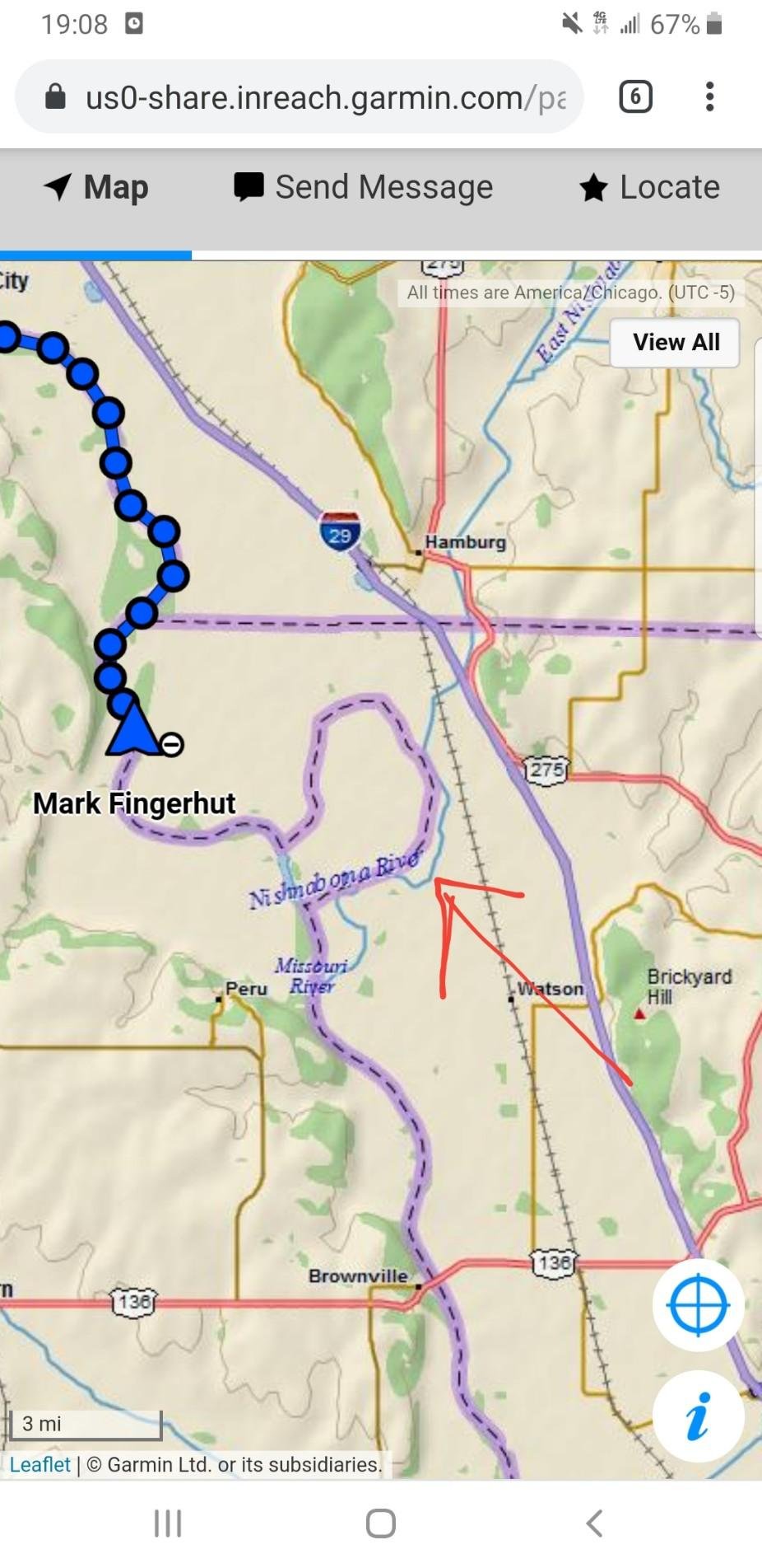
“Can you explain what’s going on with the border there?”
In talking with my parents who visited me in Sioux City and stopped for a night in Omaha on their way, they remarked that they stayed in a hotel that was near a neighborood that was west of the Missouri River, but a part of Iowa (Carter Lake).

How about the lower Mississippi – ever seen that mess?

Why, in the 1980s, did a group of 5 guys spend 4 months digging up a steamboat wreck from the 1850s in the middle of a cornfield?
What’s going on here? Well, here is your answer. (Thanks for sending this my way, Anna Wenger.)
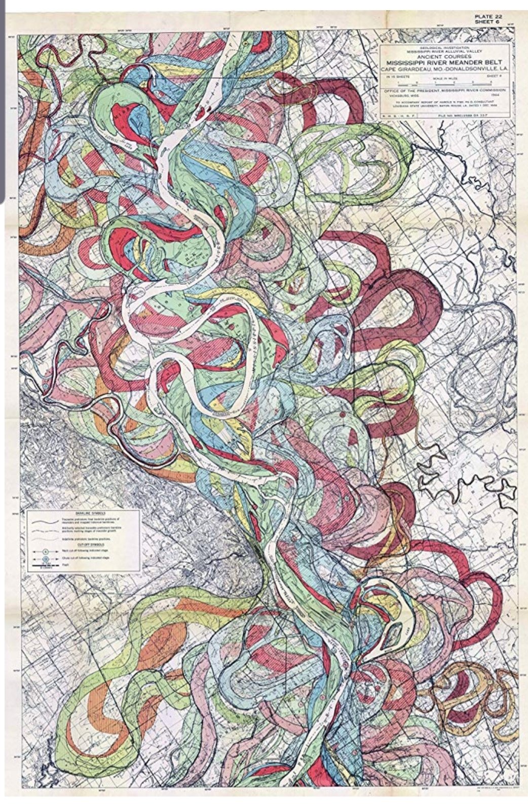
Over thousands of years, rivers, especially ones that generally flow over flat, muddy ground, will shift channels. The river constantly cuts through dirt and mud to form a new channel, obeying the laws of gravity to find the most efficient path towards lower ground. Banks erode. A horseshoe bend develops, then over the years, the river cuts into the start of the horseshoe until it erodes the bank completely, cutting off the horseshoe bend from the main channel and forming a lake – often called a horseshoe or oxbow. Left unchecked, a river like the Missouri will meander all over the plain between its bluffs, cutting a new path with each high water or flood event.
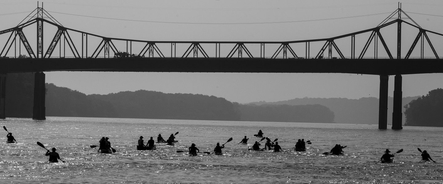
Certain portions of the Missouri I’ve paddled are still free-running, natural states of the river. The Missouri River Breaks section in Montana is the most natural and closest to its original state, then a few stretches of river between some of the larger dams and lakes, and a 50 mile stretch below the last dam on the Missouri, Gavin’s Point. Sioux City, Iowa generally marks the beginning of the channelized lower portion of the River. From Sioux City all the way down to St. Louis, the Army Corps of Engineers works to maintain a navigable, stable, 6 to 9 ft deep channel for barges and other watercraft. They do this by reinforcing the banks of the river with wooden piers driven into the mud, tons of crushed rock piled on the banks to prevent erosion, or wing dikes also made of crushed rock that point out into the river and ensure a fast current and prevention of sediment settling that would cause shifting in the channel of the river.
In the 1950s and 60s, in addition to building the 13 dams on the Missouri, the ACE also worked on shortening the main channel of the river. Where there may have been a long, curvy bend in the river, they simply dug out the shortcut between the start and ends of the bend to eliminate the extra miles for boat traffic. In doing so, they shortened the total length of the river by 72 miles!
One other result of the shifting of river channels was its effect on the geography of state borders. In many cases, the river acts as the border between states. When state borders were originally drawn, the river was in its natural state, and thus, continued to shift until channelization and stabilization occured. The borders did not shift with them. So a farmer farming his land on the East side of the river in Missouri may tomorrow be farming land on the west side of the river, but still in Missouri.
Today I got the chance to tour the Steamboat Arabia museum in Kansas City. Similar to my story of the Steamboat Bertrand in Nebraska, the Steamboat Arabia wrecked just upstream from Kansas City in the 1850s, then was recovered from the middle of a farm field in the 1980s, under 50 feet of mud and sand and a half mile from the river.
River channelization and meaures to control the flow and natural tendencies of the river vary in their success. Recent years have seen 100 to 500 year floods occuring with shocking regularity. Engineers designing dams, levees, dikes and other control structures on the river based their calculations on data that was 50 to 100 ears old and prior to the extreme effects of climate change. It seems the more we try to control the river, the less control we really have. I am certainly of the belief that the river be allowed to retain or in some cases, revert to its natural state when feasible. I don’t advocate for the destruction of the dams on the river, or letting all floodplain farmland be once again consumed by the river. But seeing the rampant development that’s occuring on floodplains just in the St. Louis area is very scary. The Missouri River is alive, it is powerful. It may live in its man-made channel today, but it will not forever.
I am certainly new to the issues surrounding the river and a big reason for taking this journey was to learn more. I hope to continue to do so, and also to educate others around these issues.
mf
