Lake Francis Case

After spending the evening at the downstream campground at Big Bend Dam, I was ready to get an early start on Lake Francis Case. As I opened my eyes very early as it began getting lighter, there was a crack of thunder and soon it was raining pretty hard. I rolled over and went back to sleep for an hour or so. The early morning downpour let up a bit and I emerged and started packing up. My campsite was equipped with a weird wooden half-shelter that covered part of the picnic table, so between that and my umbrella, I was able to pack up and sip my coffee in relative dryness. About 100 ft away, there was a group of fishermen huddled under a shelter who had put their boats in the water, ready for a long day of fishing on the lake, but were apparently opposed to going out in the rain. The rain would slow down, they’d walk over to their boats, then the rain would pick back up, then they’d go back to the shelter. This happened 2 or 3 times as I was getting ready to go, and I found it a little bit funny.

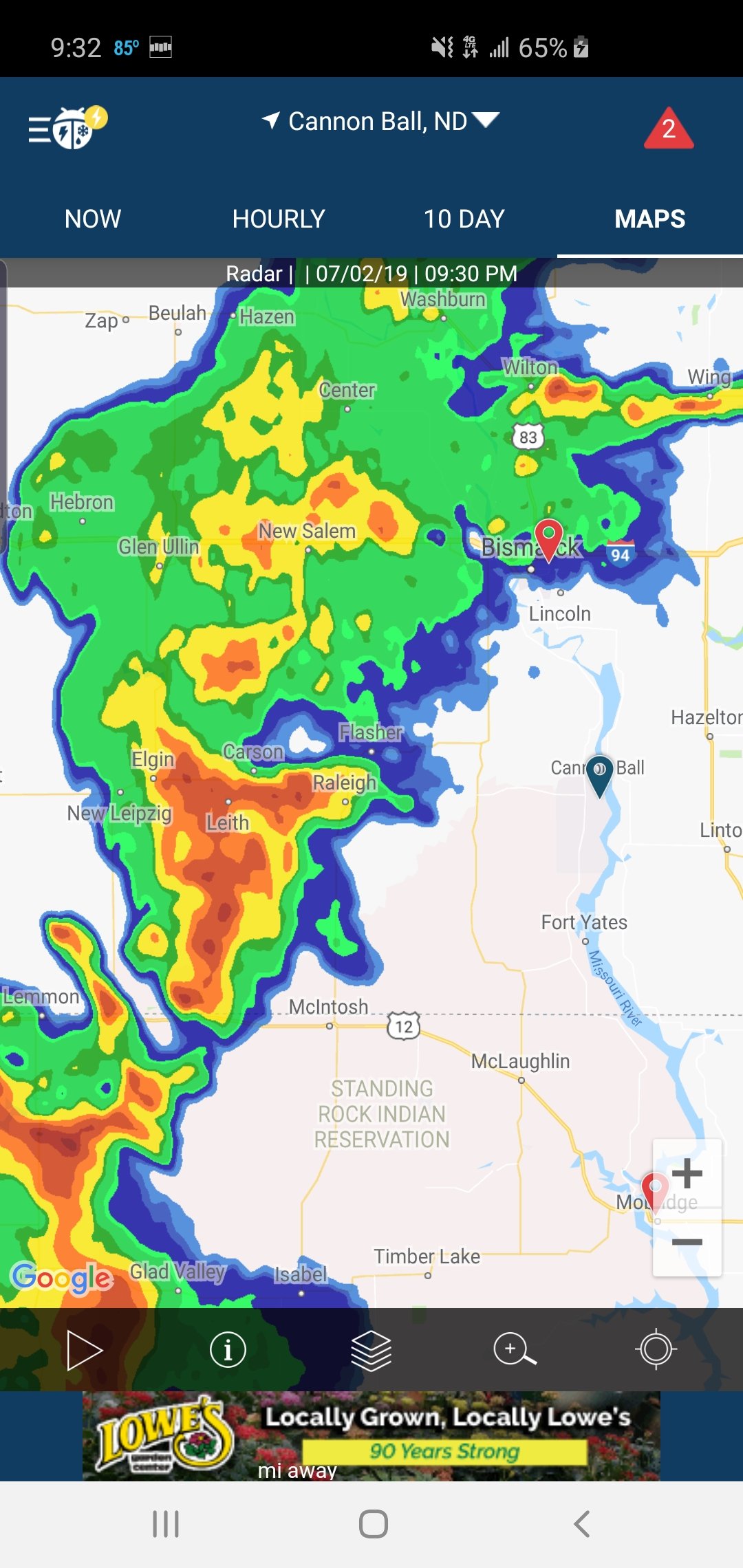
I timed my shove off with the completion of the rainstorm and the plan was to paddle around 18 miles to Chamberlain, SD. Chamberlain was my halfway stopping point when I drove from St. Louis to Montana to begin this trip. The meandering nature of the Missouri means that Chamberlain is a lot more than halfway on the river vs. on the road. I had gotten wind that the riverside campsites in Chamberlain had been flooded recently and may or may not be operational. I messaged Norm Miller in the morning and got him on the case. As I paddled to Chamberlain, I was receivng updates on what was open, what wasn’t, where I should paddle to and where I should avoid – the wonder of technology and a virtual ground crew…

I paddled up to American Creek campground around 2pm. The boat ramp I landed at generally delineated the half of the campground that was open vs. the half that had been flooded and was still in the process of being drained and cleaned. Even a site 18 miles downstream from a dam has to deal with the unpredictability of flooding, as the ordeal of managing flows, floodwaters and prioritization is a massive challenge up and down the Missouri. Volumes could be written about this challenge and all the factors that go into the decision making, and it’s quite controversial. In order to save certain spots along the river, others must be flooded. Who suffers, who gets saved, who loses business, who loses crops, houses, livelihoods – it’s generally up to the big boss at the Army Corps of Engineers who sits at the master controls of the 13 dams up and down the river.

I met Brenda, one of the owners of American Creek and she pointed me to a nice shaded spot next to the boat ramp where I could put up my tent for the next two nights. It had been a while since I took a day off, and Chamberlain was a good place to do just that. I spent the rest of the day relaxing, picked up a package of more dehydrated food that my wife sent to the local post office, then had dinner at the local watering hole and restaurant at the marina – the Smoking Mule. I ordered the chicken gizzards – I generally will eat anything and the deep friedness of these was good, but damn they were gross.

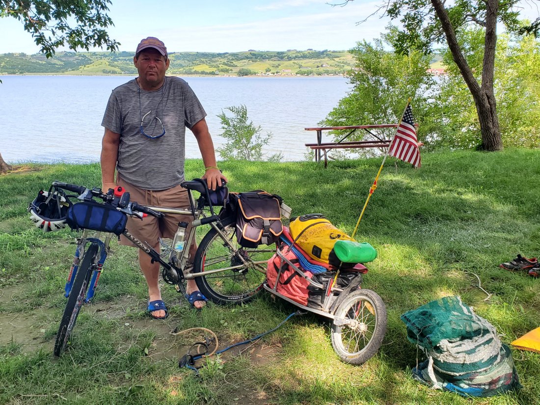
My goals for the next day were to rest my arms, shoulders and back, catch up on some blogging and journaling, and then keep an eye on Scott Hite as he biked into Chamberlain. The ever-impressive Missouri River Paddlers Facebook group turned me on to the journey of another paddler – Scott. He paddled the Missouri to the Gulf in 2015, and has done a ton more paddling on the Mississippi, Illinois River, and extensively around the Gulf, Florida and the Everglades. He’s an all-around interesting dude. I learned that this year, his adventure was bicycling from Michigan down to St. Louis, then up along the Missouri River to the source in Montana.

I had Scott’s Garmin tracker and I watched him get closer and closer throughout the day. While I blogged and drank coffee at a local sexily-named shop called Tranquil Desires, then grabbed lunch at The Anchor then browsed vintage books and baseball cards at and antique shop topped off by a McDonald’s sundae on a hot afternoon, Scott was getting closer. Back at camp, I sat in the breezy shade and read for a few hours. Sure enough, Scott rolled into camp around 7:30. We chatted as he set up his tent. Through his journey, he’s raising awareness and money for waitone.org. Scott started a hotline aimed at those who are contemplating a mass-shooting. Similar to a suicide hotline, it gives those ready to do the unthinkable a chance to talk to someone before they go through with it. I had so many questions. He told me about me about how the Colorado theater shooter explained in an interview after the act that he had called a mental health hotline prior to the shooting, only to get no answer. Scott carries three cell phones with him and answers calls 24/7, should someone call. His main priority for this trip is to get media attention and spread awareness for his hotline. He hopes to get national exposure at some point along the way. It’s also critical he stays within areas where he has cell phone reception on this trip, which dictates his route to a degree.

Scott and I returned to The Smoking Mule, where we enjoyed some food and drinks and volleyed river stories back and forth, his vast experience dwarfing my short, uneventful time on the river so far. Back to camp, we sat around in the dark getting chewed up my mosquitos, telling more stories before retiring for the night. It didn’t last very long. At 5:30am, the tornado sirens blared. I peaked out into the faint light of the early morning, it was windy, the waves were big on the lake, and the cottonwoods above us were bending. I turned on my phone to check the radar: storms moving in but not an obvious tornado. Scott and I got out of our tents, secured some of our gear, then decided to walk over to the bathroom/shower building for shelter. Lots of other campers left their RVs to do the same. When the front hit, we got inside the women’s bathroom, groggily acknowledging the other campers and waiting for the storm to pass. The wind raged and the rain poured down. After a good 45 minutes, we emerged and walked back to our camp. Branches were down everwhere. It didn’t look like there was significant damage. Arriving at our tents, Scott’s was leveled and sitting in 3 inches of water.

My tent held, but was misshapen with bent poles. I helped Scott relocate and re-erect his tent in a dry spot and we went back to sleep for a couple more hours in the not-quite-as-strong wind and rain.

After I packed up, Scott and I bid our farewells, him continuing on the road north and me on the river south.

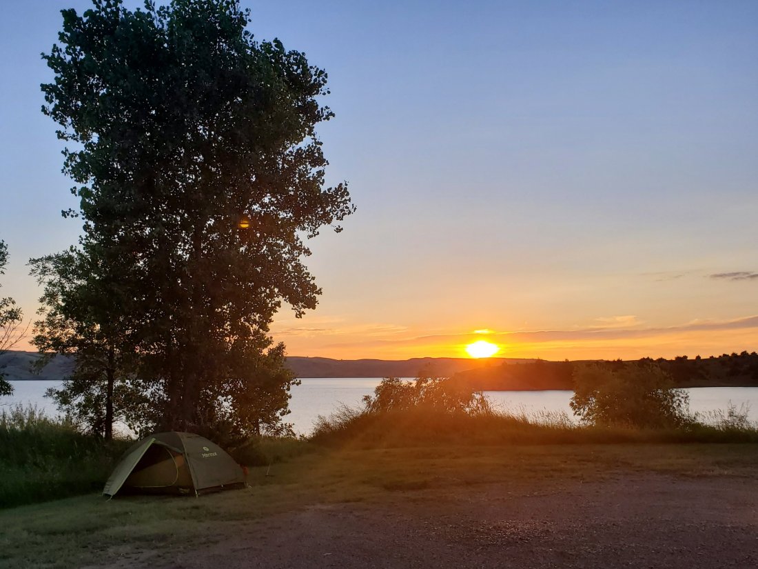
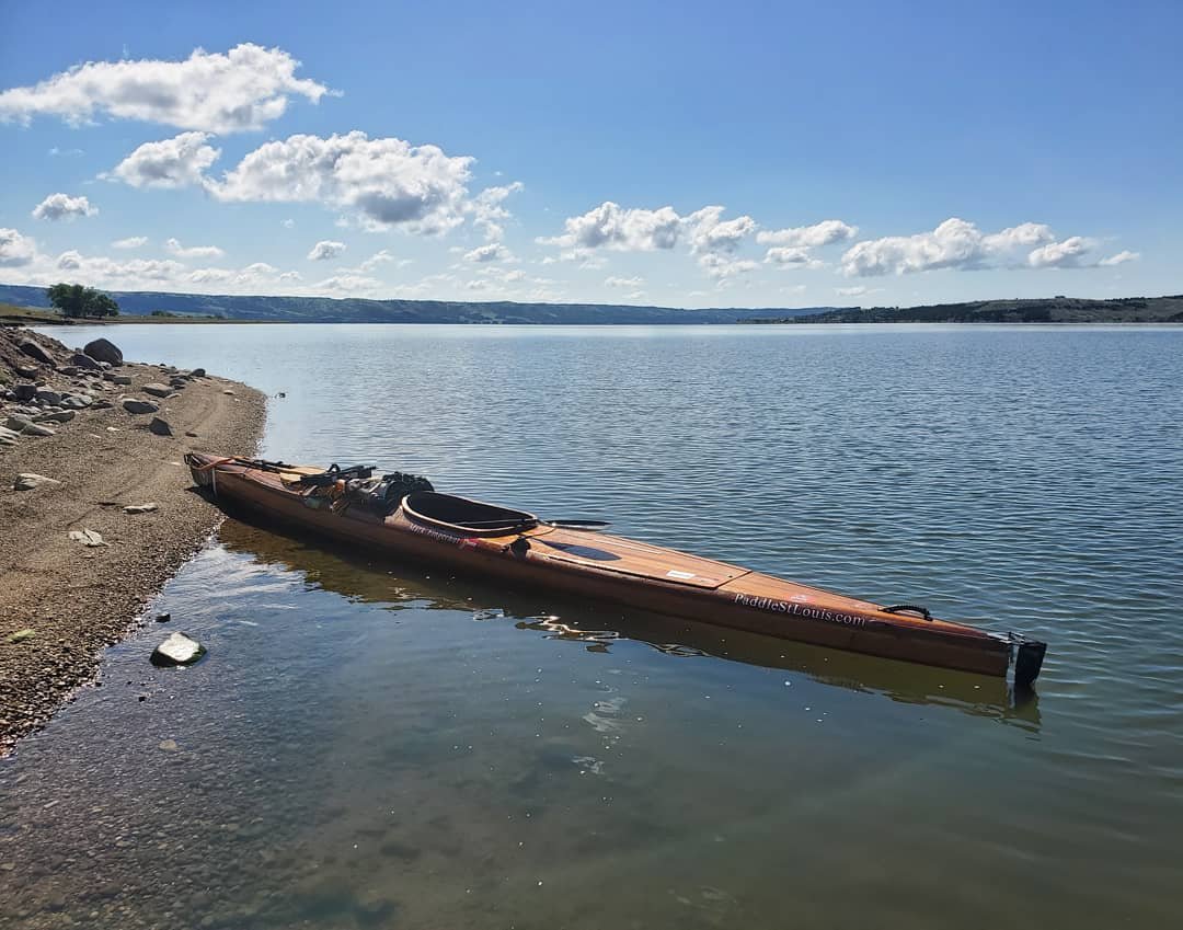
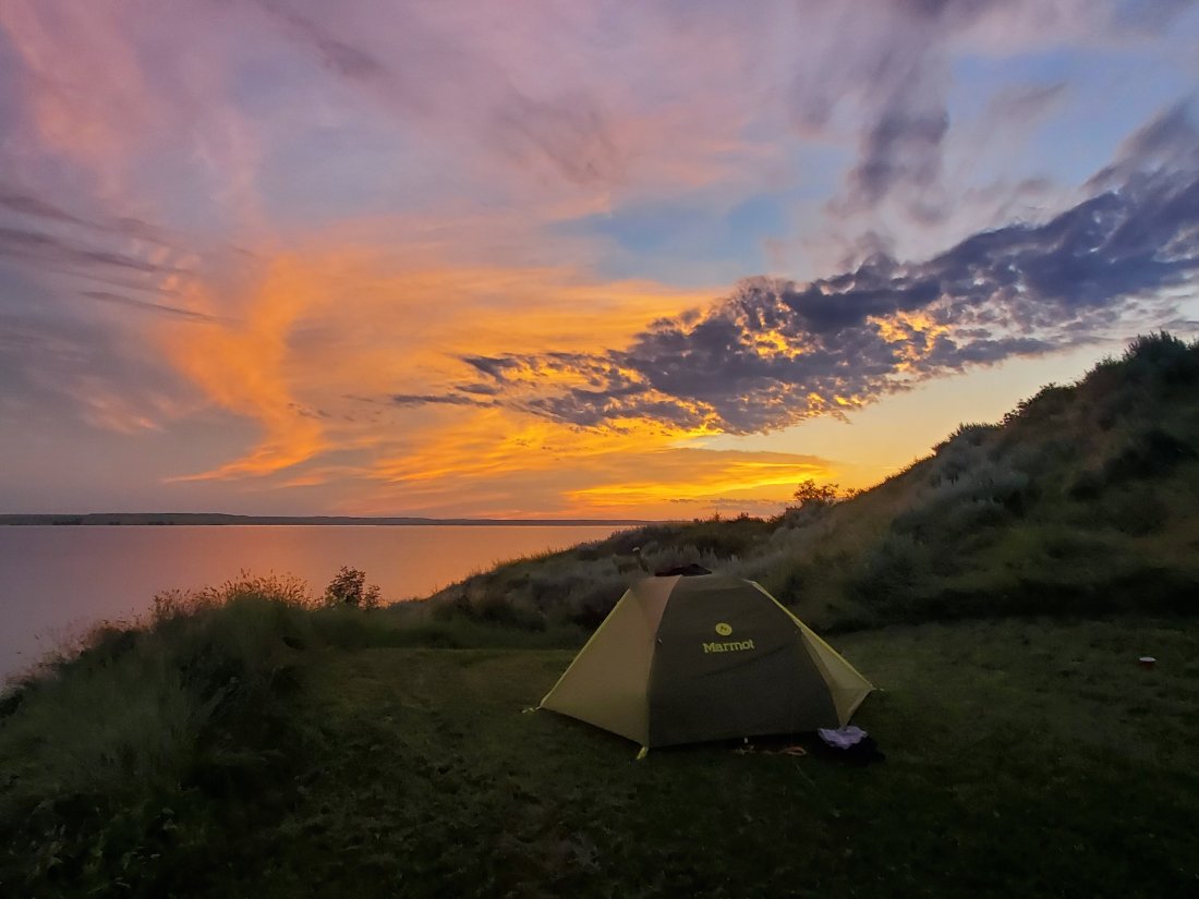
The lake calmed down quite a bit after the violent storms of the morning and I cruised southeast. It was much cooler than previous days, a cool front moving in with the storms. I paddled straight through to around 5:30, pulling up at Elm Creek ramp. I set up my tent in a nice shady spot near the ramp, talked with a gentleman arriving to do a little fishing and set up a bonfire to keep the bugs away. I had a dehydrated dinner and went down with the sun.

My goal for the next day was to meet up with friends from St. Louis – Doug and Shelly were starting their vacation by driving up to meet up with me. By around noon, I had made it to Snake Creek, where a bridge crosses over the lake and where there’s a real nice bar and grill where I enjoyed a burger and couple Busch Lights, even grabbing two for the road to go along with some of their homemade jerky. I paddled 10 more miles in some intermittent rain then into the Platte Creek Cove where I was greeted with calls of “on on”, the standard directional confirmation of the hash house harriers, the source of my friendship with Stinky and Swallow. I pulled up on to the muddy shore of their campground, gave some big hugs then enjoyed a cold beer they’d brought me.

We relaxed and caught up on the events of the summer, Stink made some fantastic porksteaks, a staple of summer barbeque in St. Louis, then we enjoyed a good driftwood bonfire well into the night.

I bid farewell to Stink and Swallow the next morning as they continued on their journey to the Badlands, Black Hills, Colorado and beyond. I had about 32 miles to the end of the lake, which I was content to split into 2 days. However, I soon learned that this was probably going to be the absolute best day on the river I’d yet to experience. The wind was nil, the water was glassy, and temps reached a high of about 75 during the day. Several times throughout the day, I simply set the paddle down, looked around and just absorbed everything that each of my 5 senses was feeding me – pure bliss. The lake was about 2 miles across all day, and I made several crossings with no problem whatsoever. Later in the afternoon, I turned on my phone and got a little reception – seeing that Norm had posted in the South Dakota paddlers group that I was nearing Fort Randall Dam. The first message was from a lady named Jackie who said she wanted to come and paddle but couldn’t make it, but would let friends know who were boating on the lake that day to keep an eye out for me. I shit you not, I looked up from my phone and saw a pontoon boat about a quarter mile ahead. As I approached, the guy called out. It was Jackie’s friends, Dave and Eileen. They waved me in for a chat and a cold beer. As I crossed the lake again, the next boat I came across was a group of retirees who also waved me in, asked me what I was doing and plied me with beer. South Dakota hospitality at its finest.

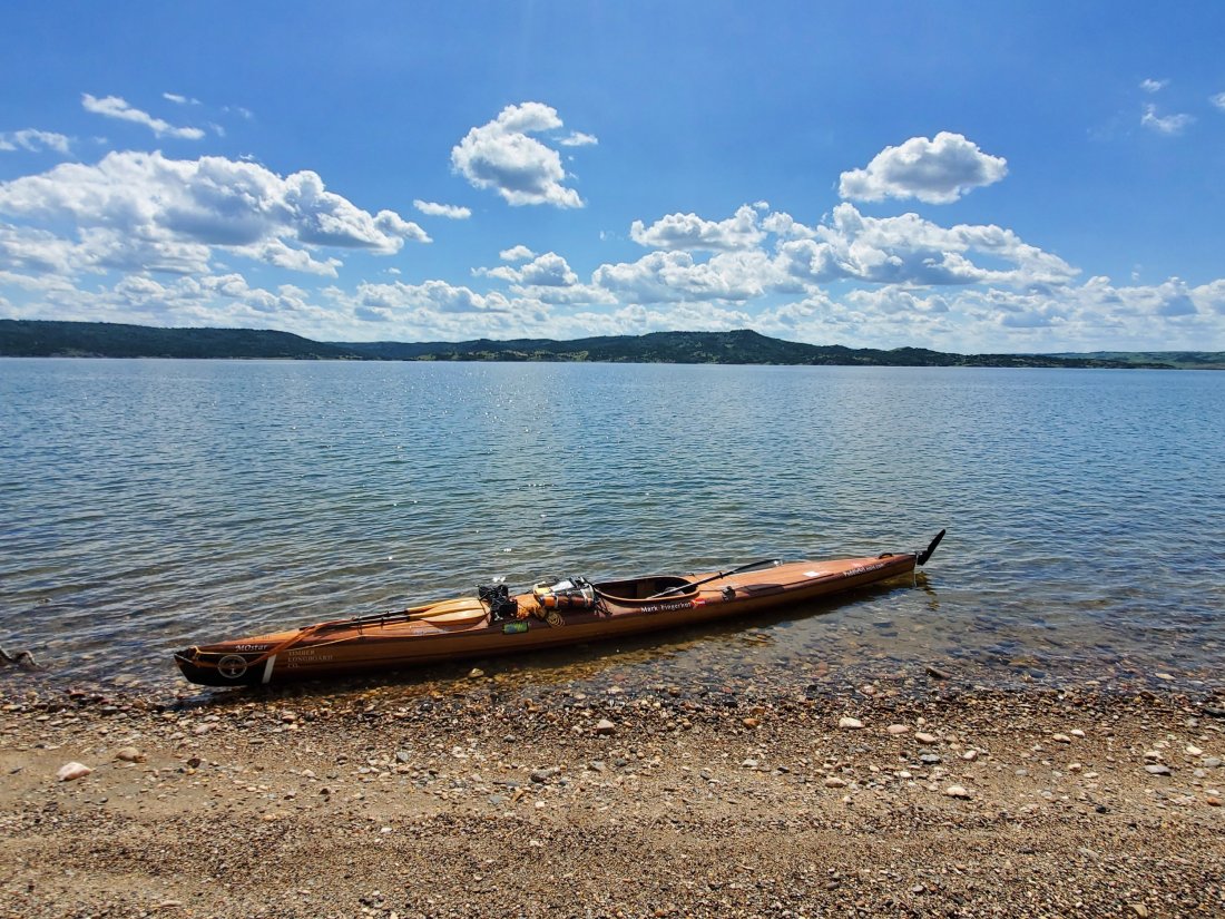
The day was too nice not to keep paddling, so I continued all the way to the dam – doing about 32 miles. I pulled up at North Point campground and got a good spot right on the water. After an uneventful evening, I was again in bed with the sun and slept well. Another lake bites the dust.

mf

PS – To save you a wikipedia click, Francis Case was apparently a US Congressman/Senator from South Dakota from 1937 to 1952. I don’t know that he did anything noteworthy, yet he gets a pretty nice lake named after him, go figure.

Lake Sharpe

After leaving the gracious hospitality of the Kuhls at Oahe Dam and Pierre, SD, it was time to tackle Lake Sharpe. Lake Sharpe is 81 miles long and its main feature is a massive 21 mile bend, where after making the big loop, you end up about 1.5 miles from where you were 21 miles ago. Jack dropped me off at the downstream boat ramp at Oahe Dam. I called to inquire about a dam tour at Oahe, but they confirmed that you do need a car to take the tour – I ran into the same issue at Fort Peck. Due to security, you have you drive your car into the powerhouse following a tour guide. Those who are on foot, or kayak in my case, are apparently out of luck unless you find an accommodating fellow tourist’s car to ride in. This time I let the terrorists win and skipped the tour and went ahead and shoved off.

The water was swift, cold and clear. The city of Pierre, capital of South Dakota, is around 6 miles downstream of the dam.
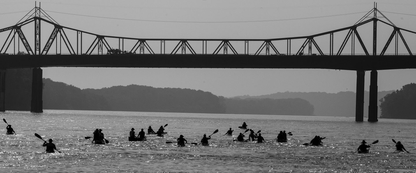
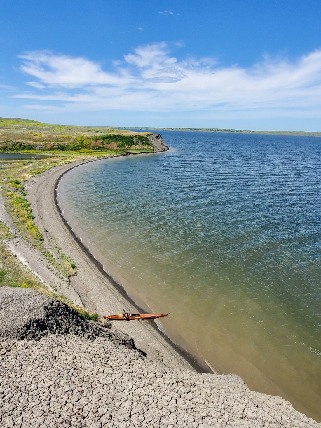
I passed by without stopping, enjoying the underside of an old rotating railroad bridge and well as the lovely Framboise Island. The muddy Bad River joined on the right adding some chocolatey sediment. As the river turned east, I got a pretty good tailwind, strong enough that I put up my umbrella, set down my paddle and sailed for a good 2 or 3 hours. I was moving just as fast as if I was putting in a pretty good effort paddling. With an opaque golf umbrella, I would just have to lift it every once in a while to ensure I was moving in the right direction.Pretty soon the current slowed, then stopped completely and I was into Lake Sharpe proper. There was some wind around, but not too strong, so I continued to make miles. Around 5:30, I was around 30 miles in and approaching DeGray boat ramp. I pulled in to the rocky boat ramp and settled on a small patch of grass next to a gravel parking area for camp. The flies were pretty bad, but I got set up and made a dehydrated dinner and enjoyed a good sunset. I woke up several times during the night as a mild storm rolled through. A bit of thunder and lightning and some rain, but nothing too rough, enough to ensure I packed my tent away wet the next morning.

The plan for today was 32 miles to get to the western side of the Big Bend, where there was a pretty good campsite with good facilities. It was a fairly calm and uneventful day. It did get very hot in the afternoon, and I stopped several times to fully immerse myself in the cool lake water. I passed many herds of cattle who had the same idea as I, taking a mid afternoon dip. I can’t help but practice my most accurate moos as I pass them, knowing I’m doing a pretty good job if the entire herd happens to stop and stare at me.

As I approached the bend, I had a bit of a headwind. But as I made the turn north, then eventually back west, the wind was now at my back and I did a bit more sailing. The campground came into view and I made the last few miles among some wave-running kids. The campground looked pretty packed with RVs and vacationing families. There was a sandy swimming beach with cabins on the left. The far left cabin looked unoccupied and there was a good bit of shaded, mowed grass next to the cabin. So I pulled in and quietly erected my tent on the far side of the cabin, out of the view of the main campground and any officialdom that might make their rounds.It was a long, hot day, so after a nice shower in the ‘comfort station’ of the campground and a quick dinner, I was asleep. Not for long, storms rolled in around 11:30 and lasted pretty much the rest of the night. Now an expert at thunderstorms of the northern plains, I judged from the coordination of the frequent thunder and lightning that this was not a direct-hit storm. It was very windy with heavy rain and I was lucky to have a bit of shelter in my tent, next to a wood cabin and some stout cottonwood trees, but I know we weren’t getting the absolute brunt of this storm. At one point, probably 2am, I got up and made sure my boat was still out of reach of the big waves on the lake, it was. I later learned this this same storm spawned 60 to 80 mph winds in nearby towns that flipped over a few trailers.

Come 6am, the storms seemed to be strengthening and I could tell by sound that the waves were bigger. Once again, I ventured out of my tent and walked over to my boat. This time I was not so lucky. The waves were crashing over the back of my boat. The back hatch was no longer on my boat; water, sand and seaweed was swamping my back hatch, which still held some of my gear. Shit. I quickly and with much difficulty pulled my boat all the way off the beach and into the grass. I gave a quick silent thank you to Jim Emanuel, who early on in my trip insisted I attach my hatch covers to my boat with 550 cordage. Without his sage advice, the rear hatch cover would have been halfway to Pierre and I would have been an awful situation having to find an alternative way to enclose my hatch on a custom boat. Jim, cheers to you!

After a few more hours, the rain died down and I got to work draining the water, sand and other detritus from my boat. Eventually I took off and crossed directly across to the very northern edge of the bend. Once I went around the top of the bend, I decided to make another crossing to the eastern edge of the bend to save a few miles of paddling. I was getting close to the end of the lake – Big Bend Dam. Quite hot again today, I stopped for a quick swim/cool down. I made one final long crossing and arrived at the boat ramp at the dam. I didn’t have a plan for portaging my boat down below the dam. At the ramp, there was a young Native American couple trying to get a wave runner to start. I relaxed in the shade for a few minutes, seeing if they’d have any luck. Luckily for me, they did not and started to load it back on their trailer. I approached and asked if they might be able to drive me down to the campsite below the dam. Ken was very nice and willing to help. He unhooked his trailer with the wave runner and left that with his lady friend. We loaded my kayak into the bed of his pickup, somehow tying it down and jamming it in somewhat securely. A 20 ft kayak in a short-bedded pickup means even at an angle, it will be hanging out quite a bit. Ken carefully drove across the dam, with the back of my kayak about 6 inches from the guard rail. He dropped me at the campsite just below the dam, about 100 ft from where I’d put in on Lake Francis Case in the morning. I slipped him 20 bucks for his troubles. Lake Sharpe was complete.

I grabbed an open campsite near the boat ramp and happened to set up next to Ron and his wife, the campground hosts. Campground hosts are people hired by the campground owners, in this case the Army Corps of Engineers, to just kind of watch over the camp, help people out if they need anything, police the area a bit and act as host for all campers. Ron offered me a cold beer as I was setting up, then after I had made a good meal of dehydrated taco meat on tortillas, invited me back over to sit and talk with them as the sun went down. Ron and his wife spend the summers here at this campsite, then spend the winter down in Port Aransas, Texas, their entire year in a huge RV. Sounds like a pretty good life to me. He told me stories of flooding, massive storms and his interactions with familiar thru-paddlers from years past. Into my tent I went, ready to take on the next lake in the morning.

mf

Completing Lake Oahe

After an evening of cold beers, a great burger and good conversation with fellow camper and proud South Dakotan Russ at the bait shop at West Whitlock State Park, he generously brewed me some fresh coffee back at his camper to fill my thermos to get me started on the right foot the next morning. I awoke to a nice sunny day, but winds from the South. I immediately crossed over to the South side of the lake and for about 8 or 9 miles was able to paddle in the shelter of the shore in fairly calm water. I enjoyed passing under the very long route 212 bridge over the lake. When the lake made its turn South, I was once again paddling into the wind. I made some hard miles before things calmed down later in the afternoon. I passed a boat ramp around 4 but kept going, as I wanted to tackle Little Bend the next day and wanted to get as close as possible that night. I made about 6 or 7 more miles before finding a pretty nice beach in a partially sheltered cove. I had a lovely view of the sunset to the West, even though it was pretty warm and my legs were targets of the biting flies.

There was a bit of wind and rain overnight, but nothing too bad luckily, as I has absolutely no shelter or windbreak on that beach. I packed up my damp gear and was on the water early. Slight winds from the North, mostly at my back for the moment, I crossed from the East to the West side on the approach to Little Bend. At Little Bend, Lake Oahe makes a hard West turn for around 8 miles before doing a complete 180 back to the East for another 8 miles. A massive U-turn that some have actually portaged up and over the thin spit of land at the neck of the turn, but I was there to paddle. I crossed over once again, aiming for the very end of the bend. I encountered strong winds from the North and pretty large waves. I surfed may way across and landed on a beach to collect myself and ensure no leakages from waves crashing over my hatches. A couple more miles and I was out on the end of the bend, with the waters of Lake Oahe for nearly 270 degrees in every direction:

Once around the bend, I was once again sheltered from the wind and paddling in calm water. Sure, the wind is can be tough to paddle in and make for rough waters, but at least it keeps you cool. The Southern end of Little Bend was hot, so I stopped at Little Bend Conservation Area ramp for a quick swim to cool off. I made one last crossing for the day in glassy waters to Pike Haven Resort, where I was given a nice spot to pitch my tent overlooking the lake. I grabbed a shower in the spider-infested shower house, then settled into their nice bar/restaurant for a few cold ones and a nice steak. I emerged from the coolness of the bar just as the sun was setting in order to avoid the evening heat and was greeted with one of the nicest sunsets of my trip so far:

From Pike Haven to the end of Lake Oahe is around 32 or 33 miles. I planned to tackle it in 2 days, stopping about halfway. Pretty quickly after getting out on the water, I saw a distant boat coming towards me. Normally, if I am facing a boat coming my way, they turn off well in advance of any kind of close calls. This boat kept coming, I nervously watched it approach. As it got closer, the driver cut the engines and drifted up to me. Jack Kuhl introduced himself as my host for the end of the lake and Pierre. I had gotten Jack’s contact info early on, and was planning to contact him when I got to the dam, but Jack was able to locate me on the lake via my tracker and decided to come out to see me. After discussing plans to meet, he went off to do some fishing and I continued on with relatively calm conditions. As I approached two resorts that I had contemplated stopping at later in the afternoon, Jack returned. He suggested I paddle on a few more miles to Peoria Flats, where he could load me up on his trailer and drive me 10 minutes to his house where I’d have all the comforts of River Angeldom.

Approaching Peoria Flats, I saw Oahe Dam in the distance. Ensuring the forecast was not expected to be very windy the next day, I decided to leave the last 6 miles of the lake for then. Jack backed his flatbed trailer all the way into the water and I paddled the kayak right up onto it, tied it down, then off we went – by far the easist offloading of my boat so far this trip. Back at the Kuhl residence, I met his wife Sue and cooled off with a beverage and shower followed by an amazing meal of freshly caught Walleye and corn on the cob. Jack had paddled the entire Missouri River in 2015, so we exchanged stories and notes, I think Sue might have been a little bored listening to us go on. But we also talked about our travels, with the Kuhls being pretty wordly travellers themselves.

The next day, Jack dropped me back in the water at Peoria Flats and I paddled the last 6 miles of the lake. There was some wind and waves but not too bad. I also did a Facebook live video during this stretch. While it worked fairly well, I don’t think my reception was super clear, as the video kept dropping. Still, a lot of people joined, said hello and asked me some questions. At the dam, I cruised back onto Jack’s trailer, then we located a nearby rock, under which resided a small stash of keepsakes and treasures left there by previous through-paddlers. I checked out what was there, including some bug spray, a head lamp, a buff, some energy bars, a (sought after) purple hat awarded to those who have paddled the entire river – which I left in the stash. I also found a small baggy into which someone had left a nicely rolled joint, still smelling pretty nice and potent. Alas, the ziplock bags of the stash were no match for mother nature, as water had seeped in to soak everything and make it all pretty nasty. I added a few stickers that I collected along the way on my trip so far, nestled in next to the soggy joint. I also nominated Jack for another summer project: clean up and place the stash in a more weatherproof container, so that perhaps the next paddler coming through could actually enjoy the wonderful generosity of previous paddlers and maybe even a few puffs of the sticky-icky.

After the short day of paddling, Jack graciously showed me around nearby Pierre, SD, including the site of Fort Pierre, the South Dakota Heritage Museum and the Verendrye site – a big hill overlooking the town where in 1913, a few teenagers discovered an engraved lead plate planted by French explorers way back in 1743. The plate itself is stored in the museum, where they also had a pretty cool exhibit on Minuteman missiles, which have played a big part in the history of the Dakotas. After a quick stop into the local Wal-Mart to load me up with fresh cherries, which have become my preferred snack while paddling, back to the Kuhl residence for another amazing dinner.

The next morning I was loaded back up and ready to begin the next lake – Lake Sharpe. I thanked the Kuhls for their generosity and for being wonderful River Angels.

To summarize Lake Oahe: I spent 10 days paddling this 231 mile long beast of a lake. I took 3 rest days – 2 at Bridge City Marina in Mobridge and 1 at West Whitlock State Park. The reputation of Lake Oahe is that it can be unbelievably rough and dangerous based on the weather conditions. I’ve heard many stories of paddlers being stuck on the shore for days at a time – 10 days in one case. Jim Emanuel had to take shelter in a shower house last year as 100mph winds came through, flattened tents and brought down an electrical pole at the campsite. Folks have been caught out on the water as massive storms appeared almost out of nowhere and stirred things up. My Oahe experience was luckily not as exciting. I consider myself extremely lucky to experience the weather and conditions I did. Other than that one terrifying storm in the middle of the night that I weathered in my sand-covered tent near Cannonball, I didn’t have a ton of overly challening conditions. I was also lucky to have my awesome boat from Timber Longboard Co., which I confidently paddled into (up to) nearly 20mph winds and the waves that were whipped up by them. Peck, Sakakawea, Oahe – the big three lakes on the Missouri. I’ve now completed all of them. I am hoping that within another week of paddling, I will descend past the last dam of the Missouri at Gavin’s Point/Yankton. From there I’ll hit the fastly moving water of the lower Missouri and begin the real home stretch.

mf

Oahe Shows Its True Colors

The longest reservoir on the Missouri River, Lake Oahe, is generally oriented North to South. It stretches 231 miles from Bismarck, ND to Pierre, SD. Because of its orientation plus weather and winds generally moving from West to East, Oahe has a reputation for being the most challenging passage of the 3 big lakes. So I was quite pleasantly surprised with how my first 4 days of paddling on the lake turned out. I think the strongest winds I encountered were 10 – 12 mph and were from the Northwest, so I wasn’t battling wind or waves for the most part. I even had a truly legenday day conditions-wise as I crossed over the lake from West to East near Fort Yates:There was the late night storm I had to endure, but I’d much rather deal with severe weather on shore, in my tent versus potentially being caught on the water for it.

After a couple relaxing days at Bridge City Marina in Mobridge, it was time to hit the water again. As I paddled out of the marina around 9am on Monday, July 8th, I was facing a fairly strong headwind. Paddling on the East side of the lake, I tried to paddle in the shelter of coves along the way, but was still facing tough wind and waves. The waves weren’t generally a big issue, typically a 2 or 3 foot wave would break on the front of my boat, water might splash on the top of the front of my boat, but generally the splash dissipated by the time it reached the cockpit where I was sitting. I didn’t wear the skirt and didn’t really get much water splashed into the cockpit. The bigger challenge was the wind itself. It was in my face, and it seemed to push both my boat and my body backwards. The main effect was lack of mileage covered vs. the effort I was putting forth. As I checked my Garmin throughout the day, I was consistently surprised how few miles I was covering. I made a fairly long crossing of several coves from 2 – 4pm, targeted a cove where I might set up camp and was disappointed to see I had only hit 15 miles that day.

Luckily I dodged some approaching thunderstorms that night, as my tent was perilously perched on a gravel isthmus between the lake and a tidal pool with no trees or windbreaks to be found. The wind throughout the night had waves lapping up a few feet from my tent, but I made it through. After a short early morning rainstorm that kept me in my tent a little longer, I was quickly packed and on the water by 6:45am. The wind forecast for the day was calmer in the morning, increasing to 10 to 15mph from the West later in the day.

With fewer waves, I made a good 5 miles before 8:30am before things started picking up. When they did pick up, they did so quickly, creating 3 to 4ft whitecapped waves out of the West, coming in from my right to left. Although the waves were big, I prefer this to headwinds, as I am still able to cover mileage as opposed to strong headwinds. My general approach is to keep and eye on the waves that are forming around 30 yards ahead of me and at a 45 degree angle from my boat to my right. Those are the waves I am going to hit as I move through the water. If I see whitecaps in that space, I can generally expect to encounter some pretty rough stuff when I cover that 30 yards. If no whitecaps, I know it’s probably safe to grab a drink of water, or snatch a quick bite of snacks. My Timber Longboards Co. boat performs wonderfully in these conditions. I roll across the top of big waves. The whitecapped waves may break against the side of my boat and may send water crashing over the top and sometimes into the cockpit. A few times, I got a good soaking when I wasn’t expecting it, otherwise I welcomed a splash of cool water on a warm day. I didn’t use the skirt in the morning, and had to bail out some water with my bailer cup/toilet and my sponge periodically.

I pulled into Dodge Draw Cove around 1pm, where there was a boat ramp, parking lot and drop toilet. I had covered 14 exhausting miles and was prepared to call it a day. I checked the weather forecast for the rest of the day and the following day. I was dismayed to see forecasts of 25 to 30mph for the next day. This meant that I would most likely be shorebound the next day. So I could indeed call it a day and likley be stuck at a pretty boring boat ramp for a day, or I could put up with the 10 – 15mph winds for another 10 miles and make it to a pretty nice campground with full facilities at West Whitlock State Park. I decided to go for it. This time I put the skirt on, as I could expect to get swamped quite a bit more in the increasing winds. I dug in and really cranked out some paddling. I covered the 10 miles in around 3 hours and pulled into West Whitlock before 5pm. I’d made a very difficult 25 miles for the day, possibly my hardest physical day of the trip so far. I found a really nice state park campground, parked my kayak on the swimming beach, grabbed a campsite right up the hill, then got a ride from a friendly family down the road to a bait shop/restaurant for some cold beers and a delicious burger for dinner, while chatting with some very nice folks who were also staying at the park. It sure beat Dodge Draw.

I heard strong winds blowing through the trees around my camp all night and into the morning. I woke early and was reassured at my decision to take a rest day after seeing a whitecapped Oahe:The last 10 miles really took a lot out of my upper body yesterday as well, so I’m quite happy to give that a rest today. Tomorrow’s forecast is for 10 to 15mph winds from the South, not perfection like my first 4 days on Oahe, but something I can deal with. My first 8 or 9 miles is due West, then the lake turns to the South where I may once again be facing headwinds. It’s certainly been interesting having the added challenge of winds, weather, lake orientation and lots of other little factors to consider rather than just getting in the boat and paddling. I did a little repair work on the boat this afternoon, updated my blog and journal, will enjoy a hot shower later before heading back to the bait shop to grab some beers and dinner with Russ, the ethanol plant worker on vacation and camping just down the road.

mf

Garrison Dam to Mobridge, SD

Currently, I’m sitting in an air-conditioned cabin, 20 yards from Lake Oahe at the lovely Bridge City Resort and Marina. I have the TV on and am about to root for the US Women’s team to win the world cup. My hosts at Bridge City, Mike and Jessie Norder have been amazing hosts, super generous in feeding me, inviting me to their twin sons’ 18th birthday party and even lending me their small pickup truck to check out some cool sites around Mobridge. I plan to hit the water again tomorrow, Monday, July 8th if the wind cooperates.

Since completing Lake Sakakawea, I’ve paddled 198 miles. Half has been flowing river, half has been on the often challenging Lake Oahe. Here’s my story of the last 198 miles:

Garrison Dam to Bismarck, ND

I spent two relaxing days in Pick City and Riverdale, ND, where Garrison Dam is located. I enjoyed the dam tour, I can’t get enough of learning about these massive mid-century infrastructure projects. I even got to see a 4 ft Paddlefish hanging out below the dam. My cousin Dave arrived after flying in to Bismarck, then driving a rental car north an hour to Riverdale. We had a great night eating delicious food and enjoying some drinks at Iron Oar with the owner Nate and his friend Derrick.

After a good night sleep in the lodge, I packed up all my gear and McGyver’d my boat to the top of Dave’s rackless rental car and we drove to the bottom of Garrison Dam in a steady drizzle to the boat ramp. Looking back at Lake Sakakawea from the top of the dam and seeing big waves and whitecaps in the rain, I was so happy to be done with the lake (for now). I put in a few hundred yards from the dam and the rain let up pretty quickly. About a mile downriver, Norm had told me to look for a massive petrified tree that is even visible from space via google maps. With high water levels, I didn’t expect to be able to see it. But as I approached the spot, sure enough, there it was:

Norm says it’s a Redwood, left over from many thousands of years ago, very cool. Proceeding on, the wind increased and I was paddling into 2 to 3 foot waves on a very wide stretch of the river. With the luxury of a cool cousin driving a support vehicle for this stretch of the river, I was able to pack my boat with only minimal gear and much less weight. So I had to get used to paddling a boat that sat higher in the water and was more susceptible to being pushed by the wind. Although it generally moved faster in the water, it also sat up higher with less weight and would therefore catch more wind. Once I made a southward bend in the river, the wind seemed to decrease a bit. Around mid-day, I encountered the Knife River where it joins the Missouri. I paddled two miles up the currentless Knife to a small boat ramp to meet Dave. I hopped in the car and we drove a mile to the Knife River Indian Villages historic site. We took in the small museum, the amazing reconstructed and restored earthen hut and viewed the craters of long collapsed earthen huts of the Mandan and Hidatsa tribes. Back on the water, it remained fairly windy the rest of the day, and I pulled into Washburn, ND to meet Dave at the riverfront city park and complete a 40 mile day. Dave drove us north to Coleharbor, ND, past what was easily the largest digging crane I’d ever seen mining coal, to the Harbor Inn, a small hole in the wall bar specializing in steaks. I had a massive Prime Rib to replace some of the calories burned that day.

After sleeping in tents on the Washburn waterfront, I was on the water early for an amazing calm and serene morning with the objective of Bismarck, ND. My classical music mix was the only appropriate soundtrack to accompany this scene:

Later in the afternoon, I started seeing more recreational boats, a sure sign of approaching Bismarck. A few mid-river sandbars had a handful of boats parked with partiers enjoying a liesurely Sunday afternoon on some of North Dakota’s finest beaches. The final 10 miles into Bismarck was a veritable gauntlet of speedboats, pontoons and a few fishing boats all making the river much wavier than it had been earlier. I kept very close to the east shore out of the traffic, also enjoying views of some pretty elaborate and ornate riverside houses. At one point I made a shortcut through a side-channel where there were a few boats, mainly families, enjoying a bit of a quieter piece of the river away from the bustle of the main channel – that is until a likely inebriated, moronic driver of a pontoon sped through feet away from me, upsetting the quiet scene.

Passing under the bridges of Bismarck, I got to paddle by a huge paddlewheeler full of tourists seeing the sites and shooting strange looks at the lone kayaker among the speedboats and wave runners. Finally, I pulled into the South Port Marina, where I was greeted by Dave with a cold Busch Light and some welcome appetizers in the cafe. Dave sprung for a room at the nearby Fairfield Inn, where I had a wonderful shower and did some laundry before we went out to a cool beer, pizza and vintage arcade game bar where we celebrated Dave’s 54th birthday.

In the morning, Dave drove all my gear back to my boat, then dropped me back at the hotel room to relax for a few more hours. He headed to the airport for the return trip to St. Louis. I called around and managed to get in for a much needed massage at a nearby spa. My back tightness was noted by the masseuse and she skillfully loosened everything up to get me back into paddling shape.

Bismarck, ND to Mobridge, SD – Lake Oahe

After a few errands to pick up a couple needed provisions, I walked back to the marina, had some lunch then hit the water. My objective was an easy 10 mile paddle to a sandbar that Jim Emanuel had recommended as one of his favorite camp spots on his trip downriver last year. As I arrived at the spot and set up my tent, I flinched as shots started ringing out from a boat ramp slightly upriver on the opposite bank. I huddled behind my tent with my binoculars and observed 3 young guys indisciminately firing guns near the boat ramp. They didn’t seem to be shooting across the river and I don’t think they even saw me, however their careless gunplay certainly made me nervous. Eventually they left and I enjoyed a nice sunset and a long phone conversation with my wife.

According to maps, Lake Oahe actually starts at Bismarck. However, the river continues to flow for around 20 to 25 more miles until it dumps into the top of Lake Oahe and truly becomes a lake. As the river turned into a 2 to 3 mile wide behemoth of a channel, there was lots of willows and other water plants growing from the shallows, making navigating a bit of a challenge. But again with water levels being generally high, I had no trouble paddling through some shrubbery to make the crossing to the east side of the lake.

The conditions on the water were pleasantly calm, and as I got close to the Cannon Ball River entering the lake on the opposite side, Norm messaged me and suggested I cross to check it out. I made the crossing relatively easily, but was happy to stop and take a full immersion in the lake at the Cannon Ball. The river was named by Lewis and Clark after the cannonball like rocks that mark its convergence with the Missouri. I saw a few of the rocks, but I’m sure many more were hidden under the high water. Close to the Cannon Ball is also the site of the DAPL protests of 2016 and where the gas pipeline was constructed and passes under the river. I saw no signs of the pipeline.

As my mileage for the day approached 40 miles, a rainstorm loomed ahead of me and I began looking for a campsite. I was on the west side of the lake – which is part of the Standing Rock Reservation, but I was advised it’s generally acceptable to camp over here, just try to do so surrepticiously if possible. Spots to set up a decent camp were few and far between. As the rain started, I was forced into a swampy area and an obvious cow pasture. I quickly set up my tent under the shelter of a low Cottonwood tree and was able to actually tie up my boat to another tree to secure my craft for the coming storm. I sat in my tent waiting out the quick rainstorm. Exhausted from a 40 mile, very warm day and not wanting to deal with the mosquitoes or the damp 3 ft high grass around my tent, I made a quick dinner in my tent then laid down. With spotty reception on my phone and listening to local radio forecasts, I was made aware of a bigger storm moving in. I dozed off around 9:30pm, warily seeing this on my phone (I was camped a few miles south of Cannon Ball and the storms were moving in from the west):

About an hour later, I awoke to the flashing of lightning and a slowly growing rumble of thunder. As the storm moved in, both the thunder and lightning became nonstop. I could not distinguish individual thunder sounds, just a very low constant rumble accentuated with loud, violent cracks every few seconds. Lightning was flashing literally every 2 seconds if not less. I huddled under my sleeping bag hoping my tent would hold up in the wind, the Cottonwood would not break and crush me or get struck by lightning and spread the deadly electricity to my tent it was touching. A few cracks of lightning illuminated even the insides of my tighly closed eyes and I was certain of a direct hit. Luckily I was wrong. On top of the violence of the storm, because I had camped on a sandbar the previous night and packed up my dew covered tent on the sand, as my tent shook in the wind this night, I also received a shower of fine sand from the underside of my rain fly. Sand covered the sleeping bag I was tightly wrapped in, the floor of my tent and peppered my face which I also buried inside the sleeping bag. I felt quite helpless as the storm made its was across the lake. As the thunder and lighting became less frequent, I peeked out of the tent and was pleasantly surprised to see my boat still there strapped to the tree. Relieved, I sent a message to my wife that I was ok and just rode out a doozy of a storm. Storms is St. Louis can get bad, for sure. But rarely have I had to experience such a violent storm without the luxury of a structure to take shelter in. It was a short night after the storm, but I managed to get some rest then quickly pack up my damp gear in the morning.

The next day was fairly calm in the morning, then gave way to nearly perfectly calm water later in the afternoon. I first made around a 9 mile crossing of open water to get to the reservation town of Fort Yates. There I stopped on a gravel beach and hid my boat pretty well, then walked into town where google told me there was a burger and pizza joint called The Rock. Sure enough, I devoured a huge double bacon cheeseburger and a medium fries, which was actually an entire large plate. From Fort Yates, I decided to make a 6 mile crossing back to the east side of the lake, as there was a developed campground and resort another 10 miles downstream. I made the crossing on a full stomach, then stopped to snap some photos of the picturesque conditions of the afternoon:

I paddled the last 10 miles to the Stateline Campground and Resort which appropriately straddles the line between North and South Dakota. I found a crowded campground – mostly RVing families gathered to celebrate the 4th of July, but was told by the owner where I could find a quiet spot to set up my tent and enjoy the two cold beers one of the campers had graciously given me. I didn’t mind the fireworks late into the night, a city boy has been training all his life to sleep through night-long 4th of July celebrations.

With around 42 miles to Mobridge, SD, I planned to paddle around half that, camp then do the other half the following day. I slept in a bit on July 4th, then enjoyed a coffee and made some oatmeal with some of my raspberry fruit leather. I paddled from around 10:45am to around 5pm and found a quiet cove to camp in. I selected a rocky beach and had to scoop out quite a bit of cow dung to make it a livable camp. It was a lovely evening overlooking the huge bend in the lake which I’d paddle the next morning. I added the sticker of North Dakota to my boat, marking the completion of my second state of the trip.

It was a grey but dry morning, until I was almost fully packed and ready to pull out. Then the rain came. I grabbed my umbrella and huddled over my boat against the sideways rain. After a solid 45 minutes of steady rain, it let up and I got on the water. Around 12 mph winds from the north made paddling the big east to west bend in the lake a wavy challenge. As the lake turned south again, the wind subsided, I saw the two bridges of Mobridge in the distance, and I even used my umbrella for the second time today, this time as a sail to propel me forward and give my paddling arms a rest. I got some pretty funny looks from some fishermen – a dude in a big wooden boat with a golf umbrella directly in front of him with a paddle in his lap. I could care less, I had to get to Burger King.

Pulling into Mobridge mid-day, I was aware of the Burger King strategically located mere steps from the river – this is when the water is high. When the water is not high, it can be a half mile to mile long slog through mud and swamp to get there. I spotted the sign from the lake and pulled in, and stuffed my face with the bounties of our fast food nation. I even popped into the meat shop next door (‘Merica!!!) and picked up some amazing homemade beef and buffalo jerky.

Well-practiced in paddling Lake Oahe on a comically full stomach, I made the last 3 miles from Mobridge to the dock at Bridge City Resort and Marina. River angels Mike and Jessie welcomed me and set me up in a cozy camper for the night. I got a hot shower, did some laundry, enjoyed a cold beverage, and made plans to stick around for a few liesurely days to relax and recover from 198 hard-earned but memorable miles.

mf

Missouri River Relief Plug

Since the start of my trip, I’ve gotten a lot of new followers on IG and FB and my blog right here!

Just a reminder and plug that I am raising money during my trip for Missouri River Relief. If you feel so inclined and would like to contribute to an organization that focuses on protecting our great River and educating those about all things Big Muddy, you can do so at my Facebook link below, or through MRR’s website. Thanks to all who have already contributed!

https://m.facebook.com/story.php?story_fbid=10161628236415107&id=893355106

Here’s a statue of a cowboy riding a Walleye.